Best Beaches For Swimming, Snorkeling And Families
St Barthelemy packs more than a dozen public beaches into about 21 square kilometres, and the right one depends on whether the plan is swimming, snorkeling or a family beach day.
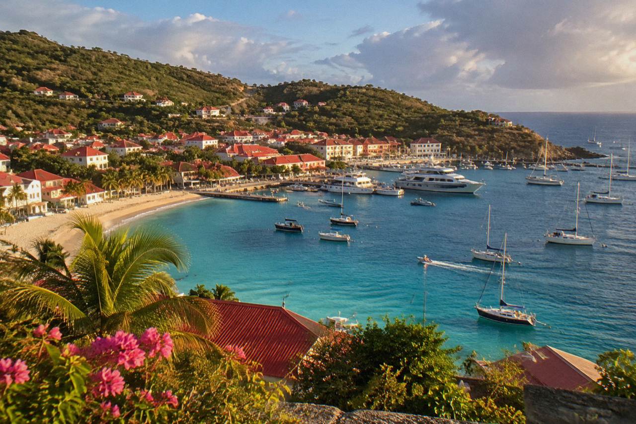
All St Barts beaches are public. Grand Cul-de-Sac and Lorient sit on protected north-shore water suited to swimming, Colombier and the reserve zones are the snorkeling draw, and the tourism committee lists every beach as free to access.
St Barthelemy, usually written St Barts, is a small French island in the Caribbean whose shoreline is a chain of public beaches: the tourism committee lists Saint-Jean, Gouverneur, Saline, Shell Beach, Flamands, Colombier, Grand Cul-de-Sac, Lorient, Toiny, Marigot and Corossol, and every one of them is free to access. Choosing among them is less about quality and more about matching a beach to the day's plan: a swim, a snorkel, or a family afternoon with shade and easy water. This guide sets out what the named beaches, the marine reserve rules and the boat options from St Martin each support.
Which St Barts Beach Is Best For Swimming?
The honest answer is a shortlist by map position and setting: Grand Cul-de-Sac and Lorient on the northeast shore, Saint-Jean beside the airport, Flamands on the north coast and Gouverneur and Saline on the south coast. All are public, all are free to access, and the sea is warm year round, about 26 C in winter to about 29 C from August to October.
What holds up is geography. Grand Cul-de-Sac sits on the island's northeast corner, where the coastline curves into a broad bay, and the tourism committee's beaches list places Lorient just west of it on the same shore. Saint-Jean occupies the center of the north coast, split by a low headland, with Gustaf III Airport's runway ending at its eastern edge. Flamands lies further west along the same coast. Gouverneur and Saline are the two named south-coast beaches, reached over the hills from Gustavia. A swimmer choosing among them is choosing exposure: the north and northeast faces take the Atlantic swell, the south faces the Caribbean side. Swimmers should judge conditions on the day.
The water itself is reliably warm. The Meteo-France normals, 1991-2020, give a mean daily high air temperature of 28.5 C in January rising to 31.7 C in September, and the secondary sea-temperature figures run about 26 C in winter to about 29 C from August to October. In practical terms, the sea is swimmable in every month, and the choice of beach comes down to position and access rather than temperature.
| Beach | Map position | Shore facing | Setting Notes support |
|---|---|---|---|
| Grand Cul-de-Sac | Northeast corner | Atlantic side | Broad curving bay, public |
| Lorient | Northeast, west of Grand Cul-de-Sac | Atlantic side | Village beach, public |
| Saint-Jean | Center of north coast | Atlantic side | Beside the airport runway, public |
| Flamands | North coast, west of Saint-Jean | Atlantic side | Long north-facing strand, public |
| Gouverneur | South coast east of Gustavia | Caribbean side | Hill-framed bay, public |
| Saline | South coast east of Gouverneur | Caribbean side | Behind salt-pond flats, public |
For swimmers who want a plan rather than a single name, the St Barts beach hopping itinerary strings several of these into one route, and the best beaches by coast page breaks the same list down by shoreline. Readers deciding between the island and its neighbor can also compare St Barts and St Martin directly.
Which St Barts Beaches Are Best For Snorkeling?
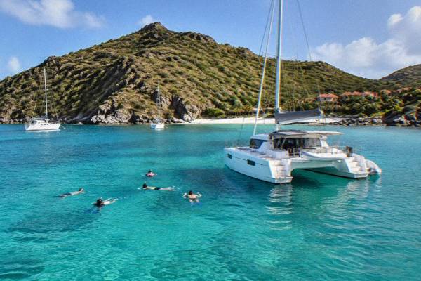
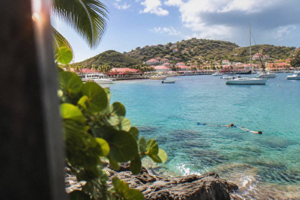
Colombier is the island's headline snorkeling beach, and it sits inside the St Barts marine reserve, which the environment agency's regulatory-zones page lists with a 5-knot speed limit, a jet-ski ban, 23 dive sites and strict rules against touching turtles, corals or shells. Grand Cul-de-Sac's lagoon and the water around Colombier are where green and hawksbill turtles are commonly reported, and Ile Fourchue, also in the reserve, is reached by boat only.
The reserve is the real distinction. The environment agency's pages divide its waters into simple and enhanced protection zones covering Colombier Bay and Fourchue, and the rules are strict in both: no touching, chasing or feeding protected species including turtles, corals, urchins, starfish, sharks and rays; no gloves in the water; no collecting coral, plants, shellfish, crustaceans, sand, rocks or shells; and no jet skis, seabobs, electric surfboards or towed sports anywhere in the zones. Drones are prohibited near or within reserve zones without authorization. For a snorkeler this means the underwater scenery is protected by law, and the etiquette is set by regulation rather than by convention.
Colombier itself is reached by boat or by a walk over the headland from Flamands. The Colombier Beach page covers the access options in full, and the Colombier hike page describes the land route. Snorkelers who prefer to stay on shore can work through the land-based snorkeling beaches guide, which lists the options reachable without a boat.
The simplest way to snorkel Colombier and Ile Fourchue is on the water. The site's featured trip, the Gustavia, Colombier Beach and Ile Fourchue tour, departs from St Martin or Sint Maarten and sails to St Barts for the day, and the operator's listing shows the current dates, which on the listing run only from 12 May to 31 August 2027. The same waters can be reached on a private boat: The operator's listing covers the full-day private charter option from St Martin.
| Reserve rule | What the environment agency's page states |
|---|---|
| Speed on the water | Maximum 5 knots in protected zones |
| Motorized gear | Jet skis, seabobs, electric surfboards and towed sports banned |
| Wildlife | No touching, chasing or feeding turtles, corals, urchins, starfish, sharks or rays |
| Collecting | No coral, plants, shellfish, crustaceans, sand, rocks or shells |
| Dogs | Not allowed on beaches or in the water in reserve areas |
| Dive sites | 23 listed within the reserve |
| Vessels in Colombier and Fourchue bays | None over 25 m, ecological mooring buoys preferred |
What Are The Best Family Beaches In St Barts?
The family answer rests on access and setting: Lorient, Grand Cul-de-Sac and Saint-Jean are the beaches closest to the island's main residential and hotel areas, all are public, and the environment agency's beach rules ask families to leave dogs at home, since dogs are banned on every beach island-wide under a standing municipal order, and to report turtle nests rather than disturb them.
The dog ban is the detail many families miss. A long-standing municipal order prohibits dogs on all beaches on St Barts, even on a leash, and the environment agency's beach page explains the reason: protecting birds, reptiles and nesting turtles, and preventing sand pollution. Signs stand at beach entrances, and violations are an infraction subject to a fine. A family planning a beach day with a rental dog-sitter arrangement, or traveling with a pet, should read the St Barts pet travel guidance before assuming any beach is an option.
Beyond that rule, the family shortlist follows the map. Grand Cul-de-Sac and Lorient sit on the gentler northeast shore near the largest concentration of hotels and villas, Saint-Jean sits beside the airport where the St Jean area guide covers the practicalities, and Flamands and Anse des Cayes extend the north-coast choices. Every beach is public, so there is no entry fee and no club membership question at the sand line itself. The environment agency also asks visitors to reduce light and noise near nesting areas and to take waste away, which is the core of the family etiquette.
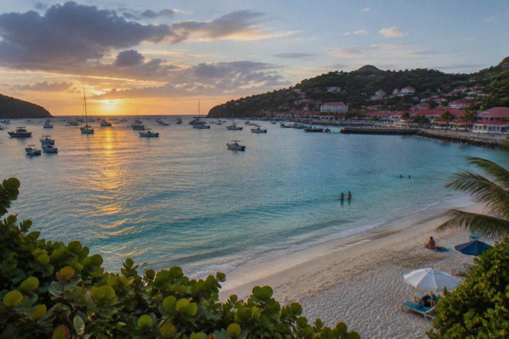
Families staying a full week may prefer to split days between the sand and the water, and the St Barts family itinerary builds that balance into a day-by-day plan. For staying near the sand itself, the beach hotels guide names the properties by their shoreline positions.
Which Beaches Are Closest To Gustavia?
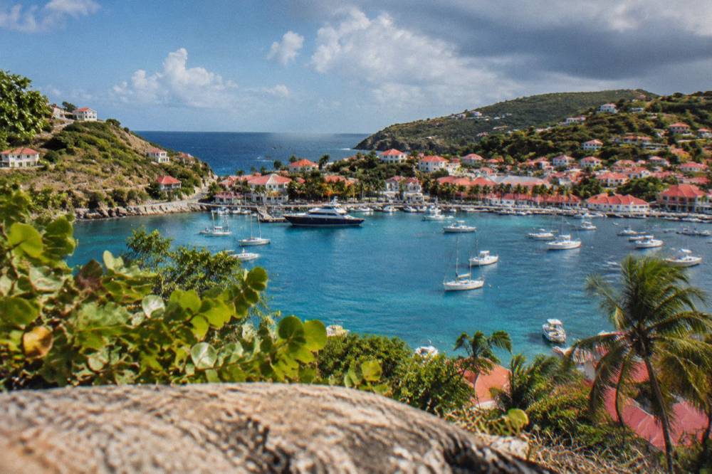
Shell Beach, also called Grand Galet, is the beach by Gustavia, a short walk from the harbor town's western edge, and it is the only named beach on the island's west coast. Corossol sits just north of Gustavia on the northwest side, and beyond it the north and south coast beaches, Flamands, Saint-Jean, Lorient, Grand Cul-de-Sac, Saline and Gouverneur, all lie within the island's roughly 21 square kilometres.
The practical point for cruise and ferry arrivals is that a beach visit can start on foot. Shell Beach sits below the headland west of Gustavia's harbor, and the Shell Beach page describes the position and access. Cruise passengers tender into Gustavia, there is no cruise pier, so the walk from the tender quay to the Shell Beach path is the shortest beach connection on the island. The Gustavia harbor and cruise port pages cover the arrival logistics in detail.
Corossol, north of town, adds a village setting, and the Corossol beach and village page covers it. From Gustavia, the road network reaches every other named beach over steep, narrow, hilly roads, driving on the right, with an island-wide speed limit of 50 km/h and 30 km/h in Gustavia and St Jean. The getting around St Barts and car rental guides cover the driving realities, and the St Barts parking page addresses the town-end question, without printing any tariff.
For the beaches beyond walking distance, book a rental car.
| Beach | Direction from Gustavia | Access notes |
|---|---|---|
| Shell Beach (Grand Galet) | West edge of town | Walkable from the harbor, public |
| Corossol | Northwest, closest village beach north of town | Public, village setting |
| Flamands | North over the hills | Public, reached by road |
| Saint-Jean | North-center past the hills | Public, beside the airport |
| Gouverneur | South over the hills | Public, hill road |
| Saline | South coast east of Gouverneur | Public, behind salt flats |
Can You Reach Colombier Beach Without A Boat?
Yes: Colombier is reached by boat or by a walk over the headland from the Flamands side, and no road reaches the sand. No walk time, length or difficulty grade is printed; Colombier Bay sits inside the marine reserve, vessels over 25 m are barred from the bay, and ecological mooring buoys are preferred for boats that anchor there.
The land route is the Colombier hike, which the site covers separately, and the beach itself has its own page with the access detail. The boat route is where the reserve's rules bite: the environment agency's regulatory-zones page sets the 5-knot limit inside the zones, and the sailing products listed here, all of which depart from St Martin or Sint Maarten, plan their arrivals around exactly those constraints. The featured Gustavia, Colombier and Ile Fourchue sail is the per-person option, and its listing shows operation from 12 May to 31 August 2027 with no other dates given.
For travelers who would rather not depend on a walking route or a ferry day, the private alternatives exist: The operator's listing covers the private charter from St Martin, which the trip list lists as an 8-hour day priced per group. Every boat product listed here leaves from the St Martin or Sint Maarten side, from marinas including Simpson Bay, Cole Bay, Anse Marcel and Grand Case; none departs from Gustavia, because no on-island boat tour is bookable listed here.
What Rules Apply On Every St Barts Beach?
Dogs are banned from every beach on St Barts island-wide, on or off leash, under a municipal order, and the marine reserve's zone rules add a 5-knot boat speed limit, a jet-ski and seabob ban, protection for turtles and corals, and drone restrictions in and near reserve waters. All beaches are public and free, public nudity is not legal on the island's public beaches, and topless sunbathing is widely accepted under French norms, though no beach is officially designated for nudity.
The island-wide rules matter as much as the reserve ones. The dog ban carries signs at beach entrances and a fine for violations. The reserve rules, described above, govern the water side. On attire, discretion is the local etiquette at the far ends of the remoter beaches, and the St Barts nude beaches page covers the question fully, including the important caveat that no official nude beach exists. Families and other visitors sharing a bay rely on the same discretion norms, and the environment agency asks visitors to avoid photographing others and to keep noise and light down near nesting areas.
Two more practical rules round out the picture. Drones are prohibited in or near the reserve without prior authorization, which removes the obvious aerial-photo plan from Colombier and Fourchue. And jets, in a related sense of island limits, do not land at St Barts at all: the airport's 646 m runway takes only small STOL turboprops in daylight and visual conditions, which is why nearly every beach day here begins with a ferry or a small plane from the St Martin side. The how to get to St Barts page lays out those gateways.
| Rule | Scope | Source basis |
|---|---|---|
| No dogs on beaches | Island-wide, on or off leash | Municipal order, environment agency beach page |
| 5-knot speed limit | Marine reserve zones | Environment agency regulatory-zones page |
| No jet skis or electric water gear | Reserve zones | Environment agency regulatory-zones page |
| No touching turtles or corals | Reserve zones | Environment agency regulatory-zones page |
| No collecting shells, sand or coral | Reserve zones | Environment agency regulatory-zones page |
| Drone restrictions | In and near reserve zones without authorization | Environment agency regulatory-zones page |
| No vessels over 25 m | Colombier and Fourchue bays | Environment agency regulatory-zones page |
When Is The Water Best For Swimming And Snorkeling On St Barts?
The sea is warm in every month, about 26 C in winter and about 29 C from August to October, and the Meteo-France normals, 1991-2020, show air temperatures warm year round, with a mean daily high of 28.5 C in January and 31.7 C in September. The trade-off is that hurricane season runs 1 June to 30 November with a peak from mid-August to mid-October, overlapping the warmest water, so the shoulder months balance warmth against storm-season timing.
Rain is the other variable the climate table quantifies. The normals give 891.3 mm of rain across the year, spread unevenly: October is the wettest month at 135.6 mm, February the least rainy at 38.4 mm, and November carries 118.6 mm. None of this predicts any given day, and no storm, crowd or availability forecast appears on this page. What the numbers do support is planning logic: the December-to-April window combines the cooler end of the temperature range with the drier months, while May through July sits in the quieter shoulder before the statistical peak of the hurricane season near 10 September.
| Month | Mean daily high (C) | Rain (mm) | Season note |
|---|---|---|---|
| January | 28.5 | 52.6 | High season, drier side |
| February | 28.6 | 38.4 | Lowest monthly rain in the normals |
| April | 29.8 | 50.9 | Shoulder into low season |
| July | 31.2 | 80.4 | Hurricane season, warm sea |
| September | 31.7 | 96.9 | Warmest mean high, peak storm window |
| October | 31.4 | 135.6 | Wettest month in the normals |
| November | 29.9 | 118.6 | Storm season ends 30 November |
Beach-day timing also interacts with the autumn closure pattern: many hotels and restaurants close each year in the late-summer low period and reopen in waves between mid-October and early November, so a late-autumn beach trip lands on an island still waking up. The best time to go to St Barts and St Barts in October pages carry that calendar in detail, and the water temperature page expands the sea figures.
Which St Barts Beach Should You Choose For Your Day?
Match the beach to the plan, not to a ranking: swimmers can work the northeast and south-coast bays from Grand Cul-de-Sac to Gouverneur, snorkelers should aim at the reserve waters of Colombier and Ile Fourchue, families get the easiest logistics at Lorient, Grand Cul-de-Sac and Saint-Jean, and town-bound visitors get Shell Beach by Gustavia, with every option public and free, and the boat-based snorkeling day departing from St Martin or Sint Maarten rather than from the island.
That summary is deliberately free of superlatives. What the tourism committee's list, the environment agency's rules and the map together support is a choosing framework, and the table below condenses it. The what is the nicest beach in St Barts answer page tackles the ranking question head on, and the honest answer there is the same one given here: no official ranking exists, and the choice is a matter of shoreline, access and plan.
| If the day's plan is... | The shortlist from the named beaches | Why |
|---|---|---|
| A long swim | Saint-Jean, Flamands, Gouverneur, Saline | Named public beaches on the north and south coasts |
| Snorkeling | Colombier, Ile Fourchue, Grand Cul-de-Sac lagoon | Reserve waters, turtle habitat, 23 dive sites in the reserve |
| A family beach day | Lorient, Grand Cul-de-Sac, Saint-Jean | Public beaches near the main hotel and villa areas, no dogs allowed anywhere |
| A walk from the tender quay | Shell Beach (Grand Galet) | The beach by Gustavia, no road needed |
| A boat-and-beach day trip | Colombier and Ile Fourchue by sail or charter | Tours depart St Martin or Sint Maarten, reserve rules apply |
For a beach plan that extends beyond St Barts itself, the St Barts to St Martin and island hopping guides cover the neighboring crossings, and the wider things to do in St Barts page places the beaches in the island's full activity context. More on every shoreline is on St Barthelemy Travel's beach and area pages.
The boat option deserves one final, honest framing. Every bookable tour listed here, including the Nikki Beach private charter that combines the crossing with a beach-club stop, departs from the St Martin or Sint Maarten side, because no on-island boat tour is bookable here. Five of the six products are private charters priced per group, and the one per-person group sail runs only from 12 May to 31 August 2027 on its listing. Travelers already sleeping on St Barts can still use these products by planning them around a St Martin night, which the St Maarten before or after St Barts page is built for.
Common Questions About St Barts Beaches
Are all beaches in St Barts public?
Yes. The tourism committee lists every named beach, from Saint-Jean to Corossol, as public and free to access.
Can you swim at every St Barts beach?
The sea is warm year round, about 26 C in winter to about 29 C from August to October, and swimming is normal at all the named beaches. No lifeguard, current or wave concern is known for any specific beach, so judge conditions on the day.
Which St Barts beach is best for snorkeling?
Colombier and the waters of Ile Fourchue, both inside the marine reserve, are the headline snorkeling settings, with the reserve listing 23 dive sites and protecting turtles, corals and shells under its rules. Grand Cul-de-Sac's lagoon is the commonly cited shore option.
Can you take a dog to a St Barts beach?
No. A municipal order bans dogs from every beach on the island, on or off leash, with signs at the entrances and fines for violations, and the environment agency separately bars dogs from reserve beaches and waters.
Do any St Barts boat tours depart from the island itself?
No bookable tour listed here departs from St Barts. All six products leave from St Martin or Sint Maarten, from marinas such as Simpson Bay, Cole Bay, Anse Marcel and Grand Case, and visit St Barts on a day or overnight basis.
Is there an official ranking of the best beach in St Barts?
No. Neither the tourism committee nor any other source ranks the beaches, so any "best" list, including this one's shortlists, is a matter of map position, access and planned activity rather than a certified verdict.