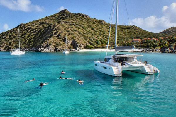
Walking To Colombier Beach In St Barts
Colombier Beach sits at the northwestern tip of St Barts inside the marine nature reserve, reachable only on foot or by boat. This guide covers the access paths, the reserve rules, the climate, and the boat day trips from St Martin.
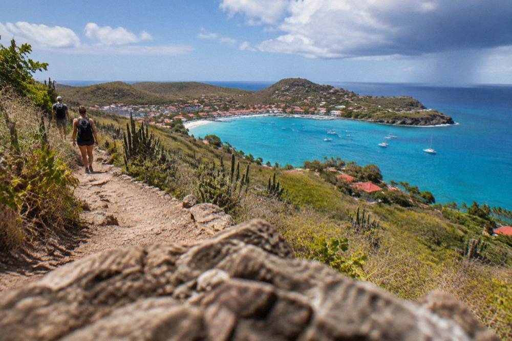
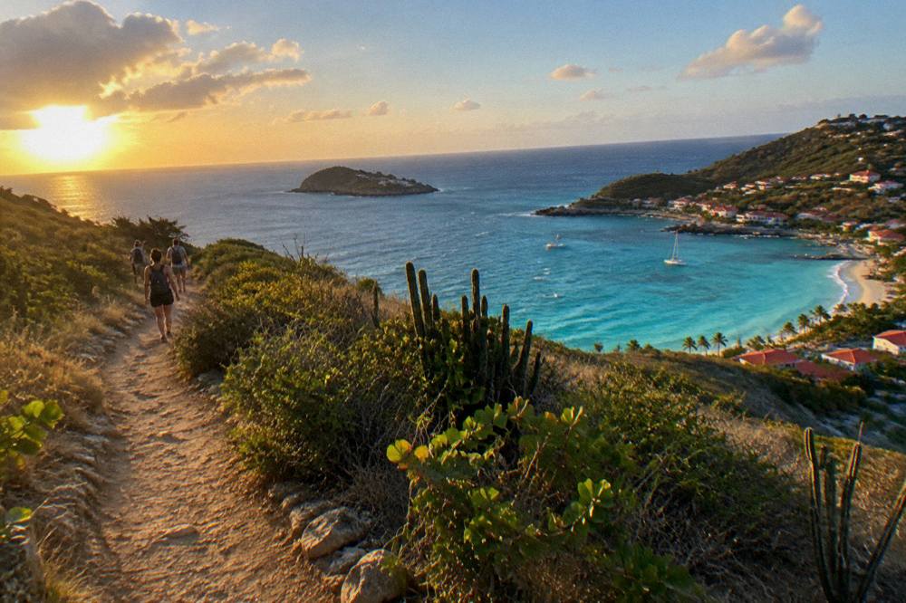
Colombier is a public beach at the northwestern tip of St Barts, inside the national marine reserve, with no road access: you reach it on foot from the surrounding hills or by boat. The reserve enforces a 5-knot speed limit, bans jet skis and dogs, and protects sea turtles.
St Barthelemy, usually written St Barts, is a small French island in the Caribbean of about 21 square kilometres with roughly 10,700 residents, and at its northwestern tip lies one of the island's most talked-about shores: Colombier Beach. There is no road to it. The beach sits inside the national marine nature reserve, reached on foot through the hills or across the water by boat, and that combination of public sand and protected sea shapes everything about a visit. This guide from St Barthelemy Travel covers the walking access, the reserve rules that govern the bay, the climate data that helps with timing, and the boat day trips that call here from St Martin.
Where Is Colombier Beach In St Barts?
Colombier Beach, also called Plage de Colombier, is a public beach at the northwestern tip of St Barts, inside the boundary of the island's national marine nature reserve, and it has no road access, which is why it is reached on foot through the hills or across the water by boat rather than by car. The tourism committee lists Colombier among the island's public beaches, alongside Saint-Jean, Gouverneur, Saline, Shell Beach, Flamands, Grand Cul-de-Sac, Lorient, Toiny, Marigot and Corossol. Every beach on the island is public and free to access, and Colombier's position beyond the road network is what makes it different from the rest.
The headland around the beach is part of the island's western hill country. Gustavia, the harbour capital, sits to the south; the airport at Saint-Jean lies to the east across the hills; and the next named shore going clockwise is Flamands on the north coast. That geography matters for planning, because everything you carry in, you carry on your back, and everything you carry out, you carry out again. The island has no shops, kiosks or facilities at the beach itself, and the reserve's rules, covered below, forbid leaving garbage behind.
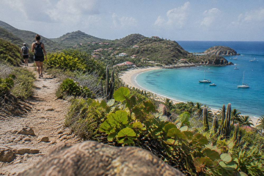
For context, here is where Colombier sits among the island's named public beaches:
| Beach | Area of St Barts | Access type |
|---|---|---|
| Colombier | Northwestern tip | On foot or by boat, no road |
| Flamands | North coast | Road access |
| Marigot | Northwest, near Colombier side | Road access |
| Corossol | West coast | Road access |
| Shell Beach (Grand Galet) | By Gustavia | Road access, short walk from town |
| Gouverneur | South coast | Road access |
| Saline | South coast | Road access, then a walk from parking |
| Lorient | North coast | Road access |
| Saint-Jean | Near the airport | Road access |
| Grand Cul-de-Sac | Northeast | Road access |
| Toiny | Southeast | Road access |
The full island picture, including every named shore and what the map supports about each, is in the St Barts beach guide by coast, and the Colombier area guide covers the headland and neighbouring bays in more depth.
How Do You Walk To Colombier Beach In St Barts?
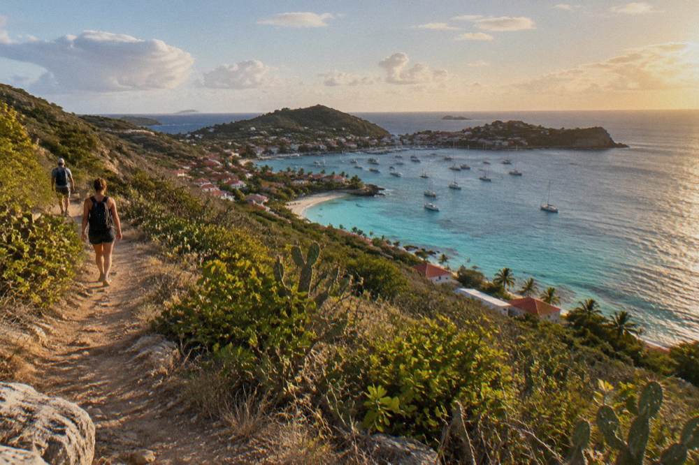
Colombier Beach is reached on foot by trails that cross the hills from the surrounding area, commonly approached from the Flamands side of the island, and the walk is the only land route in because no road reaches the bay. The paths appear on the island's maps as coastal and hillside trails. The island's trails and viewpoints are documented as map places only: no walking time, trail length, difficulty grading or condition description is given here for the Colombier path. The route character is narrow hill paths on a steep island.
To reach the Flamands side trailhead where the walk begins, book a rental car.
The terrain is the practical story. St Barts is a hilly island of about 21 square kilometres, its roads narrow and winding with steep grades even where they exist, and the Colombier trails predate none of that geography. Walking shoes rather than flip-flops, water, sun protection and a start earlier in the day rather than later are the standard preparation the conditions argue for. The Meteo-France normals, 1991-2020, show the mean daily high never falls below 28.5 C in any month, so heat is a year-round factor on an exposed hillside path.
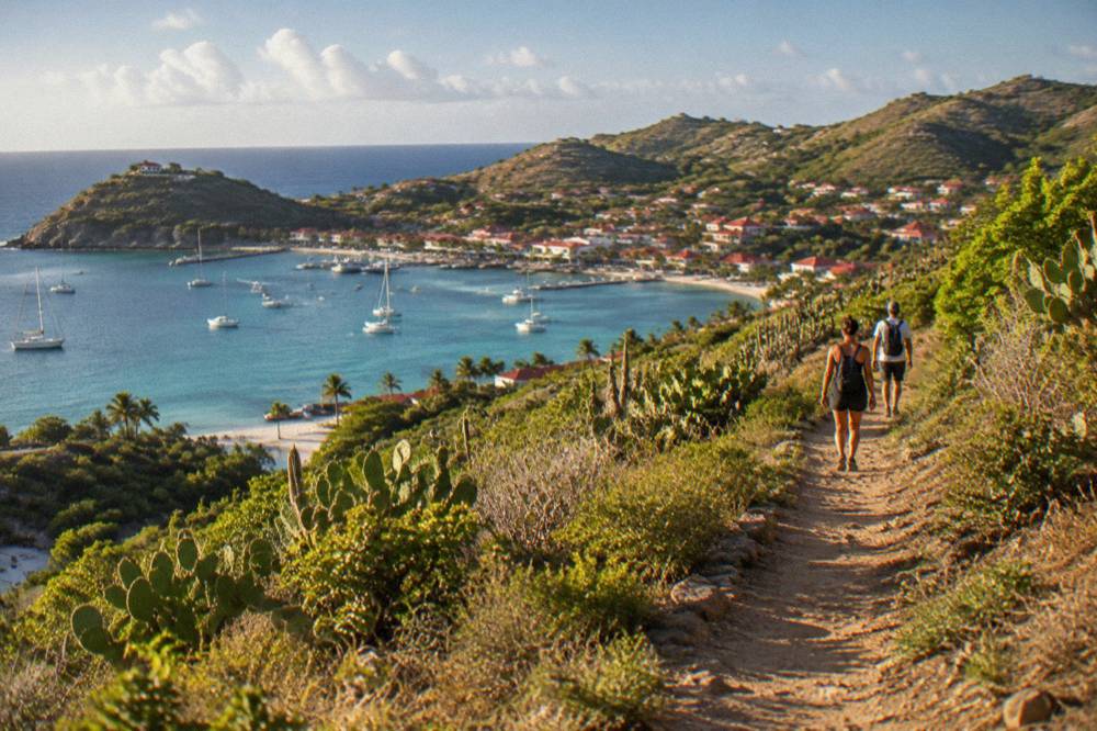
A few practical points the reserve and the island context do establish:
| Factor | What To Know |
|---|---|
| Access on foot | Hill trails from the surrounding area, no road |
| Beach status | Public and free to access, like every beach on St Barts |
| Dogs | Prohibited on all beaches island-wide, on leash or not |
| Marine reserve zone | Colombier Bay is inside the reserve's protected zones |
| Best footwear | Enclosed walking shoes for steep, narrow hill paths |
The walking routes are one of two ways in. The other is the water, and the bay is a regular stop for boats out of St Martin, which is where the bookable options begin. One per-person group sail runs the corridor from St Martin and calls at Colombier Bay, and its dates matter: the listing shows it operating only from 12 May to 31 August 2027.
The most direct way to compare dates and pricing for that sail is on the operator's live listing, and the Gustavia, Colombier and Ile Fourchue tour page on this site breaks down what the day covers. It is worth reading the reserve rules below before booking any day on this water.
What Marine Reserve Rules Apply At Colombier Bay In St Barts?
Colombier Bay sits inside the St Barts national marine nature reserve, where the environment agency's regulatory-zones page lists a 5-knot speed limit in protected zones, a ban on jet skis and other motorized water devices, a ban on collecting coral, shells or sand, a ban on dogs, and strict protection for sea turtles and other species that forbids touching, chasing or feeding them. The reserve covers five zones including Colombier Bay and Ile Fourchue, with simple and enhanced protection areas, and in enhanced zones fishing, anchoring and scuba are further restricted.
The rules change the character of a day here more than at any unreserved beach on the island. The 5-knot limit applies on the water inside the zones, which is why boats arrive slowly and quietly. In Colombier and Fourchue bays specifically, the agency's page lists no vessels over 25 metres, a preference for ecological mooring buoys over anchoring, and anchoring restrictions that protect the seabed. For swimmers and snorkellers, the no-touch rules cover sea turtles, corals, urchins, starfish, sharks and rays, and gloves are banned in the water to prevent collecting. Green and hawksbill turtles are the species commonly noted in the island's waters.
Here is the full rule set as the environment agency publishes it:
| Rule | Applies to |
|---|---|
| 5-knot speed limit | All vessels in the reserve's protected zones |
| No jet skis, seabobs, electric surfboards, towed sports | All motorized and electric water devices in reserve zones |
| No touching, chasing or feeding protected species | Turtles, corals, urchins, starfish, sharks, rays |
| No gloves in the water | Swimmers and snorkellers, to prevent collecting |
| No collecting coral, plants, shellfish, crustaceans, sand, rocks or shells | Everyone, on land and in water |
| No dogs on beaches or in the water | All reserve beaches, in line with the island-wide dog ban |
| No vessels over 25 m in Colombier and Fourchue bays | Boats and yachts |
| Ecological mooring buoys preferred; anchoring restricted | Colombier and Fourchue bays |
| No drones without authorization | In and near reserve zones |
| No underwater lighting or noise pollution | Reserve zones |
The dog ban deserves emphasis because it is island-wide, not reserve-specific: a long-standing municipal order prohibits dogs on all of St Barts' beaches, on or off leash, with signs at beach entrances and fines for violations. Turtle nest sightings are meant to be reported to the environment agency, which lists a contact number for that purpose. Drones, increasingly common on travel itineraries, need authorization before flying in or near the reserve.
If a boat day rather than a walk is the plan, the full-day group sail below is the one per-person product listed here that calls at Colombier Bay, and it departs from St Martin, never from St Barts itself.
When Is The Best Time Of Year For The Colombier Hike In St Barts?
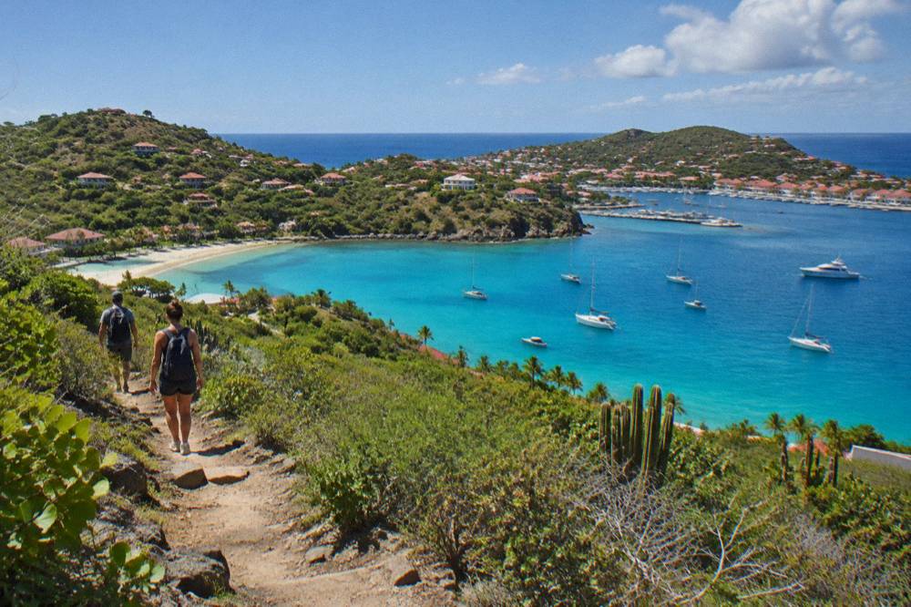
The best walking conditions on St Barts fall between December and April, when the Meteo-France normals for 1991-2020 show mean daily highs of 28.5 to 29.8 C and the lowest monthly rainfall totals of the year, while the Atlantic hurricane season runs 1 June to 30 November with its peak from mid-August to mid-October and October the wettest month at 135.6 mm. The island is warm in every month, so the choice is less about heat than about rain, sea state for the boat alternative, and what is open on the island around the trailhead.
The climate table tells the story plainly. February is the month with the lowest monthly rainfall at 38.4 mm, and October the highest at 135.6 mm, with September close behind at 96.9 mm. The mean daily high ranges from 28.5 C in January to 31.7 C in September. Annual rainfall totals 891.3 mm. Sea temperature is warm year-round, about 26 C in winter and about 29 C from August to October, from a secondary source, so swimming is not the constraint; the sky and the swell are.
| Month | Mean daily high C | Mean daily low C | Rainfall mm |
|---|---|---|---|
| Jan | 28.5 | 23.5 | 52.6 |
| Feb | 28.6 | 23.3 | 38.4 |
| Mar | 29.0 | 23.5 | 41.4 |
| Apr | 29.8 | 24.2 | 50.9 |
| May | 30.7 | 25.1 | 61.7 |
| Jun | 31.2 | 25.9 | 56.0 |
| Jul | 31.2 | 26.0 | 80.4 |
| Aug | 31.6 | 26.3 | 79.6 |
| Sep | 31.7 | 26.2 | 96.9 |
| Oct | 31.4 | 25.8 | 135.6 |
| Nov | 29.9 | 25.0 | 118.6 |
| Dec | 28.9 | 24.1 | 79.2 |
Two seasonal patterns matter beyond the weather rows. Many hotels and restaurants on the island close each autumn and reopen in waves between mid-October and early November, so a walk in late September can coincide with a quieter island all round. And the one per-person group sail that calls at Colombier Bay runs only from 12 May to 31 August 2027 on its listing, which puts the boat version of this trip squarely in the warmer, wetter half of the year, while private charters run on their own schedules. No storm, crowd or availability outcome can be predicted for any date, and none is attempted here.
What Should You Pack For The Colombier Hike In St Barts?
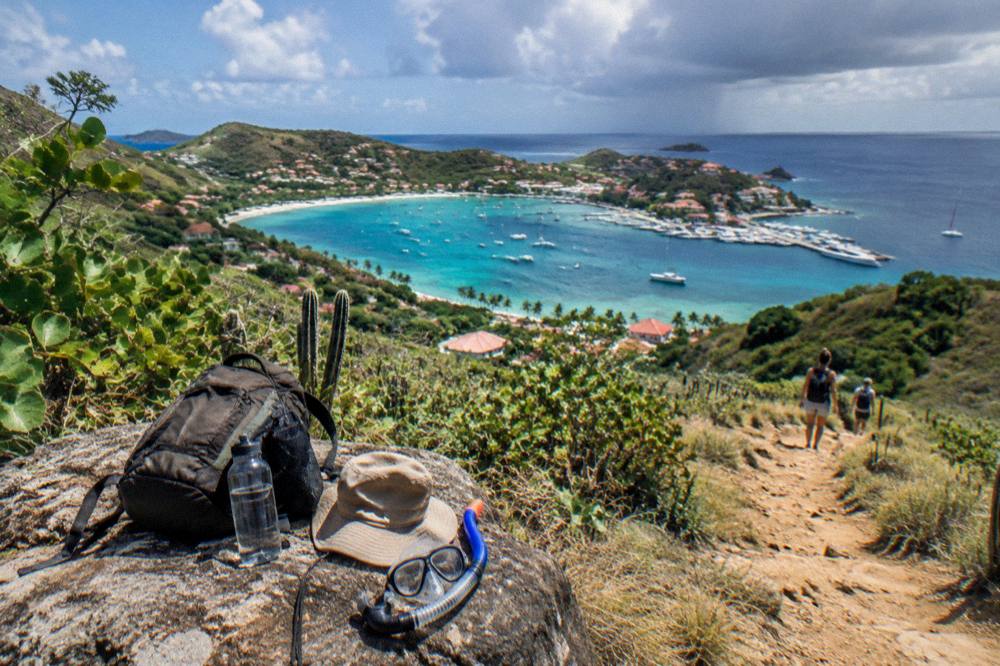
For the walk to Colombier, the conditions argue for enclosed walking shoes, more water than you think you need, sun protection including a hat and sunscreen that is reef-safe for swimming in the reserve, a bag to carry garbage back out, and snorkelling gear if you plan to swim, since no facilities, shops or rentals exist at the beach. The reserve bans collecting anything from the sand or sea, so the packing rule is leave nothing, take nothing, and the island-wide dog ban means pets stay home.
The hill paths of St Barts are narrow and steep, the same character that makes the island's roads winding even where they are paved, and the Meteo-France normals show mean daily highs above 28 C in every single month. Shade, where the terrain offers it, comes and goes, so the honest packing advice is generic hot-country hill walking. A morning start is the standard advice on any tropical walk, and the sea temperature, warm year-round at about 26 to 29 C, means a swimsuit and mask are worth the weight.
A packing table against the constraint each item answers:
| Item | Why it earns its place |
|---|---|
| Enclosed walking shoes | Steep, narrow hill paths on a hilly 21 sq km island |
| Water, more than seems necessary | No facilities at the beach; highs above 28 C every month |
| Hat and sunscreen | Exposed tropical hillside, year-round heat |
| Reef-safe sunscreen | You are swimming inside a marine reserve |
| Snorkel mask and fins | Green and hawksbill turtles are common in these waters |
| Dry bag for garbage | Reserve rules require taking waste away |
| Light rain layer | Monthly rainfall runs 38.4 mm to 135.6 mm across the year |
One thing not to pack is a drone without checking first: the environment agency prohibits drones in and near the reserve without authorization. And no walking tour of any kind is listed here: the beaches and open public places are free and walked on your own, and any guided day here is a boat day.
Can You Reach Colombier Beach By Boat From St Martin?
Yes: Colombier Bay is a regular stop for boat day trips that depart from St Martin or Sint Maarten, at ports including Simpson Bay, Cole Bay, Anse Marcel and Grand Case, and every bookable St Barts tour on the platforms leaves from the St Martin side, never from St Barts itself. The alternatives for independent travellers are the scheduled ferries, Great Bay Express from Philipsburg on the Dutch side and Voyager from Marigot on the French side, which cross to Gustavia in about 45 and about 50 to 60 minutes respectively, with crossings that can be rough.
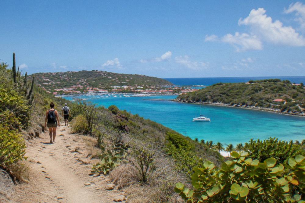
The boat route and the walking route deliver the same beach from opposite directions, and they are not mutually exclusive. A common pattern is a walking day on the hills and a separate boat day that includes Colombier Bay as a swim and snorkel stop alongside Ile Fourchue, the neighbouring protected island in the same reserve. Because the reserve caps speed at 5 knots in its zones, the final approach into the bay is always slow, and the mooring buoys in the bay are the preferred way boats hold position.
The two ferry operators, for the independent route via Gustavia:
| Operator | Departure port | Arrival | Crossing (operator figure) |
|---|---|---|---|
| Great Bay Express | Bobby's Marina, Philipsburg, Sint Maarten | Gustavia | About 45 minutes |
| Voyager | Marigot Ferry Terminal, St Martin | Gustavia | About 50 to 60 minutes |
Both operators' ferry pages require a passport, ask passengers to check in well before departure, and run services subject to weather, with frequencies that rise in the November to April period; the operator's ferry page shows current times and fares. For the charter version, the private options below are priced per group and depart from St Martin or Sint Maarten as well.
The Nikki Beach charter pairs a St Barts call with the island's best-known beach club brand; the Nikki Beach St Barts page covers the shape of that day, and the best beach club in St Barts answer page sets the club scene in context.
What Else Is Near Colombier In St Barts?
Near Colombier on St Barts are the north-coast beach of Flamands and the small shore of Marigot to the bay's northeast, the protected island of Ile Fourchue offshore inside the same marine reserve, and, further around the coast, Gustavia with its harbour, Shell Beach and the island's shopping, all reachable on an island whose full road network crosses barely 21 square kilometres. The bay's neighbours reward a second day as much as the hike rewards the first.
Ile Fourchue is the closest thing to a companion piece: another reserve zone, subject to the same 5-knot limit, mooring-buoy preference and 25-metre vessel cap, and a stop on the same group sail that calls at Colombier. Marigot, the beach, shares the name of the French-side ferry town on St Martin, which is a coincidence of naming worth flagging so the two are not confused in planning. On the wider island, the Flamands beach page and Saline beach page cover two of the other great walking beaches, and the beach hopping itinerary strings the public shores into a multi-day plan. Readers weighing Colombier against the rest may also want the nicest beach in St Barts answer and the most beautiful beach in St Barts answer.
For a full private day on this water, the charter below is the other main per-group option from St Martin, priced per group rather than per person, and it runs to the island's northern anchorages on its own schedule.
Two further references round out the planning set: St Barts beach hotels for sleeping near the north-coast trailheads, and the Colombier Beach page for the beach itself without the walk. The second comparison band below collects the three boat products side by side.
The short version: Colombier rewards two kinds of effort, the hill path on foot and the slow 5-knot approach by sea, both governed by a marine reserve that keeps the bay quiet by rule rather than by chance. Walk early, carry everything out, leave the turtles alone, and the northwestern tip of St Barts gives back exactly what the maps promise.
Common Questions About The Colombier Hike In St Barts
How long is the Colombier hike in St Barts?
No walking time or trail length exists for the Colombier path. The beach has no road access and is reached on foot by hill trails from the surrounding area, commonly approached from the Flamands side. The island's trails are documented as map places only, so no distance, duration or difficulty grading is published here.
Is Colombier Beach public in St Barts?
Yes. The tourism committee lists Colombier among the island's named public beaches, and every beach on St Barts is public and free to access, including Colombier, Saint-Jean, Gouverneur, Saline, Shell Beach, Flamands, Grand Cul-de-Sac, Lorient, Toiny, Marigot and Corossol.
Can you swim and snorkel at Colombier Beach?
The sea at Colombier sits inside the marine reserve, where swimming and snorkelling are governed by the environment agency's rules: no touching, chasing or feeding protected species including sea turtles, no gloves in the water, and no collecting coral, shells, sand or rocks. Green and hawksbill turtles are commonly noted in these waters.
Are dogs allowed on the walk to Colombier?
No. A long-standing municipal order prohibits dogs on all beaches on St Barts, on or off leash, and the marine reserve's rules separately ban dogs on beaches and in the water within its zones. Fines apply.
Can you get to Colombier by boat instead of walking?
Yes. Boat day trips from St Martin and Sint Maarten, departing from ports such as Simpson Bay, Cole Bay, Anse Marcel and Grand Case, call at Colombier Bay. Every bookable St Barts tour listed here departs from the St Martin side, never from St Barts itself.
When is the best month for the Colombier hike?
The Meteo-France normals for 1991-2020 show the lowest rainfall from December through April, with February the lowest month at 38.4 mm and October the highest at 135.6 mm. The island is warm in every month, with mean daily highs from 28.5 C in January to 31.7 C in September. Hurricane season runs 1 June to 30 November, peaking mid-August to mid-October.