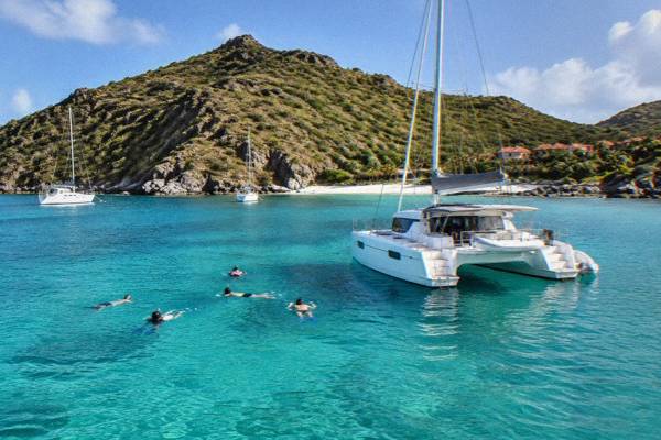
Gustavia Harbor
Gustavia Harbor is the working heart of St Barthelemy: a U-shaped bay of tenders, yachts, quay-side shops and red roofs that every visitor to the island passes through at least once.
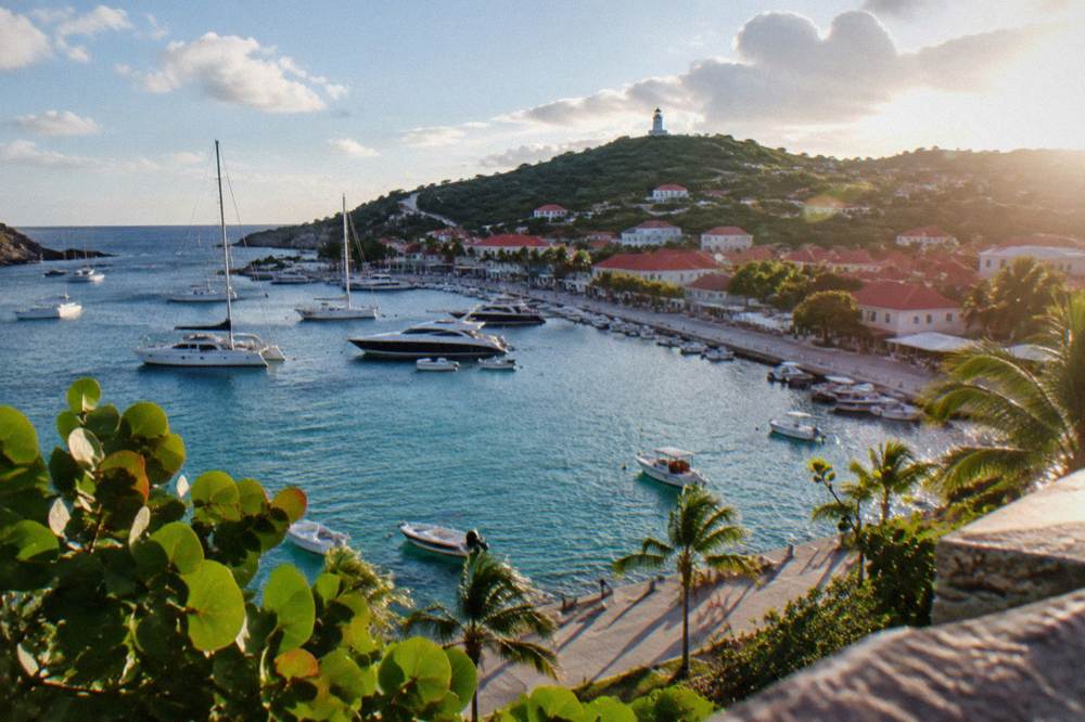
Gustavia Harbor is the capital's natural bay on the west coast of St Barts. Cruise ships anchor offshore and tender in, ferries from St Martin dock at the terminal, and yachts moor inside the marine reserve's regulated waters. The waterfront itself is free to walk, with forts, museums and beaches within a short drive.
Gustavia Harbor is the natural bay that gives the capital of St Barthelemy its shape, its name and its working rhythm. The town, the capital of an island of about 10,700 residents, wraps a U-shaped inlet on St Barts' west coast, and almost every arrival route funnels into it: ferry passengers step ashore at the terminal on the quay, cruise visitors come in by tender boat, and yachts tie up inside the bay itself. The tourism committee describes Gustavia as the island's harbour capital, and the description is literal. Everything in this guide is about that bay and the streets that climb around it.
What Is Gustavia Harbor In St Barts?
Gustavia Harbor is the sheltered west-coast bay of Gustavia, the capital town of St Barthelemy, a French overseas collectivity in the Caribbean since 2007, with the euro as its currency and French as its official language alongside widely spoken English. The bay holds the ferry terminal, the commercial port and the yacht anchorage, and the town's shops and restaurants sit directly on its quays. It is the island's main point of arrival and its most walkable concentration of streets.
The harbour is the reason the town exists where it does. A deep inlet on the leeward side of the island gives protection from the prevailing trade winds, and the flat land along the water is the only stretch of St Barts where a town of this size could gather. Hills rise steeply behind the quays, and the red roofs that cover them are the visual signature most photographs of the island carry.
Three different kinds of traffic share the bay. Scheduled ferries from St Martin and Sint Maarten use the terminal. Cruise ships never berth: they anchor outside and land passengers by tender, because there is no cruise pier. And the inner harbour fills with yachts, from local day boats to the superyachts that gather around the year-end holidays.
For a visitor, the practical point is simple: Gustavia is compact and flat where it counts. The quays, the shopping streets, Le Select and the two forts are all within the same small bowl, and the beaches of Shell Beach (Grand Galet) sit a short climb from the harbour edge.
What Lines The Gustavia Waterfront In St Barts?
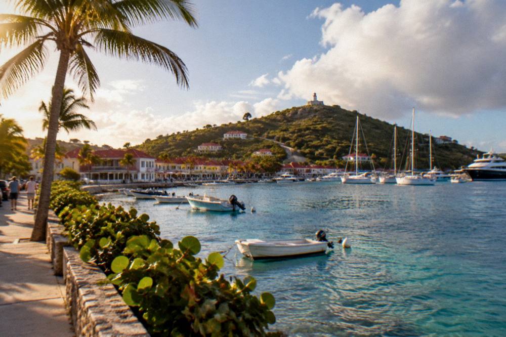
The Gustavia waterfront in St Barts runs from the ferry terminal and commercial quays at the head of the bay, past duty-free shopping streets, restaurants and the harbour-front promenade, up to Fort Karl at the southern point and Fort Gustaf with its lighthouse at the northern side. All of it is free to walk, and every named sight sits within the same half-loop of shore.
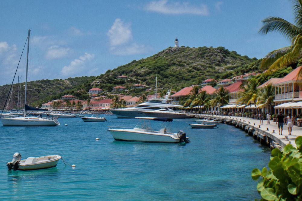
The quays themselves divide by function. The ferry terminal handles the scheduled crossings from St Martin. The commercial port area handles cargo and fuel, the port's own site covering rules and contacts rather than any published cruise schedule. The visitor-facing stretch is the promenade and the streets behind it, where the Gustavia shopping concentration sits, from French fashion boutiques to jewellers.
Above the shopping, the two forts bracket the bay. Fort Karl sits above Shell Beach on the south side of the inlet, a low stone platform with the bay at its feet. Fort Gustaf holds the lighthouse at the northern edge of town. Both appear on the map as named historical places. Close by, the Wall House Museum covers the island's Swedish period and wider past for visitors who want the interior detail.
Eating and drinking cluster in the same bowl. The Gustavia restaurants scene runs from harbour-side tables to lanes one street back, and the pattern matters seasonally: many hotel-affiliated and upscale tables close each autumn and reopen between mid-October and early November, a recurring pattern rather than a fixed calendar. Smaller local spots stay open year-round.
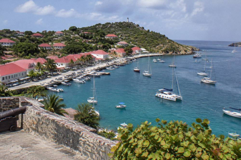
The waterfront's free layer is worth naming plainly. The promenade, the public quays, the view points at both forts and the beaches are all public and free, the tourism committee listing every beach on the island as public. No guided walking tour is listed here: what is free is the shore itself.
How Do Cruise Visitors Reach Gustavia Harbor In St Barts?
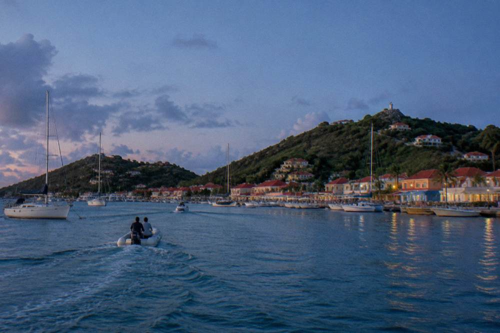
Cruise ships calling at St Barts anchor offshore and land passengers by tender boat into Gustavia Harbor, because the island has no cruise pier or dedicated docking berth. The port regulates what calls it accepts, and no official public cruise schedule is published in advance, so the only reliable source for a specific call is the cruise line's own itinerary. Tender rides land passengers steps from the quays and the shopping streets.
This tender arrangement is deliberate. The port's commercial pages cover operations, rules and contacts but publish no arrival calendar, and the town's scale is part of why. Gustavia is a small bowl of a town serving an island of about 10,700 residents, and the tender system is the physical limit on how many people can be ashore at once.
For a cruise passenger, the practical geography is friendly. The tender landing puts you on the quay at the centre of town. From there the whole walkable core is in front of you, and anything further is a taxi or rental car ride over the hills.
The fuller arrival mechanics, including the ferry and flight routes through St Martin, are covered in the site's Gustavia cruise port guide. The short version: ferries from Philipsburg and Marigot dock at the terminal in the same bay, and small-plane flights land at Gustaf III Airport on the other side of the hills above Saint-Jean.
A day ashore from a tender is also enough to see the harbour from the water instead, which is the angle most photographs are taken from.
That band is worth a word of explanation, because it is the one thing in this article you can book. Every boat product listed here departs from St Martin or Sint Maarten and visits St Barts; none starts in Gustavia. Cruise passengers cannot realistically use them on a tender day, but anyone staying on St Martin, or on St Barts itself and willing to cross first, can build a full day around the harbour and the coast beyond it.
Do Yachts Fill Gustavia Harbor In St Barts?
Yes: Gustavia Harbor is one of the Caribbean's noted yacht anchorages, and the inner bay holds moored sailing yachts and motor yachts year-round, with the largest concentration around the year-end holiday period. The waters fall under the St Barts marine reserve's rules, which cap speed at 5 knots in protected zones, ban jet skis and prohibit anchoring and fishing in the enhanced protection areas. Boats over 25 metres face limits in neighbouring Colombier and Fourchue bays.
The marine reserve framing matters more here than anywhere else on the island, because the harbour and its neighbouring bays are regulated water. The environment agency's regulatory-zones page lists the rules plainly: a 5-knot speed limit inside the reserve's zones, no jet skis, seabobs or towed motorized devices, no touching or feeding protected species including sea turtles, no collecting coral or shells, and no dogs on beaches or in the water within reserve areas. Drones are prohibited near the reserve without authorization.
| Marine reserve rule | What the environment agency's page states |
|---|---|
| Speed inside zones | Maximum 5 knots |
| Motorized water toys | Jet skis, seabobs and towed devices prohibited |
| Wildlife | No touching, chasing or feeding turtles and other protected species |
| Collecting | No coral, shells, sand or rocks may be taken |
| Dogs | Not allowed on beaches or in the water in reserve areas |
| Vessels in Colombier and Fourchue | None over 25 m, ecological moorings preferred |
For the yachts themselves, the year has a rhythm the events calendar drives. The St Barths Bucket Regatta brings superyachts in mid-March, and Les Voiles de St Barth follows in April. The harbour's biggest visual concentration comes around New Year's Eve, when fireworks over the bay are a standard annual event, though 2027 dates for the fireworks, Carnival or Les Voiles remain unconfirmed.
Which Boat Tours Visit Gustavia Harbor From St Martin?
Every bookable boat tour connected to this site departs from St Martin or Sint Maarten and visits St Barts as a day trip, with Gustavia Harbor, Colombier Beach and Ile Fourchue the usual stops on a full-day route. None departs from St Barts itself, so a visitor already on the island would cross to St Martin first. Prices, ratings and durations for each product render in the listings below rather than in this text.
The flagship option on this page is the Boomerangs group sail and snorkel, a per-person day trip that runs from St Martin through Gustavia, Colombier and Ile Fourchue. Its listing shows a seasonal per-person window: the group sail runs only from 12 May to 31 August 2027 on its listing, so anyone travelling outside that stretch needs one of the private alternatives instead.
The private alternatives suit travellers outside that window or groups wanting their own boat. A private sailboat charter covers a similar coast in a day, priced per group rather than per person.
And for a slower version, an overnight catamaran turns the crossing into two days with a night on the water.
A comparison of the three, with figures left to the listings above:
| Product | Type | Departure | Seasonal note |
|---|---|---|---|
| Group sail and snorkel | Per-person day sail | St Martin / Sint Maarten | Runs 12 May to 31 August 2027 on its listing |
| Private sailboat charter | Private day charter | St Maarten | Priced per group |
| Overnight catamaran | Two-day private charter | St Martin | One night aboard |
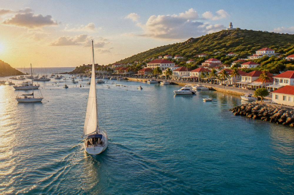
What each of these shares is the approach. Coming into Gustavia from the sea gives the view the town cannot give itself: the bowl of red roofs, the forts at either point, and the airport's hillside runway edge beyond. For ideas that start on the island instead, the site's root page on things to do in St Barts collects the non-boating options.
Where Does Gustavia Harbor Sit Within St Barts?
Gustavia Harbor sits on the west coast of St Barts, the leeward side, and the town is the island's road hub: every main route out of the capital climbs over the interior hills toward Saint-Jean and the airport to the northeast, Grand Cul-de-Sac beyond it, and the south-coast beaches of Gouverneur and Saline. Nothing on this 21-square-kilometre island is far, but every road out of town is steep and winding.
The geography is worth internalising before renting a car. Driving is on the right, roads are narrow and steep, and the island-wide limit is 50 km/h with 30 km/h in the built-up areas of Gustavia and St Jean. Avis, Budget and Hertz keep counters at the airport, and local agencies rent the open Mini Mokes the island is known for. Fares and rental prices are best checked directly with the agencies.
| Place | Position relative to Gustavia |
|---|---|
| Shell Beach (Grand Galet) | Southern edge of town, below Fort Karl |
| Gustaf III Airport (SBH) | Over the hill east of town, at Saint-Jean |
| Saint-Jean beach | Northeast, beside the airport |
| Flamands | North coast, past Saint-Jean |
| Grand Cul-de-Sac | East coast |
| Gouverneur and Saline | South coast |
| Lorient | North of Gustavia on the west side |
Each of those beaches is public and free, and the site carries a dedicated page for most of them, including Saline, Flamands, St Jean and Gouverneur. The hills make any flat estimate of drive times between them misleading.
When Is The Best Time To See Gustavia Harbor In St Barts?
The busiest harbour months run from December through April, when the climate is at its most temperate and the yacht calendar fills, while the Meteo-France normals for St Barts, 1991-2020, show the island is warm year-round, with a mean daily high of 28.5 C in January rising to 31.7 C in September and 891.3 mm of rain across the year, October the wettest month at 135.6 mm. Hurricane season runs 1 June to 30 November, peaking mid-August to mid-October.
The numbers deserve a table, because the seasonal decision on St Barts is really a rainfall and hurricane-window decision:
| Month | Mean daily high | Mean daily low | Rain |
|---|---|---|---|
| January | 28.5 C | 23.5 C | 52.6 mm |
| April | 29.8 C | 24.2 C | 50.9 mm |
| July | 31.2 C | 26.0 C | 80.4 mm |
| September | 31.7 C | 26.2 C | 96.9 mm |
| October | 31.4 C | 25.8 C | 135.6 mm |
| December | 28.9 C | 24.1 C | 79.2 mm |
Figures are Meteo-France normals, 1991-2020, for the St Barthelemy station. The sea stays warm throughout, about 26 C in winter to about 29 C from August to October. No storm, rain or crowd outcome can be predicted for any date, and none is attempted here.
Two seasonal patterns shape the harbour town specifically. First, many hotels and restaurants close each autumn and reopen between mid-October and early November, so an October visitor may find a quieter Gustavia than the guides imply, with some tables still shut. Second, the events calendar pulls the yachts in: the Bucket in mid-March, Les Voiles in April, the Music Festival from 8 to 18 January 2027, and the Gourmet Festival from 9 to 15 November 2026. The Gourmet Festival in particular fills harbour-side tables, and its 2026 dates are confirmed on the organizer's announcement.
How Do You Arrive At Gustavia Harbor By Ferry Or Plane?
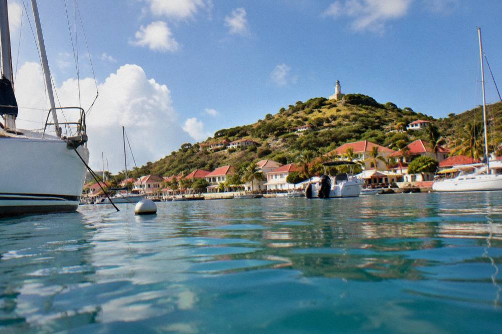
Ferry passengers reach Gustavia Harbor from St Martin on two scheduled operators: Great Bay Express from Philipsburg on the Dutch side, a crossing of about 45 minutes, and Voyager from Marigot on the French side, about 50 to 60 minutes; the operator's ferry page asks passengers to arrive well before departure with a passport, and the crossing can be rough. Flying in means a small STOL turboprop into Gustaf III Airport, whose 646 m runway excludes jets and operates in daylight only.
The airport is the other half of the arrival story, and it is unlike almost any other. The runway is 646 m, approach and departure demand special pilot qualification, and operations are daylight and visual-conditions only. Scheduled feeders include St Barth Commuter from St Martin, Grand Case and Guadeloupe, Tradewind from San Juan and Antigua, and Winair from Sint Maarten. Fares, timetables and flight times in minutes are subject to change.
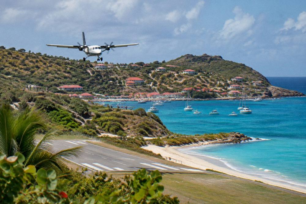
The ferry practicalities matter more than expected. Check-in closes before departure, passports are required, and sailings are subject to weather cancellation. The site's detailed pages on the ferry operators and on getting to St Barts carry the fuller mechanics.
For staying in town rather than just passing through, Gustavia where to stay covers the accommodation side of the bowl, and the wider island choice is compared in the site's best-area guide.
To make the harbour town your base, book a hotel stay.
Whichever way you arrive, the harbour gives St Barthelemy its front door, and it repays the hour it takes to walk its full curve, from the tender landing past the quays to the fort above Shell Beach, with the yachts of the marine reserve's regulated water at your shoulder the whole way. More on the island around the bay is collected across St Barthelemy Travel, including the coast walks and the beaches that ring this small French island.
Common Questions About Gustavia Harbor In St Barts
Can cruise ships dock at Gustavia Harbor?
No. Ships anchor offshore and land passengers by tender boat, because St Barts has no cruise pier. There is no official public cruise schedule; a specific call is confirmed only by the cruise line's itinerary.
Is the Gustavia waterfront free to walk?
Yes. The promenade, quays, fort view points and all beaches are public and free. No guided or tip-based walking tour is listed here; what is free is the shore and the open public places themselves.
Do any boat tours start in Gustavia?
No. Every bookable tour listed here departs from St Martin or Sint Maarten and visits St Barts as a day trip, typically calling at Gustavia, Colombier and Ile Fourchue.
What rules apply to boats in the harbour?
The marine reserve's environment agency page lists a 5-knot limit in its zones, a jet-ski ban, no touching of turtles or collecting of coral and shells, and no dogs on beaches or in the water in reserve areas.
How do I get to Gustavia from St Martin?
By ferry from Philipsburg with Great Bay Express, about 45 minutes, or from Marigot with Voyager, about 50 to 60 minutes, or by a small STOL turboprop flight into Gustaf III Airport on the other side of the island's hills. Fares and timetables are subject to change.
When do the yachts gather in Gustavia Harbor?
The largest concentrations come around the year-end holidays and the spring regattas: the Bucket in mid-March and Les Voiles in April. Hurricane season runs 1 June to 30 November, with the peak from mid-August to mid-October.