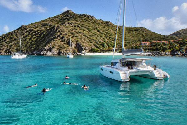
Fort Karl And The Gustavia Waterfront
Fort Karl is a small ruined fortification on the headland above Shell Beach at the southern edge of Gustavia, the harbour capital of St Barthelemy. This guide covers what it is, how to walk to it from the town, the view it gives over the harbour, and how to fit it into a day around the Gustavia waterfront.
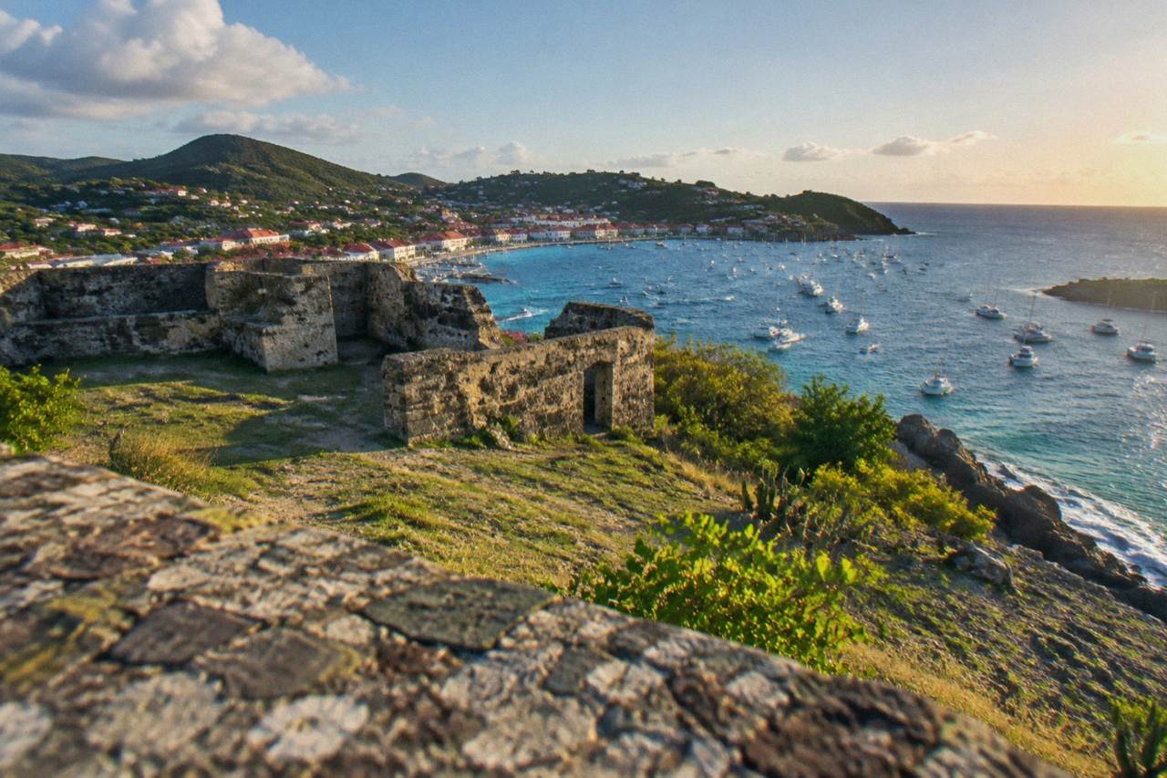
Fort Karl is a small ruined fort on the headland above Shell Beach, a short uphill walk from the center of Gustavia in St Barts. It is an open public spot with no ticket and no staff, visited for its elevated view over the harbour entrance, the anchorage and the coastline toward the airport side of the island.
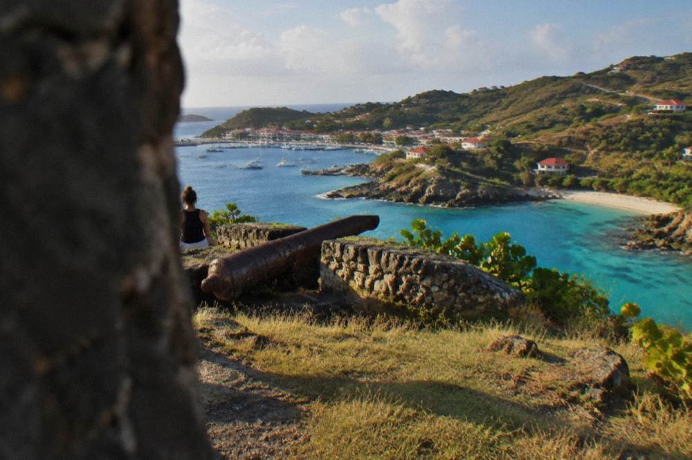
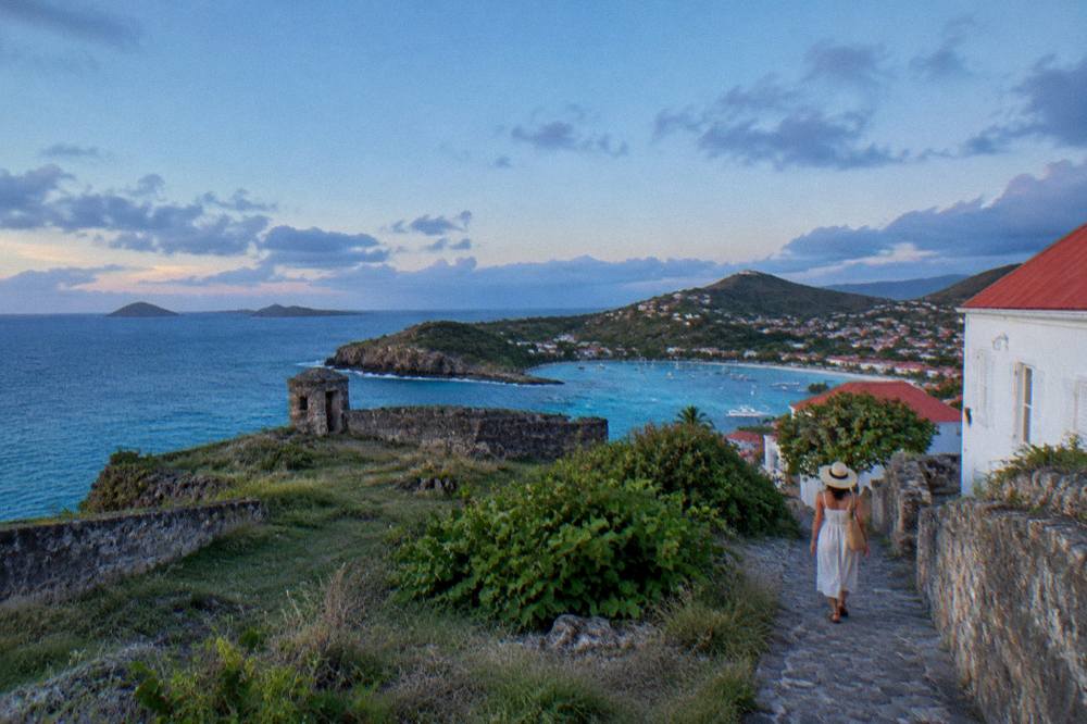
Above Shell Beach (Grand Galet), on the southern edge of Gustavia, a grassy headland carries the low stone remains of Fort Karl. The site is an open public place: there is no ticket desk, no staffed entrance and no fence around the grassy slope where the low stone remains stand. People come for one reason above all, the elevated view over the mouth of Gustavia harbour, the anchorage and the red roofs of the town, with the airport side of the island visible further along the coast. This guide from St Barthelemy Travel covers what the site is, how to reach it on foot, what you can see from it, and how to pair it with the rest of the Gustavia waterfront.
What Is Fort Karl In Gustavia St Barts?
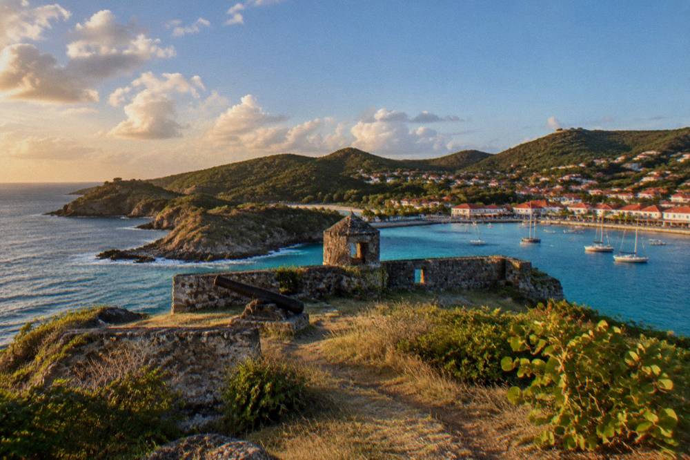
Fort Karl is a ruined coastal fortification on the headland above Shell Beach at the southern end of Gustavia, the capital of St Barts. It is an open, unstaffed public site with no entrance fee, made up of low stone remains on a grassy slope. Its draw today is the elevated outlook over the harbour entrance and the town, not a museum interior, and the tourism committee's site lists it among the island's landmarks.
That is the honest size of it. This is not a castle, not a fortress in the European sense, and not a museum. The walls that survive are low, the site is walked in a few minutes, and nothing on the island's tourism material describes interior rooms, exhibits or opening hours. The site's value is positional: it stands on the promontory that separates Shell Beach from the outer harbour, which makes it one of the few points in town where you can look down on both the water and the streets at once.
A note on what this page will not claim. No founding date, builder, garrison history or architect for Fort Karl can be confirmed. The island's broader documented history is short on this site: St Barthelemy has been an overseas collectivity of France since 2007, and the airport is named for Gustaf III. For a fort visit, none of that matters much, what matters is where the site sits and what you can see from it, both of which are easy to verify standing on the slope.
The fort is one of a pair of headland forts around Gustavia. The other, Fort Gustaf, stands on the northern side of the harbour near the lighthouse point, and the two once framed the entrance to the anchorage from opposite directions. A visit to one pairs naturally with a visit to the other, and Fort Gustaf in Gustavia has its own guide on this site with the same practical detail.
How Do You Reach Fort Karl On Foot From Gustavia?
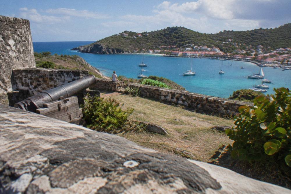
Fort Karl is reached on foot from central Gustavia by walking south through the town toward Shell Beach, then climbing the headland path above the beach. The site sits directly above Shell Beach (Grand Galet) on the promontory at the southern edge of the harbour. There is no ticket, no gate and no parking area at the fort itself, so arriving on foot from town is the standard approach.
The route is simple in outline. From the harbour front, the streets rise gently away from the water as you move south through Gustavia. Shell Beach sits at the end of that walk, a small public beach ringed by rocks on the town's southern edge, and the fort's slope rises above it. Once you are at the beach, the headland is obvious, and the site is an open public space rather than a gated attraction.
Two practical points shape the walk. First, the streets of Gustavia are narrow, steep in places and shared with cars and scooters, so walking single file on the sharper climbs is normal practice. Second, the island's traffic rules are French: driving is on the right, the island-wide limit is 50 km/h and 30 km/h applies in populated areas like Gustavia, which keeps town traffic slow and makes walking the standard way to see the waterfront. Anyone planning wider exploration should read the site's guide to getting around St Barts, which covers rental cars, taxis and the Mini Moke option in detail.
For context on the town the walk crosses, the Gustavia harbor guide covers the quay, the anchorage and the streets that climb away from the water. The harbour is the reason the town exists where it does, and the fort exists to watch over it, so the two are best understood together.
What Can You See From Fort Karl?
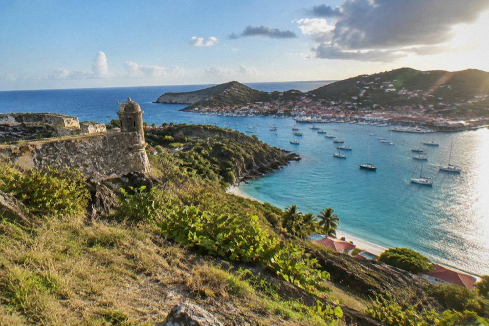
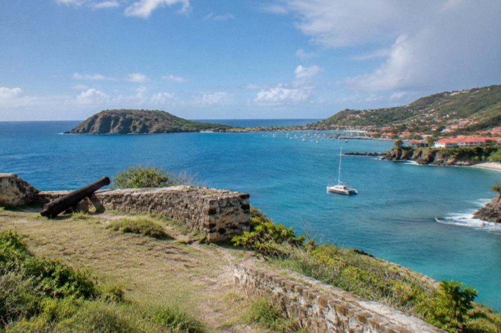
From Fort Karl the view opens across the entrance to Gustavia harbour, the anchored yachts and tenders in the roadstead, and the red-roofed town climbing the far slope. To the south and west the eye follows the rocky shoreline toward Shell Beach below and the open Caribbean beyond. On clear days the view stretches along the island's coast toward the airport side, and the whole sweep of the anchorage reads as a single picture from this one headland.
That panorama is the site's entire purpose for a modern visitor. The anchorage at Gustavia is one of the most photographed harbours in the Caribbean, and most pictures of it are taken from the water or the quay at sea level. The headland forts are the only close vantage points above the town, and Fort Karl is the southern one, which means it looks back at the town across the full width of the harbour.
The view also explains the fort's position in a way no description of walls can. The headland above Shell Beach commands the harbour's southern approach, the stretch of water any vessel must cross to reach the quay. Fort Gustaf covers the northern side. Between them they framed the entrance. Standing on the slope, you can read that geography directly: the channel, the moorings, the quay at Le Select, the famous town landmark, and the streets stacked above it.
For photographers, the practical notes are straightforward. The site faces the harbour to the north and the open water to the west, so light on the town is best in the morning and the seaward view holds its light into the afternoon. No hours are published for the site because it is an open public space, and no fee applies. The island's drone rules matter here: the environment agency's regulatory-zones page states that drones are prohibited in and near the marine reserve without authorization, so leave the drone at the hotel and use the hill.
How Does Fort Karl Compare With Fort Gustaf In Gustavia?
Fort Karl and Fort Gustaf are the two headland fort sites around Gustavia harbour: Fort Karl on the southern point above Shell Beach, Fort Gustaf on the northern side by the lighthouse point. Both are open public sites with no fee and no staff. Fort Gustaf stands closer to the lighthouse and the northern approach; Fort Karl sits above Shell Beach and looks across the full anchorage, which gives it the broader view of the town.
Because the two sites sit on opposite sides of the same harbour, visiting both is the natural way to see Gustavia from every angle. The table below compares them on position, access and orientation, without inventing history for either.
| Feature | Fort Karl | Fort Gustaf |
|---|---|---|
| Position | Southern headland above Shell Beach (Grand Galet) | Northern side of Gustavia harbour near the lighthouse point |
| What it overlooks | Harbour entrance from the south, the anchorage and the town across the water | Northern harbour approach and the lighthouse point |
| Access | On foot from central Gustavia via the streets toward Shell Beach | On foot from the harbour area toward the northern point |
| Admission | Open public site, no fee | Open public site, no fee |
| Best paired with | Shell Beach below the headland | The lighthouse point and the northern quay |
One trap to avoid: neither site is documented here with a founding date, garrison or builder, and any guide that gives you a confident construction year for either fort is printing something this site cannot verify. Treat both as landscape features with a name, a position and a view, and you will not be misled. The companion guide to Fort Gustaf in Gustavia covers the northern site in the same terms.
Can You Combine Fort Karl With Shell Beach?
Yes, and the combination is the standard visit. Fort Karl stands on the headland directly above Shell Beach (Grand Galet), a small public beach at the southern edge of Gustavia, so the beach and the fort are effectively one stop: climb the slope for the harbour view, then drop back down to the sand and rocks below. Both are free public places, with no fee for either.
Shell Beach is one of the beaches listed by the tourism committee as public and free to access, like every beach on St Barts. It sits within walking distance of the harbour front, which makes it the closest beach to the town center and the natural finish to a fort walk. The beach is small, ringed by rocky ground, and gives the headland its French name, Anse de Grand Galet.
A few island-wide rules apply wherever you step onto the sand, and they are worth repeating here because the environment agency states them plainly. Dogs are banned from all beaches on the island, even on a leash, under a standing municipal order. The marine reserve's rules, a 5-knot speed limit in its zones, no jet skis, no touching of turtles or protected species, apply in the water. Plan water, shade and shoes for rocky ground yourself.
The full beach-by-beach picture, from Saline and Gouverneur in the south to Flamands and St Jean in the north, is covered in the site's beach guides. Shell Beach's own page, Shell Beach in St Barts, covers the beach in detail, including its position relative to town and the walking route.
What Else Sits Around The Gustavia Waterfront?
The Gustavia waterfront packs the quay, the harbour, the town's shops and restaurants, Le Select, Wall House, the two fort headlands and Shell Beach into a compact walkable area around one anchorage. Fort Karl sits at the southern end of that strip, so a visit folds naturally into a half-day loop: the quay, the streets, the southern headland and the beach, all on foot, all free apart from whatever you buy along the way.
The harbour itself deserves the first stop. Gustavia is the island's capital and its working port: cruise ships anchor offshore and tender passengers in, yachts moor in the roadstead, and the ferry from St Martin arrives at the quay. The site's guide to the St Barts cruise port at Gustavia covers tendering, the quay and what a day visitor can realistically reach, and Fort Karl is comfortably inside that reach on foot.
From the quay, the streets climb south toward the fort. Along the way sit the town's shopping streets and restaurant rows, covered in the site's guides to shopping in Gustavia, restaurants in Gustavia and where to stay in Gustavia. No restaurant or shop is recommended on this page, those guides exist separately, but the geography matters: everything sits on the slope between the water and the fort's headland, so the walk passes it all.
The table below lists the waterfront sights in walking order from the harbour north to the headland south, with what each one is and where the site's own guide lives.
| Sight | What it is | Site guide |
|---|---|---|
| Gustavia harbor | The anchorage, quay and tender point of the island's capital | /attractions/gustavia-harbor/ |
| Fort Gustaf | Ruined fort site on the northern headland by the lighthouse point | /attractions/fort-gustaf-gustavia/ |
| Le Select | Long-standing town landmark and bar in central Gustavia | /attractions/le-select-gustavia/ |
| Shell Beach (Grand Galet) | Small public beach at the southern edge of town | /attractions/shell-beach-st-barts/ |
| Fort Karl | Ruined fort site on the headland above Shell Beach | This page |
For visitors building a full island plan rather than a town morning, the root guide to things to do in St Barts assembles the whole list: the beaches, the boat day trips, the fort walks and the seasonal events in one place.
When Is The Best Time Of Day To Visit Fort Karl?
Any daylight hour works, because Fort Karl is an open public site with no hours, no gate and no fee, and the St Barts climate is warm year-round: Meteo-France normals for 1991 to 2020 show mean daily highs from 28.5 C in January to 31.7 C in September. Morning light falls on the town across the harbour, while late afternoon light warms the seaward view, so the choice is photographic rather than practical. Carry water on the climb either way.
The climate table below is the full set of island normals from the site's Meteo-France data, and it makes one point clearly: there is no cold season on St Barts, only a wetter and a drier pattern. October is the wettest month at 135.6 mm of rain on the normals, February the least wet at 38.4 mm, and hurricane season runs from 1 June to 30 November with its peak from mid-August to mid-October. None of that predicts a storm or a shower on any given day, and this site never claims it does.
| Month | Mean daily high C | Mean daily low C | Rain mm |
|---|---|---|---|
| Jan | 28.5 | 23.5 | 52.6 |
| Feb | 28.6 | 23.3 | 38.4 |
| Mar | 29.0 | 23.5 | 41.4 |
| Apr | 29.8 | 24.2 | 50.9 |
| May | 30.7 | 25.1 | 61.7 |
| Jun | 31.2 | 25.9 | 56.0 |
| Jul | 31.2 | 26.0 | 80.4 |
| Aug | 31.6 | 26.3 | 79.6 |
| Sep | 31.7 | 26.2 | 96.9 |
| Oct | 31.4 | 25.8 | 135.6 |
| Nov | 29.9 | 25.0 | 118.6 |
| Dec | 28.9 | 24.1 | 79.2 |
One seasonal note that affects the town rather than the fort: many Gustavia hotels and restaurants close each autumn and reopen in waves between mid-October and early November, a recurring annual pattern rather than a dated rule. A fort-and-beach morning works in any season, but anyone planning restaurant stops around it in September or October should expect some tables to be closed and some to be open, and to confirm directly with the venue.
How Does A Fort Visit Fit Into A Day Trip To St Barts?
A fort visit fits neatly into a day trip because Fort Karl, Shell Beach, the harbour and the town shops all sit within one walkable strip at the southern end of Gustavia, and every scheduled boat arrival lands at the quay in the middle of it. Day visitors arriving from St Martin by ferry, or on a chartered boat, step ashore within walking distance of the headland, so the fort can be the anchor of a shore morning before or after time on the water.
That is the structure most first-time visitors fall into, whatever their arrival style. The ferry operators, Great Bay Express from Philipsburg and Voyager from Marigot, both land at Gustavia, and the site's guides to the ferry operators and schedule and to Great Bay Express cover the crossing in detail. The crossing can be rough, and no operator promises a smooth one, so anyone prone to seasickness should read the site's guidance before booking.
The fuller alternative is a boat day that builds the island into the trip itself. The group sail to Gustavia, Colombier and Ile Fourchue is the one per-person day trip, a group sail and snorkel excursion that departs from St Martin or Sint Maarten and never from St Barts, running on its listing from 12 May to 31 August 2027. It pairs a Gustavia stop with time at Colombier Beach and Ile Fourchue, the two marine reserve highlights on the island's northwest side.
For visitors who want the same coastline without sharing a deck, the private options listed here are priced per group rather than per person. The private charter from St Martin to St Barth runs a full day on the water with the itinerary built around the group, and the 2-day 1-night private catamaran adds an overnight stay, the only product listed here that puts its guests to bed on the water between St Martin and St Barts.
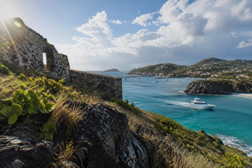
Cruise visitors have the shortest version of the same day. Ships tender into Gustavia, there is no cruise pier, and the tender point sits at the quay in the middle of the waterfront strip. Fort Karl, Shell Beach and the town are all reachable on foot from the tender point, which makes the southern headland one of the few marquee views a cruise-day visitor can collect without booking transport. The cruise port guide covers tendering and the walkable radius in full.
What Should You Know Before Walking Up To Fort Karl?
Wear real shoes and carry water, because the climb to Fort Karl is on steep, narrow town streets and then a rough slope, with no facilities, no shade structure and no water source at the site itself. There is no fee, no gate and no published hours, since it is an open public headland. Sun protection matters year-round: Meteo-France normals put the mean daily high at 28.5 C even in January, the island's coolest month.
The second thing worth knowing is what to leave behind. Drones are prohibited in and near the marine reserve without authorization under the environment agency's rules, and the headland above Shell Beach looks directly into reserve waters toward Colombier and Ile Fourchue, so this is exactly the spot where a careless launch goes wrong. Dogs cannot come either: the municipal beach ban is island-wide and applies at Shell Beach below the fort, and the reserve rules ban dogs in reserve areas on land and in the water.
Third, calibrate expectations for anyone in the party who pictures a fort. This is a low ruin on a grassy point with a famous view, not a restored structure with interpretation boards. Ten unhurried minutes on the slope, photographs of the anchorage, then back down to the beach or the town, is the realistic shape of a visit. Visitors who want a longer historical stop in Gustavia can pair the headland with the town's museums, which this site covers in its own guides.
Where Does Fort Karl Sit Among The Free Things To Do In St Barts?
Fort Karl belongs to the short list of genuinely free sights on St Barts: every beach is public and free, the open public places of Gustavia including the fort headlands cost nothing, and no guided walking tour is listed here, so the free itinerary is a self-guided one. A free day can run Shell Beach, both fort headlands, the harbour quay and the town streets without a ticket anywhere, with only food and shopping as optional spend.
That free list is worth spelling out because the island's reputation suggests otherwise. The beaches are public by law and free, from Grand Cul-de-Sac and Lorient to the southern pair at Saline and Gouverneur. The forts and the headland paths are open public ground. The harbour front is a public quay. What carries a price is the water: the bookable products listed here are boat trips departing from St Martin or Sint Maarten, and the island itself has no on-island tour products listed here at all, no jet ski, no dive booking, no kayak rental through this site.
The table below groups the free waterfront and beach sights by area, all of them public and all covered by their own guides on this site.
| Area | Free public sights | Site guide |
|---|---|---|
| Gustavia south | Fort Karl headland, Shell Beach (Grand Galet) | This page |
| Gustavia north | Fort Gustaf, lighthouse point, the quay | /attractions/fort-gustaf-gustavia/ |
| Gustavia center | Harbour front, town streets, Le Select's corner | /attractions/le-select-gustavia/ |
| South coast | Saline, Gouverneur | /attractions/saline-beach-st-barts/ |
| North coast | St Jean, Flamands | /attractions/st-jean-beach-st-barts/ |
The paid half of the island, the boat days, is where the memories that a headland cannot give are made: Colombier's water, Ile Fourchue's mooring bay, the approach to Gustavia from the sea with the forts appearing on their headlands one after the other. That approach, seen from a deck rather than a slope, is the mirror image of the view from Fort Karl, and it is the single best complement to a morning on the headland.
Common Questions About Fort Karl In Gustavia St Barts
Is Fort Karl free to visit?
Yes. Fort Karl is an open public site on the headland above Shell Beach in Gustavia, with no gate, no ticket and no staff. The same applies to the island's other public places and to every beach on St Barts, all of which are public and free to access.
How do I get to Fort Karl from the Gustavia harbor?
Walk south from the harbour front through the town streets toward Shell Beach, then climb the headland above the beach. The site sits directly above Shell Beach (Grand Galet) on the promontory at the southern edge of the harbour. The whole waterfront strip is compact and walked by visitors routinely.
What can you see from Fort Karl?
The view covers the entrance to Gustavia harbour, the anchorage with its moored yachts, the red-roofed town, and the coastline toward the airport side of the island, with Shell Beach and the open Caribbean below to the south and west. It is one of the few elevated vantage points over the town.
Is Fort Karl the same as Fort Gustaf?
No. They are two separate sites on opposite sides of Gustavia harbour: Fort Karl on the southern headland above Shell Beach, Fort Gustaf on the northern side near the lighthouse point. Both are open public fort sites with no fee, and visiting both gives the complete view over the anchorage.
Can you visit Fort Karl from a cruise ship call?
Yes. Cruise ships tender passengers to the quay at Gustavia, and Fort Karl sits within the walkable waterfront strip south of the tender point. The site needs no booking and no transport, which makes it one of the easiest sights for a cruise day. The site's cruise port guide covers tendering in detail.
Are dogs allowed at Fort Karl and Shell Beach?
No dogs are allowed on any beach on St Barts, even on a leash, under a standing municipal order, and the marine reserve's rules additionally ban dogs in reserve areas on land and in the water. Leave pets at the accommodation when heading to the headland or the beach below it.
The fort's slope, the beach beneath it and the harbour it watches make up one compact, free corner of Gustavia, and the rest of the island's coastline, from Colombier to Grand Cul-de-Sac, waits just beyond the headland.