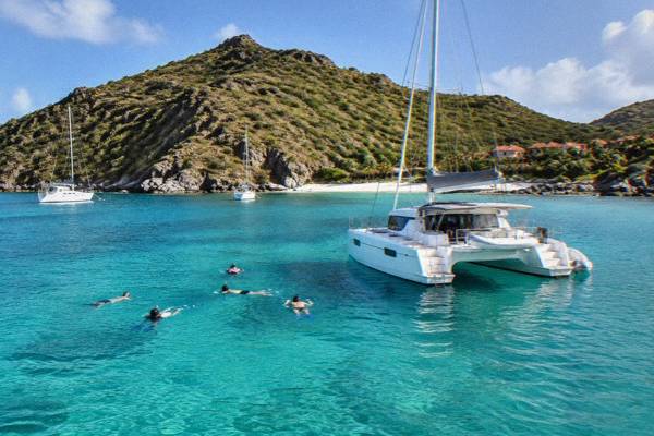
Fort Gustaf And The Lighthouse Walk
Fort Gustaf and its lighthouse stand on the hill above Gustavia, the harbour capital of St Barthelemy, and the short climb to them pairs a quiet viewpoint with the busiest sweep of water on the island.
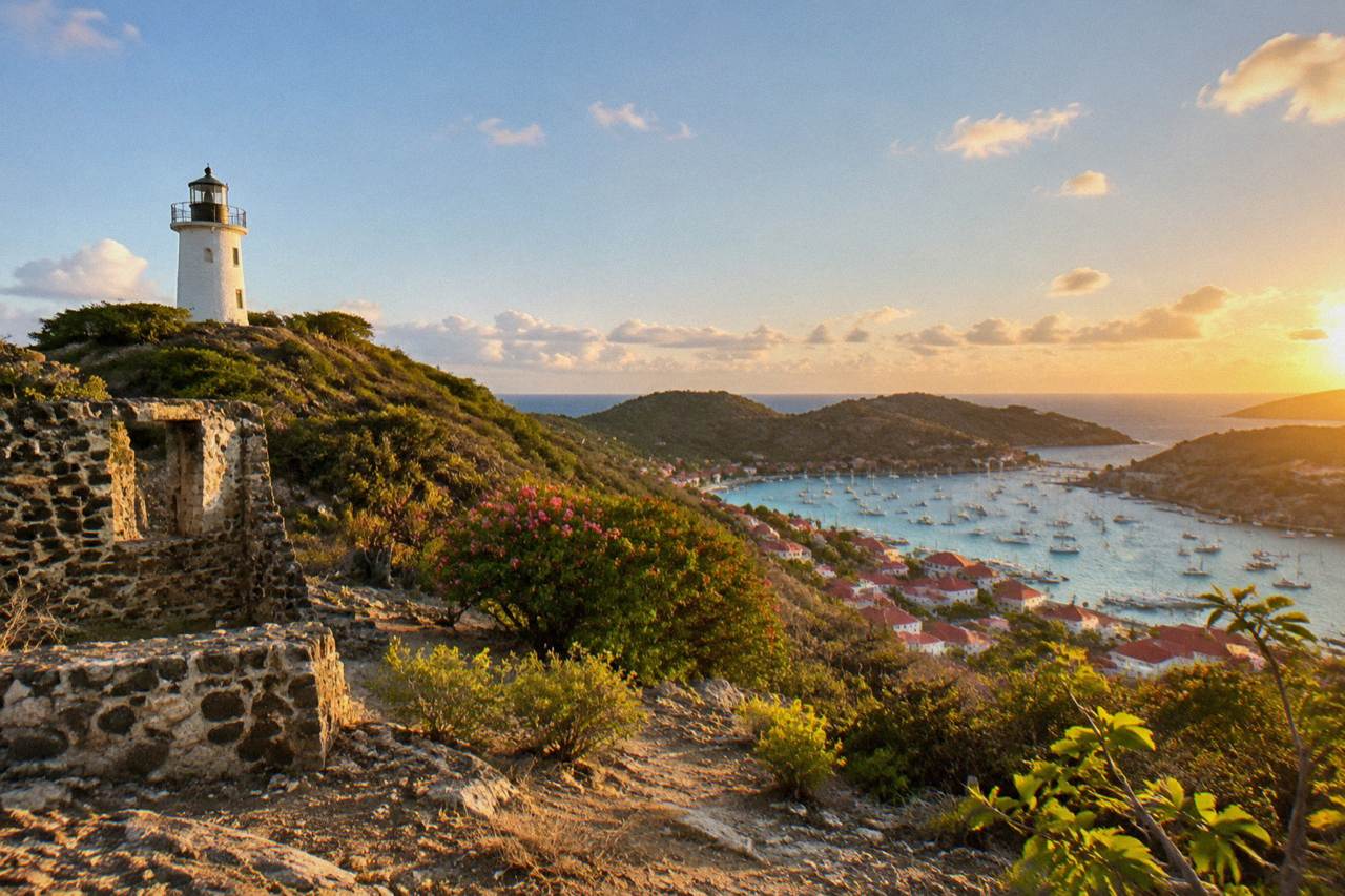
Fort Gustaf sits on the hill directly above Gustavia harbour in St Barts, next to a whitewashed lighthouse, reached on foot from the town below. The site is an open public place with no ticketed interior, and it looks out over the harbour, the airport approach and the marine reserve waters that boat trips from St Martin cross to reach the island.
Fort Gustaf and its lighthouse stand on the hillside directly above Gustavia, the capital and harbour town of St Barthelemy, the small French island in the Caribbean that this site covers end to end. St Barts is an overseas collectivity of France since 2007, about 21 square kilometres in size with roughly 10,700 residents, and Gustavia is its red-roofed centre of gravity: nearly every arrival, whether by ferry from St Martin, by small turboprop into Gustaf III Airport, or by tender from a cruise ship anchored offshore, passes within sight of this slope. The fort and the lighthouse are map landmarks rather than ticketed attractions, open public places on a hill that the town simply grows up around, and that is precisely what makes them easy to fold into a day. This guide covers where the walk sits, what the site does and does not offer, the rules that govern the protected water below it, and how the boat trips listed here connect to the same harbour view from the seaward side.
What Is Fort Gustaf In St Barts?
Fort Gustaf is a hilltop fort site on the slope immediately above Gustavia harbour in St Barts, standing next to a whitewashed lighthouse, and both are open public places with no ticket, no staffed interior and no published opening hours. The site is best understood as a viewpoint and a piece of the town's Swedish-era street pattern rather than a museum, and the tourism committee's own materials list it among Gustavia's landmarks alongside the other forts and the harbour front.
The constraint that shapes every description of it is simple: the forts and the lighthouse of Gustavia appear only as named map places, and no date, building history, architect or restoration story for Fort Gustaf is known. What can be said with confidence is positional. The site sits above the south side of the harbour basin, close enough to the town that the walk up from the quays is a matter of steep streets rather than a hike, and the lighthouse tower beside it is one of the most recognizable verticals on the Gustavia skyline. The island's broader dated history is short by design: St Barthelemy became a separate overseas collectivity of France in 2007, and Hurricane Irma struck in September 2017. Nothing further is known about the fort's past.
This matters for planning more than it might seem. Visitors who expect a curated fortress with displays, guided commentary and set hours will not find that, and no walking tour product is listed here at all: the free things on St Barts are the public beaches and the open public places, of which this is one. What the site offers instead is quiet, elevation and a genuine piece of working harbour infrastructure in the lighthouse, wrapped in the residential lanes that climb away from the waterfront. Treat it as a half hour on a hill with the whole port laid out below, and it delivers exactly what the map promises.
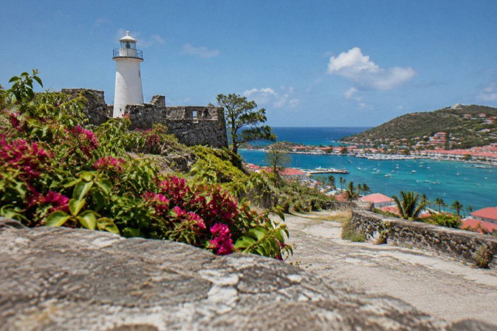
Where Does The Fort Gustaf Walk Start In Gustavia?
The walk to Fort Gustaf starts from the Gustavia harbour front and climbs through the town's steep back streets, with the lighthouse visible above as the aiming point for most of the route. The practical facts are that the start is the town, the finish is the hilltop site, and the streets between are paved, narrow and steep, consistent with the island-wide pattern of winding hill roads.
Gustavia is compact, and the fort's position above the harbour means the approach is urban rather than rural. The lanes that serve the hillside are residential, quiet by comparison with the quays, and typical of the island's terrain: St Barts is an island of hills with no river and no mountain range, and the interior rises quickly from every coast. The same road character that makes a rental car useful across the island, narrow and winding with steep grades and an island-wide speed limit of 50 km/h, dropping to 30 km/h in populated places like Gustavia, is what makes the climb on foot a steady rather than casual effort. No drive time or walking time figure appears here.
Two planning notes follow from the site's position. First, the hilltop pairs naturally with the other Gustavia landmarks that sit within the same town bowl, and the Gustavia harbour guide covers the waterfront side of that pairing in detail, from the tender pier used by cruise ships to the yacht basin that fills around the island's sailing events. Second, because there is no walking tour product on St Barts and no guide service attached to the fort, the visit is self-directed by default; the things to do in St Barts overview is the right place to see how a hilltop stop fits beside the beaches and boat days that make up the rest of an island itinerary.
For readers structuring a whole day around town, the realistic shape is a circuit: the harbour front, the quays and shops, one of the fort hilltops, and a beach within a short drive. The table below places the walk inside that bigger Gustavia picture.
| Gustavia-area stop | Position relative to the harbour | Character |
|---|---|---|
| The harbour front and quays | At sea level, ringing the bay | Working port, tenders, yachts, shops |
| Fort Gustaf and the lighthouse | On the hill above the south side of the bay | Open viewpoint, quiet residential lanes |
| Fort Karl | On the opposite western headland of the bay, see the Fort Karl guide | Hilltop site with its own harbour outlook |
| Shell Beach (Grand Galet) | A short walk west of the harbour, see the Shell Beach guide | Public beach within the town's reach |
The three trips above share one fact that matters for any Gustavia planning: every bookable tour listed here departs from St Martin or Sint Maarten and visits St Barts, never the reverse. The harbour you look down on from Fort Gustaf is the destination end of those crossings, which is why so much of what moves in the bay below is day-trip and charter traffic.
What Can You See From Fort Gustaf And The Lighthouse In St Barts?
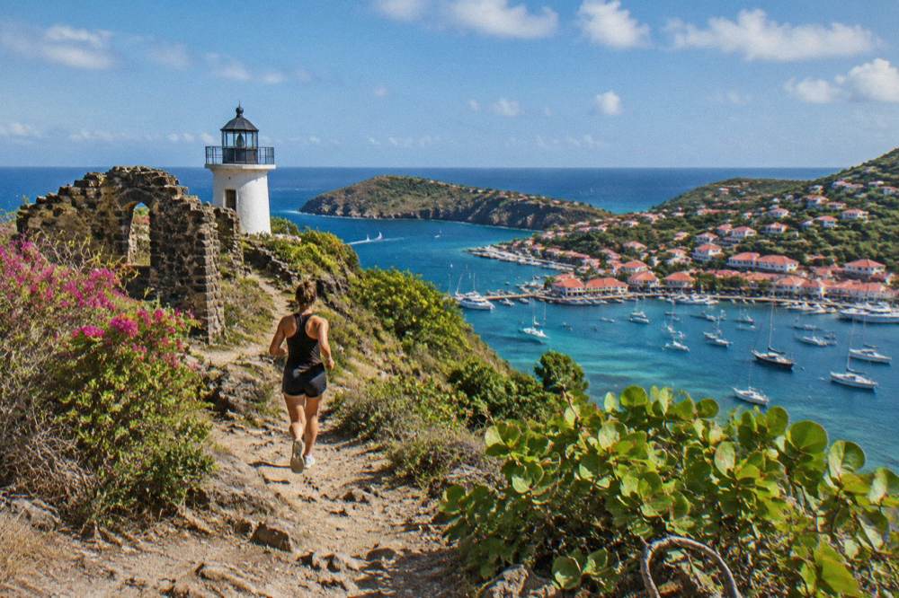
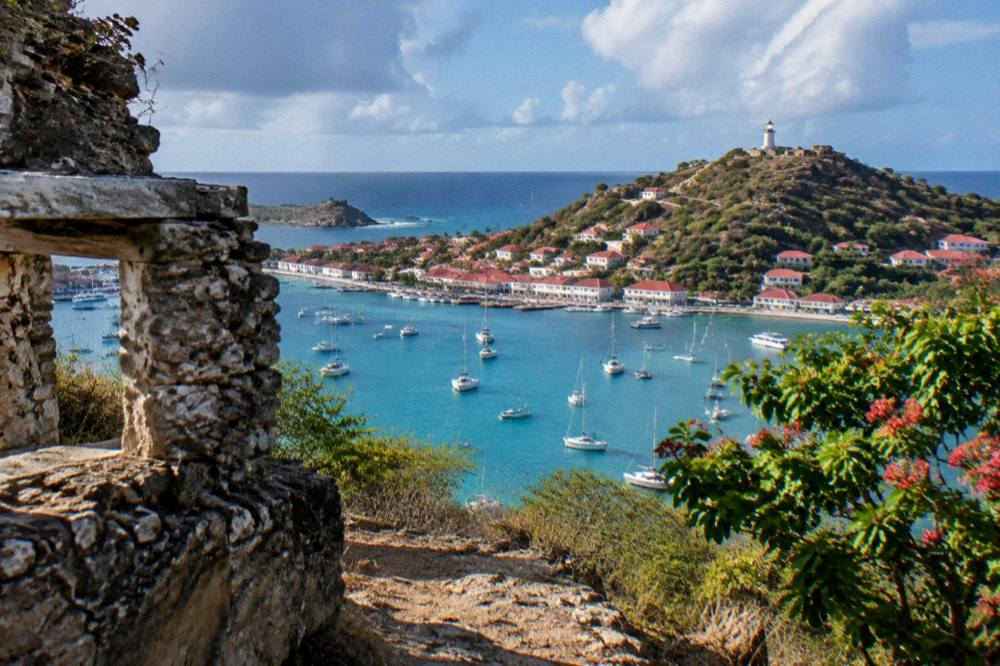
From the Fort Gustaf hillside the outlook covers Gustavia harbour and its basin, the surrounding hills of the island and the waters of the protected marine area that wraps the north side of St Barts; the tourism committee lists the site among the town's landmarks. What is certain is the foreground: the whole working harbour, laid out below like a chart.
The harbour view is the site's real content. Gustavia's bay holds the island's ferry arrivals from St Martin, the small-boat traffic of the charter fleet and, on cruise days, the tenders that shuttle passengers ashore, because cruise ships anchor offshore rather than docking: there is no cruise pier on St Barts, and the port's own materials confirm tender operations into the harbour centre. Looking down from the fort hillside, the pattern of the town reads clearly, from the quays along the water to the streets climbing toward the airport side of the island. The airport itself, Gustaf III Airport, named for Gustaf III, sits on the other side of the Gustavia basin near Saint-Jean, its 646 m runway served only by small STOL turboprops in daylight conditions, and the St Barts airport spotting guide covers that side of the spectacle separately.
The lighthouse beside the fort is a working part of the harbour's infrastructure rather than a museum piece, and it is the visual anchor of the hillside. As with the fort, this guide names it, places it and leaves it there. The reliable experience of the site is the foreground and the middle distance: rooflines, masts, the green of the slopes and the blue of the bay, with the marine reserve waters beginning at the coastline the view follows northward. Readers who want the island's other elevated outlooks will find the St Barts sunset spots guide useful for pairing a hilltop with an evening, since Gustavia's west-facing bay is one of the places the day ends well.
A note on expectations, stated plainly: no source verifies shaded seating, water points, railing conditions or any facility at the fort site itself. The site is an open hilltop in a residential part of town. Sun protection, water and sensible shoes for steep streets are ordinary precautions for anywhere on this island, whose climate normals show mean daily highs from 28.5 C in January to 31.7 C in September, warm in every month of the year.
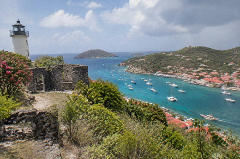
How Does Fort Gustaf Fit Into A Day In Gustavia?
Fort Gustaf works best as the elevated half hour of a Gustavia day that otherwise runs along the waterfront: harbour front, shops, a museum stop such as the Wall House, then the climb to the fort and lighthouse before looping back down to the quays or out to a nearby beach. Because the site has no hours, no ticket and no guide service, it flexes around every other part of the day rather than competing with it, and the town's other landmarks all sit within the same compact bowl.
The practical sequence starts at the water. Cruise passengers tender into the harbour centre, ferry passengers arrive from St Martin at the same bay, and the town's shops and the Le Select landmark sit steps from the quays. The island-history side of town is covered in the Wall House Museum guide and the St Barts museum and Swedish history page, both of which sit in or near the same walkable core, with no opening hours listed for either, matching the fort's own open-ended character. The climb to Fort Gustaf then adds the vertical dimension, and Fort Karl on the opposite headland makes a natural second hilltop for anyone who wants the full ring of the bay; the table in the section above lays out those positions side by side.
Below is a realistic day shape built only from positional facts. No walking times appear for any of these journeys.
| Part of a Gustavia day | Place | What To Know |
|---|---|---|
| Morning | Harbour front and quays | Ferry and tender arrivals, yacht basin, shops |
| Afternoon | Fort Gustaf and the lighthouse | Open hilltop site above the south side of the bay |
| Second hilltop option | Fort Karl | Opposite headland, its own harbour outlook |
| Late day | Shell Beach (Grand Galet) | Public beach a short walk west of the harbour |
| Alternative | A beach drive | Gouverneur, Saline or Flamands, all public, all on the island's road network |
The beaches in that last row are covered in their own pages, including Saline, Gouverneur and Flamands. All beaches on St Barts are public, which is one of the island's most useful structural facts: the free layer of a St Barts day is real and substantial, running from every shoreline to open public places like the fort hillside itself.
What Rules Apply Around The St Barts Marine Reserve Below Fort Gustaf?
The waters visible from Fort Gustaf fall under the island's marine nature reserve, whose regulatory page lists a 5-knot speed limit inside its zones, a ban on jet skis and other motorized and electric water devices, a prohibition on dogs on the reserve's beaches, a no-touching rule for protected species such as sea turtles, and restrictions on anchoring and mooring in bays including Colombier and Ile Fourchue.
The environment agency's regulatory-zones page is the authority for all of it, and the rules bind the boat traffic you watch from the hilltop.
For a visitor standing on the fort hillside, these rules explain much of what moves in the water below. The reserve covers five zones around the island, including the bays north of Gustavia that the charter boats from St Martin head for, and the 5-knot limit inside protected zones is why the boats that cross at speed from the Dutch and French sides of St Martin slow to a crawl as they enter the bays. The ban on jet skis, seabobs, electric surfboards and towed sports is island-shaping: none of those activities is listed here because none is permitted in the reserve, and no on-island activity of any kind is bookable here. The agency also prohibits collecting coral, shells, sand or rocks, bans gloves in the water, restricts drones near the reserve without authorization and limits vessels in Colombier and Ile Fourchue bays, where ecological mooring buoys are preferred. More of these guides are collected on St Barthelemy Travel.
The turtle rule deserves its own sentence. Green and hawksbill turtles are present in the island's waters, and the environment agency's beach page states flatly that they must not be touched, chased or fed, on beaches or in the water, and that nests and sightings should be reported to the agency. The island-level dog rule is broader still: dogs are prohibited on all beaches island-wide under a municipal order, on leash or not, a fact that surprises visitors with pets and is worth knowing before any beach leg of the day.
| Reserve rule | What the environment agency's page states |
|---|---|
| Speed | Maximum 5 knots on the water in protected zones |
| Motorized and electric devices | No jet skis, seabobs, electric surfboards or towed sports |
| Protected species | No touching, chasing or feeding turtles, corals and other listed species; no gloves in the water |
| Collecting | No taking coral, plants, shellfish, crustaceans, sand, rocks or shells |
| Dogs | Not allowed on the reserve's beaches or in the water; island-wide beach ban under a municipal order |
| Bays such as Colombier and Ile Fourchue | No vessels over 25 m, ecological mooring buoys preferred, anchoring restrictions apply |
| Drones | Prohibited in or near reserve zones without authorization |
The St Barts nature reserve guide expands on the zones, and the St Barts sea turtles page covers the protected-species side. For this page's purposes the point is simpler: the postcard view from Fort Gustaf looks out over regulated water, and knowing the rules makes the view legible.
The group sail above is the one per-person product listed here, and its listing runs only from 12 May to 31 August 2027, a seasonal window worth checking on the operator's live listing before building a summer plan around it. It departs from St Martin or Sint Maarten and crosses to St Barts, entering the same reserve waters described above, where its snorkel stops obey the same no-touch and no-collecting rules.
When Is The Best Light And Weather For The Fort Gustaf St Barts View?
The Meteo-France climate normals for St Barthelemy, 1991-2020, show mean daily highs of 28.5 C in January rising to 31.7 C in September, with 891.3 mm of rain across the year and October the wettest month at 135.6 mm, so the hilltop is warm in every month and the practical variables are rain and, from June to November, the Atlantic hurricane season, whose peak runs mid-August to mid-October.
No month is promised dry or clear here, and no prediction is made about any date.
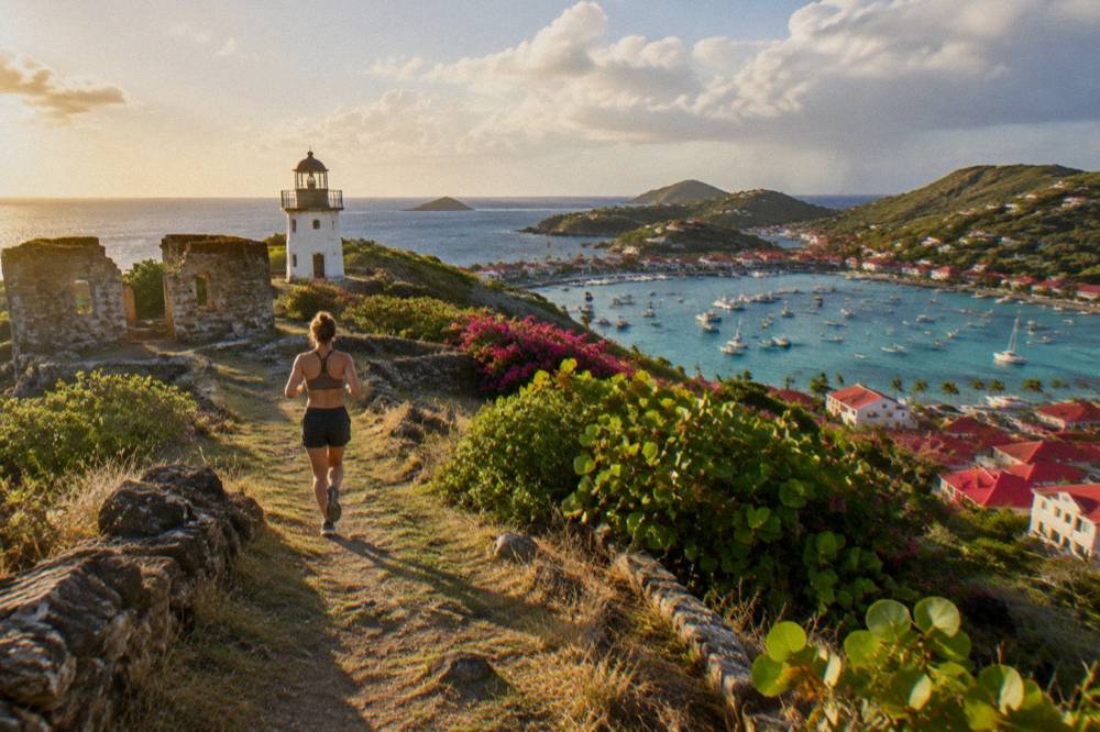
The climate table below condenses the site's normals into the months travellers most often ask about. February has the lowest monthly rainfall total in the normals at 38.4 mm and October the highest at 135.6 mm, but those are averages across the 1991-2020 reference period, not forecasts, and the island is tropical in every season. What the normals do support is packing and timing advice: a hilltop with no shade infrastructure, whatever shade the trees on the lane provide, is an early-morning or late-afternoon proposition in the warmer months, and the west-facing harbour outlook is at its most photographed as the day ends, which is exactly the territory the sunset spots guide covers.
| Month | Mean daily high C | Mean daily low C | Rain mm (Meteo-France normals, 1991-2020) |
|---|---|---|---|
| January | 28.5 | 23.5 | 52.6 |
| February | 28.6 | 23.3 | 38.4 |
| April | 29.8 | 24.2 | 50.9 |
| July | 31.2 | 26.0 | 80.4 |
| September | 31.7 | 26.2 | 96.9 |
| October | 31.4 | 25.8 | 135.6 |
| December | 28.9 | 24.1 | 79.2 |
The seasonal layer on top of the normals is the hurricane season, which runs from 1 June to 30 November with its peak from mid-August to mid-October and a climatological peak near 10 September, and the island's reference storm is Hurricane Irma, which struck in September 2017. None of this predicts any storm on any date, and it is stated here only as climatology. The autumn also carries a second pattern that affects a Gustavia day: many hotels and restaurants on the island close each autumn and reopen in waves between mid-October and early November, so the town is quieter and some waterfront options are seasonal. The best time to go season guide works through the whole calendar month by month for readers weighing that trade.
Which Boat Trips Pass Below Fort Gustaf From St Martin?
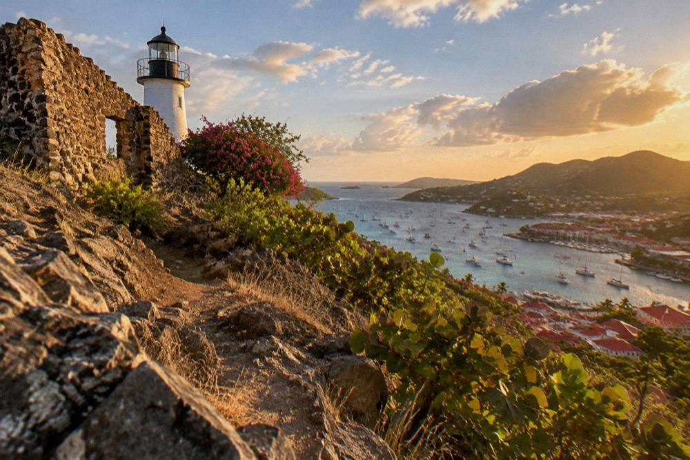
Every bookable boat trip listed here departs from St Martin or Sint Maarten, crosses to St Barts and finishes in or passes through the Gustavia harbour you see from Fort Gustaf, and the trip list spans three kinds: one per-person group sail, a set of private day charters priced per group, and one overnight private catamaran.
Five of the six products are private charters priced per group, and none departs from St Barts itself, so the fort's hilltop view is genuinely the arrival-side panorama of every trip.
The table below lays out the trip list by kind and departure. No price, rating or duration is typed here: those figures render from the product tiles and the live listings, which is where they stay current.
| Trip | Kind | Departure | St Barts connection |
|---|---|---|---|
| Boomerangs Group Sail and Snorkel | Group sail and snorkel, per person | St Martin / Sint Maarten | Gustavia, Colombier Beach and Ile Fourchue in one day |
| 8-Hour Private Charter | Private day charter, per group | St Martin / Sint Maarten | Full day crossing to St Barts waters |
| Private Charter from St Martin | Private day charter, per group | St Martin / Sint Maarten | Full day crossing to St Barts waters |
| Nikki Beach Private Charter | Private day charter, per group | Sint Maarten | Boat trip to the Nikki Beach St Barts stop on St Jean |
| 2-Day 1-Night Private Catamaran | Overnight charter, per group | St Martin | Overnight stay at St Barts |
| 7.5-Hour Private Sailboat | Private day charter, per group | St Maarten | Sailboat day crossing to St Barts |
The private charter above is one of the per-group options, and the alternative below is another, aimed at travellers who want the sailing side of the crossing rather than a motor yacht. Both enter the reserve waters around St Barts and both land in or near the harbour over which Fort Gustaf presides.
The fuller decision between the per-person group sail and the private options is covered in the things to do in St Barts overview, and the day trip guide for St Barts from St Martin covers the logistics of the crossing corridor itself, including the two scheduled ferry operators: Great Bay Express from Philipsburg on the Dutch side, about 45 minutes, and Voyager from Marigot on the French side, about 50 to 60 minutes, both of which berth in the harbour below the fort. The crossing can be rough, and neither operator's sailing is promised smooth; the ferry operators and schedule guide handles that corridor in detail.
How Does Fort Gustaf Compare With St Barts' Other Landmarks?
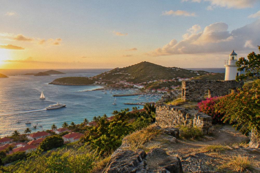
Fort Gustaf is one of several named landmarks around Gustavia that serve mainly as map places: Fort Karl sits on the western headland of the same bay, the Wall House Museum, whose collections cover the Swedish period, sits in the town, the Corossol shell museum sits on the opposite, sheltered side of the island, and none of them has firm hours, dates or ticket details. The honest comparison is positional and practical: which hill, which side of the bay, which kind of stop.
The pairing that matters most is the two forts. Fort Gustaf, with the lighthouse, anchors the town side of the harbour's slope; Fort Karl holds the headland opposite, and the Fort Karl guide covers its own outlook across the same water. Doing both in one Gustavia day is a realistic circuit for anyone comfortable on steep streets, and together they frame the bay from both flanks. The museum layer adds depth rather than views: the Wall House sits near the waterfront and the island's Swedish-history collections connect to the same period that gave Gustavia its name, with 2007 marking the island's collectivity status. On the island's quiet northwest corner, the Corossol beach and village page and the shell museum guide cover a completely different register of the island, a sheltered, traditional fishing-village side that contrasts with the harbour's glamour.
| Item | Detail | Note | Basis |
|---|
The pattern in that final column is deliberate and it is the same pattern across this entire site: when a figure or a date is unknown, the gap stays a gap. Readers comparing St Barts guides will find plenty of invented fort histories elsewhere; what this page offers instead is the practical scaffolding to visit well.
Common Questions About Fort Gustaf St Barts
Is Fort Gustaf Free To Visit In St Barts?
The site is an open public place on the hillside above Gustavia. No ticket, staffed desk or booking exists for it, and the same applies to the beaches and open public places that make up the island's free layer. No guided or free walking tour product exists on St Barts.
How Do You Get To Fort Gustaf And The Lighthouse?
On foot from the Gustavia harbour front, climbing the town's steep back streets toward the lighthouse, which is visible above the rooftops for much of the climb. Walking time and trail length remain unrecorded. The lanes are paved, narrow and steep, in line with the island's hill road pattern.
Can You See The Airport From Fort Gustaf?
The Gustavia basin and the surrounding hills are the outlook, and Gustaf III Airport sits near Saint-Jean on the far side of the same stretch of island. Its 646 m runway handles small STOL turboprops only, in daylight conditions; the dedicated airport spotting guide covers that experience properly.
Are Dogs Allowed At Fort Gustaf And St Barts Beaches?
Dogs are prohibited on all beaches island-wide under a municipal order, on leash or not, and the marine reserve's rules separately bar dogs from its beaches and waters. For a hillside street site, ordinary leash and courtesy rules apply, but the island-wide beach ban is the firm rule worth knowing before you plan any stop with a pet.
What Is The Best Time Of Day For The Fort Gustaf View?
The Meteo-France normals show the island warm year-round, with mean daily highs from 28.5 C in January to 31.7 C in September, so a shade-free hilltop suits morning or late afternoon in the warmer months. Gustavia's bay faces the setting sun, which is why the sunset spots guide pairs naturally with this walk. No month is promised clear; October averages the most rain in the normals at 135.6 mm.
Do Any Tours Visit Fort Gustaf Directly?
No. Every bookable product listed here is a boat trip departing from St Martin or Sint Maarten that visits St Barts waters and Gustavia harbour, which the fort overlooks. There is no fort tour, no walking tour and no on-island activity product of any kind listed here, a fact worth remembering when comparing this island's offerings with bigger destinations.