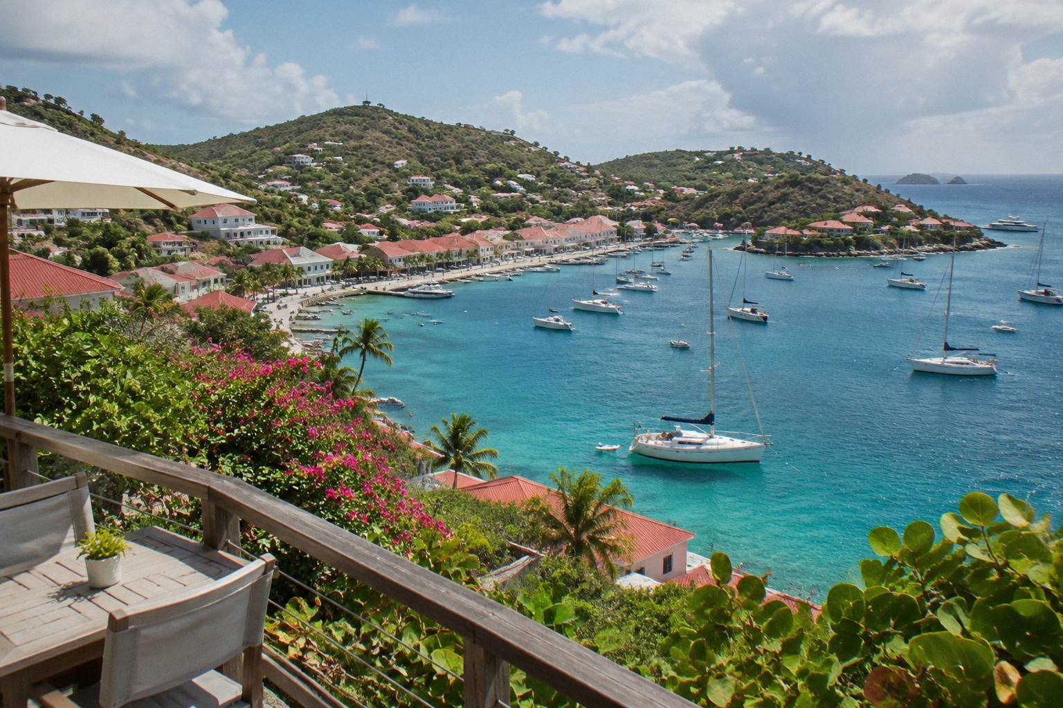
St Barts Swedish History Guide
St Barthelemy, the French Caribbean island everyone calls St Barts, carries a Swedish layer in its harbour capital, Gustavia, and in a handful of small museums and fort sites that sit above the town. This guide covers what of that era you can actually see, where each site sits on the map, and how to fold a history morning into a day built around the island itself.
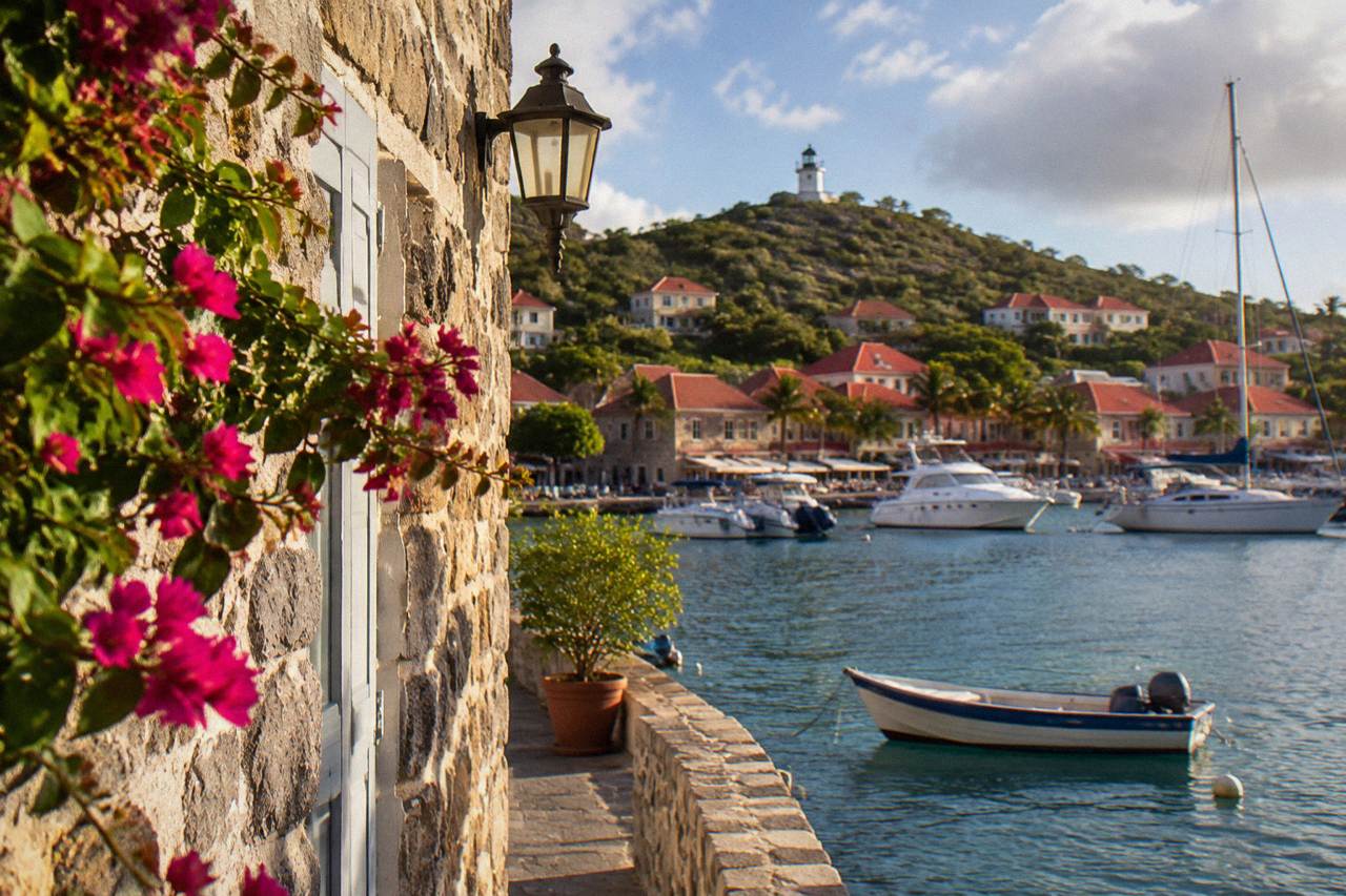
The visible Swedish history of St Barts is concentrated in Gustavia: the Wall House Museum facing the harbour, the fort sites of Gustaf and Karl on the hills either side of town, and the street names and harbour layout the Swedish period left behind. The island's other museums, the Corossol Shell Museum among them, cover natural history and island life rather than the colonial era.
St Barthelemy, better known as St Barts, is a French island in the Caribbean of about 21 square kilometres with roughly 10,700 residents, and its harbour capital carries the name of a Swedish king. Gustavia was named for Gustaf III of Sweden, and the same royal name sits on the island's airport, Gustaf III Airport, also called Remy de Haenen. That Swedish chapter is the reason so many visitors ask about museums here, and the honest answer is that the story is told in a small number of sites you can walk between in a single morning: the Wall House Museum on the Gustavia waterfront, the fort sites above the town, and a scatter of other small island museums in the villages beyond. The island's museum scene is small in every respect, and that is part of its character.
The history this site can verify is deliberately narrow: St Barts has been an overseas collectivity of France since 2007, Hurricane Irma struck in September 2017, and the airport is named for Gustaf III. No founding date, colonial treaty year or building date appears on this page. What you get instead is the geography of the history: which site sits where, what each one is about, and how to plan a day that pairs the museums with the harbour and the beaches that frame them. For the wider picture of the island's past and present, the companion page on St Barts history carries the general narrative, and things to do in St Barts covers everything else listed here.
What Can You Still See Of St Barts Swedish History Today?
The visible Swedish legacy of St Barts is a Gustavia affair: a harbour town laid out under a Swedish administration and named for King Gustaf III, a surviving stone waterfront building that now serves as a museum, and two fort sites on the hills flanking the town. The airport also carries the king's name. There are no dated building inscriptions or period rooms, so the honest visit is a walking circuit of sites rather than a timeline.
Start at the harbour and work upward. Gustavia wraps around a natural harbour that still functions as the island's port, with tenders from cruise ships arriving near the quay and yachts moored through the season. The town's grid of short streets climbs the slopes behind the waterfront, and the fort sites sit at either end of that slope. Fort Gustaf occupies the southern shoulder above the harbour entrance, Fort Karl the northern one, and both are treated in detail further down this page. Between them lies the Wall House Museum, the closest thing the island has to a home for its own story.
What the Swedish period left is mostly names and stone. The town itself is the artifact. Gustavia's name, its harbour orientation and its surviving masonry are what a visitor reads on the ground, and the museums fill in context rather than grand collections. The Gustavia harbor page covers the working port side of the same stretch of waterfront, from the quay to the Shell Beach end of town.
| Swedish-era landmark today | Where it sits | What you actually see |
|---|---|---|
| Gustavia town plan | Harbour capital, west coast | Street grid and stone waterfront climbing the hills around the port |
| Wall House Museum | Gustavia, facing the harbour | A period stone building housing the island's historical collections |
| Fort Gustaf site | Hill above the south side of the harbour entrance | Fortification site with views over Gustavia and the roadstead |
| Fort Karl site | Hill on the north side of town | Fortification site above the town and the coast toward Shell Beach |
| Gustaf III Airport name | St Jean, north of Gustavia | The island's airfield named for the same Swedish king |
Where Is The Wall House Museum In St Barts?
The Wall House Museum stands on the Gustavia waterfront, facing the harbour, making it the most central of the island's museums and the natural first stop on any history walk. It occupies a stone building of the harbourfront period and presents the island's past and heritage collections. Confirm current opening hours, ticket prices and exhibit details on site or through the local tourism office before planning around a visit.
The museum's value is its position as much as its content. You step out of it directly onto the quay where the island's whole commercial life happens: the tenders, the fishing boats, the shops of Gustavia. A history morning here flows naturally into lunch in town, a walk to Le Select, the long-standing Gustavia institution a few streets in, or the short climb to one of the fort sites. The Gustavia shopping guide covers the streets between the museum and the rest of town.
Treat the museum as an orientation point rather than a half-day destination. St Barts does not do large museums; its collections are small, local and personal, and the Wall House is the largest of them in the most visited location. Pairing it with the fort sites gives you the full historical circuit of the capital in a morning, with the whole afternoon left for the water.
If your trip is built around arriving by sea rather than by plane, the group sail that visits the island from St Martin is the natural companion: it puts you into Gustavia's harbour with time in town and a snorkel stop at Colombier in one day. Details and current pricing render below from the operator's live listing.
For a fuller look at that specific day trip, the Gustavia, Colombier and Ile Fourchue sail page describes the route the boat takes from St Martin into the harbour and along the coast. You can also See the live listing directly with the operator.
What Do Fort Gustaf And Fort Karl Show You Above Gustavia?
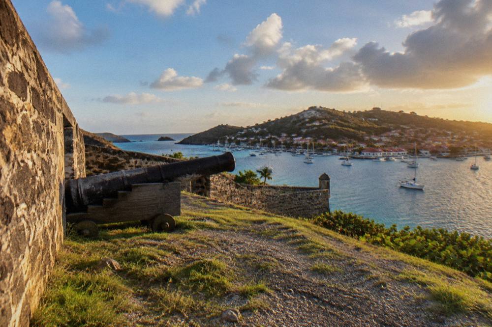
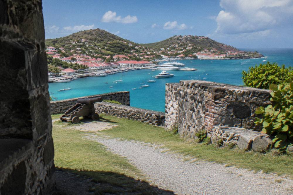
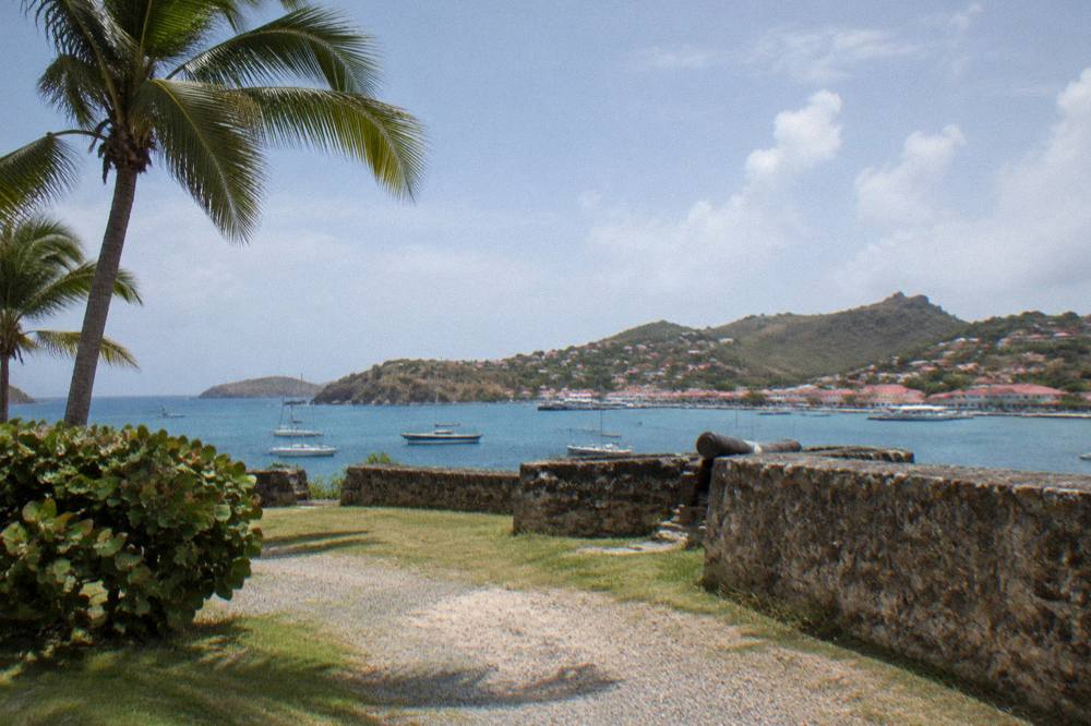
Fort Gustaf and Fort Karl are two fortification sites on the hills flanking Gustavia, one above the southern harbour entrance and one on the north side of town, both reached on foot from the waterfront. They are open-air sites rather than museums: what they offer is the surviving stonework of the harbour's defenses and the panorama over the port and the coast. Hours, admission details and construction dates are not available, and none should be assumed.
The two forts bookend a harbour walk. From the Wall House Museum, Fort Gustaf is the closer climb, sitting above the harbour entrance on the south side, with the view down over the quay, the moorings and the tenders coming and going. Fort Karl sits above the north end of town, oriented instead toward the coast that runs out toward Shell Beach. Walking both in one loop with the waterfront between them is the classic Gustavia circuit, and it needs no car.
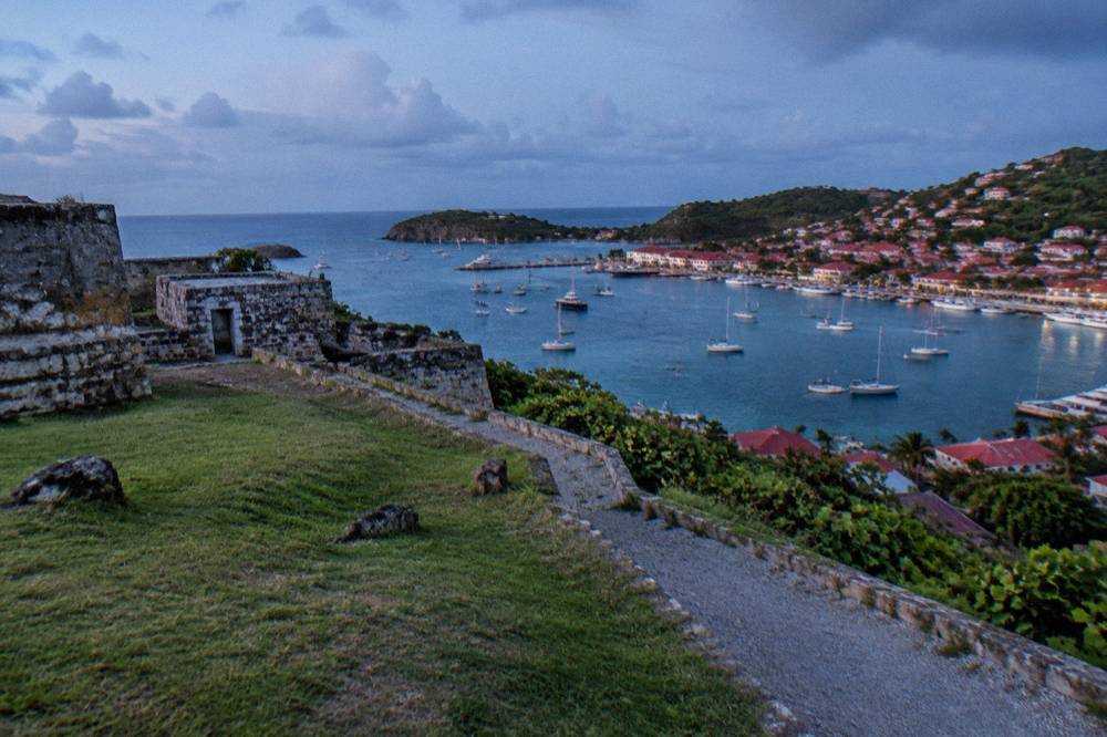
The fort sites also anchor a longer walking day. From Fort Karl the coast path leads toward Shell Beach, the public beach a short way along the shore from town, so a history morning can end with a swim before lunch back on the quay. The dedicated pages on Fort Karl and Fort Gustaf cover each site's position and approach in detail.
Because the tours listed here all depart from St Martin or Sint Maarten, the practical pattern for cruise passengers and St Martin-based travellers alike is the same: the boat or ferry brings you into Gustavia, and the fort circuit, the Wall House Museum and Shell Beach all sit within walking range of where you step ashore. A private charter gives the same town time on your own schedule; the details render from the listing below.
Is There A Shell Museum Or Other Museums In St Barts?
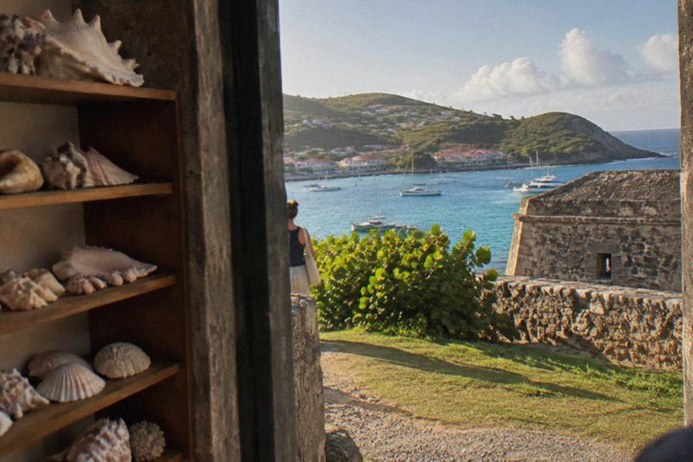
Beyond the Wall House Museum in Gustavia, St Barts has a small number of village museums, the best known being the shell museum in Corossol on the island's west coast, along with heritage displays tied to the island's churches and local life. None is large, all are locally run, and none publishes set hours or admissions, so treat them as find-on-the-day stops rather than fixed appointments.
Corossol is the destination. The village sits on the coast north of Gustavia, and the Corossol beach and village page covers the settlement itself, its public beach and its quiet, residential character. The shell museum there presents collections of shells and marine specimens, a different theme from the Swedish-era history of the capital but part of the same small network of island museums. The dedicated Corossol shell museum page gives its position and setting.
| Museum or heritage site | Village or district | Theme |
|---|---|---|
| Wall House Museum | Gustavia waterfront | Island history and heritage collections |
| Corossol Shell Museum | Corossol, west coast | Shells and marine specimens |
| Fort Gustaf site | Gustavia, south hill | Harbour defense site and viewpoint |
| Fort Karl site | Gustavia, north hill | Harbour defense site and viewpoint |
| Village churches | Corossol, Lorient and others | Island religious heritage, viewable from outside |
A museum loop outside the capital pairs naturally with the island's quieter beaches. Corossol sits close to Flamands and the stretch of coast toward Colombier, so a morning of shells and village streets can end on sand. Lorient, home to another of the island's churches and a public beach of its own, is on the same eastern loop; the Lorient beach page covers it.
How Swedish Is Gustavia Compared With The Rest Of St Barts?
Gustavia is where the Swedish layer of St Barts is concentrated, because it was the administrative harbour town of that era and keeps the name, the waterfront orientation and the fort sites. The rest of the island, from Saint-Jean to Grand Cul-de-Sac, is French in naming and character, and its landmarks are beaches, villages and the airport rather than colonial sites. A visitor with one history interest should spend it in Gustavia and let the rest of the island be what it is.
The geography makes this easy. Gustavia sits on the leeward west coast, and everything historical sits within its bowl of hills. Saint-Jean, the beach-and-airport district on the north shore, is about the water and the famous approach over the roadstead; the Saint-Jean beach page covers it. The great southern beaches, Gouverneur and Saline, are pure landscape, reached by steep roads over the hills, with no sites beyond the sand and the view.
This division of labour is the island's charm. History in the morning in Gustavia, beach in the afternoon anywhere, and the two never compete for the same hours. All beaches on St Barts are public, which makes the afternoon half of that plan free and effortless. If you want the fuller beach-by-beach picture, the best beaches on St Barts by coast sorts the island's shores by where they sit on the map.
When Is The Best Time Of Year To Visit St Barts Museums?
Any month works for the museums themselves, since St Barts is warm year round, with mean daily highs from 28.5 C in January to 31.7 C in September in the Meteo-France normals for 1991 to 2020, and museum visits are short, shaded and town-based.
The planning variables are the season around them: the November to April high season aligns with the driest months, while the 1 June to 30 November hurricane season overlaps the warmest and wettest stretch, with October the wettest month at 135.6 mm of rain.
The climate table below is drawn from the Meteo-France climate normals, 1991 to 2020, for the St Barthelemy station, and it is the only weather data this site treats as settled. October carries the highest monthly rain total at 135.6 mm and February the lowest at 38.4 mm, while temperatures barely move across the year: the island is warm in every month, and a museum morning is never a weather decision. The wider set of guides lives on St Barthelemy Travel.
| Month | Mean daily high | Mean daily low | Rain |
|---|---|---|---|
| January | 28.5 C | 23.5 C | 52.6 mm |
| February | 28.6 C | 23.3 C | 38.4 mm |
| April | 29.8 C | 24.2 C | 50.9 mm |
| July | 31.2 C | 26.0 C | 80.4 mm |
| September | 31.7 C | 26.2 C | 96.9 mm |
| October | 31.4 C | 25.8 C | 135.6 mm |
| December | 28.9 C | 24.1 C | 79.2 mm |
The seasonal pattern that matters more than rain is the autumn closure wave. Many hotels and restaurants on St Barts close each year in the late-summer low period and reopen between mid-October and early November, so an October or early-November trip lands in a town still waking up, while December through April is the full high season with the regattas and festivals that fill the harbour. No prediction of crowds or availability is made here; the pattern is the fact, the rest varies.
| Season marker | Dates | What it means for planning |
|---|---|---|
| Hurricane season | 1 June to 30 November, peak mid-August to mid-October | Overlaps the warmest, wettest months; never a storm prediction |
| Climatological season peak | Around 10 September | The statistical centre of Atlantic activity |
| Autumn closures | Reopening between mid-October and early November | Many hotels and restaurants close in the low period |
| High season | Roughly November to April | The festivals and regattas cluster here |
| Driest month | February, 38.4 mm | Meteo-France normals, 1991 to 2020 |
Can You Combine St Barts History With A Day On The Water?
Yes, and it is the single best pairing the island offers, because every boat tour listed here departs from St Martin or Sint Maarten, arrives across the channel into Gustavia's harbour, and includes coast stops such as Colombier and Ile Fourchue, so a single day can carry a museum-and-forts morning in town and a snorkel afternoon in the marine reserve. Five of the six bookable products are private charters priced per group, and one is a per-person group sail.
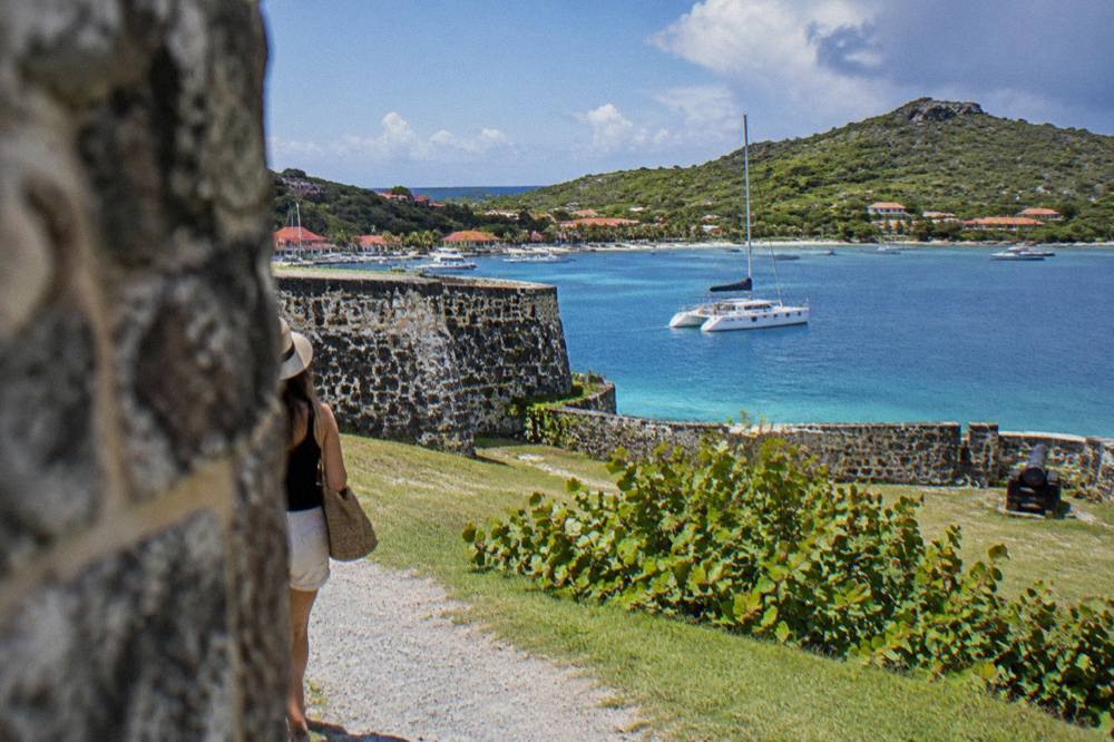
The reserve rules shape the water half of the day. The St Barts marine reserve, run by the island's environment agency, lists a 5-knot speed limit in its zones, a ban on jet skis, 23 dive sites, no dogs on beaches and no touching of turtles, so the coast stops on these tours are quiet, regulated and oriented to looking rather than motorsports. Colombier, a public beach reached most easily by boat or on foot, and Ile Fourchue, the small island in the reserve's care, are the two names that recur on itineraries.
| Bookable product listed here | Kind | Departure |
|---|---|---|
| Gustavia, Colombier and Ile Fourchue tour | Group sail and snorkel, per person | St Martin / Sint Maarten |
| Private sailboat charter to St Barth | Private day charter, per group | St Martin / Sint Maarten |
| Full-day private charter tour | Private day charter, per group | St Martin / Sint Maarten |
| Private charter from St Martin | Private day charter, per group | St Martin / Sint Maarten |
| Nikki Beach private charter | Private day charter, per group | Sint Maarten |
| Two-day one-night private catamaran | Overnight charter, per group | St Martin |
The sail into Gustavia is itself a piece of the history. The town was built as a harbour capital, and the fort sites were placed to watch exactly the roadstead your boat crosses on the way in. Arriving by sea, then climbing to Fort Gustaf, gives you the defense geography the way it was meant to be read. The related tour for this page, the Gustavia, Colombier and Ile Fourchue sail, runs on that logic, with live availability on the operator's listing.
For travellers who want the town time on their own clock, a private sailboat version of the same crossing renders below.
And for the fullest version, the overnight catamaran gives two days and a night, with the harbour and the reserve both in range.
How Do You Get To St Barts For A Museum Day?
Nearly everyone reaches St Barts through St Martin: flights from North America and Europe land at Princess Juliana on Sint Maarten, and the last leg is either a small turboprop into Gustaf III Airport or a ferry across the channel to Gustavia. The airport's 646 m runway takes only small STOL turboprops in daylight, no jets, and the two scheduled ferry operators are Great Bay Express from Philipsburg and Voyager from Marigot. Fares, timetables and flight times in minutes are subject to change.
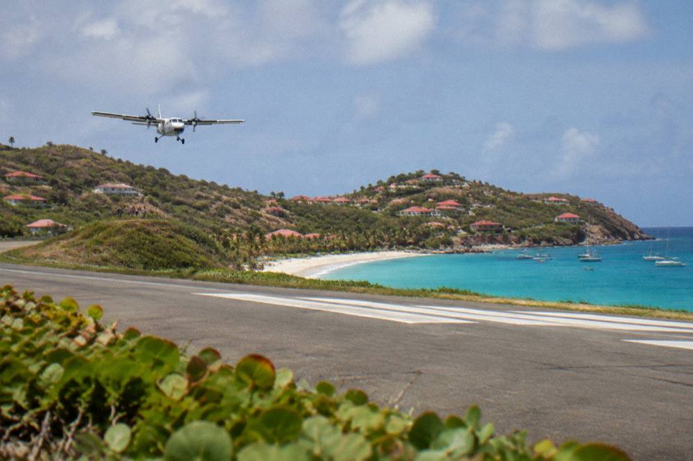
The small-plane arrival is an attraction in its own right, with the approach over the water into Saint-Jean the subject of its own page on landing at St Barts airport. The carriers are St Barth Commuter flying from SXM, Grand Case and Pointe-a-Pitre, and Tradewind from San Juan and Antigua, alongside Winair from SXM. The ferry side is covered in depth on the St Barts ferry operators and schedule page, and the crossing can be rough; no operator promises a smooth one, and sailings are subject to weather.
Once ashore, the museum circuit needs no vehicle. Gustavia is compact, the forts are walks, and Shell Beach is a stroll from the quay. For anything beyond town, a rental car, a Mini Moke or the island's taxis cover the villages; the getting around St Barts guide lays out the options, and the counters at the airport include Avis, Budget and Hertz alongside local agencies. Driving is on the right, on narrow and steep roads.
What Free Sights Sit Near The St Barts Museums?
The free sights near the museums are the public ones: Gustavia's harbour and quay, the streets of the capital, the fort sites above town, and the island's public beaches, including Shell Beach within walking range of the Wall House Museum. Every beach on St Barts is public and free to access, and the open public places of Gustavia cost nothing. No free guided walking tour is listed here, and none should be assumed.
A zero-cost day is entirely possible. Walk the quay, climb to Fort Karl, follow the coast to Shell Beach for a swim, and come back through the streets to the harbour: the whole loop is on foot and open to all. Further afield, the beaches named on this site, from Gouverneur and Saline in the south to Grand Cul-de-Sac in the northeast, are public, and the reserve asks only that visitors respect its rules, including the ban on dogs and on touching turtles.
| Free sight near the museums | Distance character | What it is |
|---|---|---|
| Gustavia quay and harbour | At the museum's doorstep | Working port, tenders, moorings |
| Fort Gustaf site | Short climb, south side | Open hillside fort site with harbour views |
| Fort Karl site | Short climb, north side | Open hillside fort site toward Shell Beach |
| Shell Beach (Grand Galet) | Walk from town | Public beach on Gustavia's edge |
| Corossol village | Short drive or ride | Quiet west-coast village with a public beach |
The museums themselves may charge admission; that is between you and the door. Everything in the table above is simply open.
Common Questions About St Barts Museums And Swedish History
Is there a museum of Swedish history in St Barts?
The Wall House Museum in Gustavia is the island's main history museum, housed in a stone building facing the harbour in the town the Swedish era named. It is small and local in scale, and it is the natural first stop for the island's past. Check opening hours and admissions on site or with the local tourism office.
Why is the capital of St Barts called Gustavia?
Gustavia was named for Gustaf III of Sweden, and the same royal name sits on the island's airport, Gustaf III Airport, also called Remy de Haenen. The town grew around its harbour as the island's port and administrative centre, and the street grid and waterfront stone of today's town are the visible inheritance of that period. The dates of the naming and the town's founding remain unclear.
What can you see at Fort Gustaf and Fort Karl?
Both are open-air fortification sites on the hills flanking Gustavia: Fort Gustaf above the southern harbour entrance and Fort Karl on the north side of town toward Shell Beach. They offer surviving stonework, harbourside views and the defense geography of the port, rather than collections or interiors. Wear shoes for the climb and go in the cooler part of the day.
Do the St Barts museums have set opening hours?
Small island museums adjust their days seasonally, with the autumn low period the most likely time for reduced schedules. The practical approach is to confirm on arrival through the local tourism office or on site, and to build the day so the forts, the harbour and the beaches carry it if a museum happens to be closed.
Can you visit the Wall House Museum on a day trip from St Martin?
Yes. The ferries from Philipsburg and Marigot and the boat tours from St Martin and Sint Maarten all arrive at Gustavia, within walking distance of the Wall House Museum, the fort sites and Shell Beach, so a history circuit fits comfortably inside a day trip. The Gustavia, Colombier and Ile Fourchue sail is one such day, pairing town time with a snorkel stop.
Is the Corossol Shell Museum about Swedish history?
No. The shell museum in Corossol presents shells and marine specimens, a natural-history theme rather than the colonial story of the capital. It belongs on a village-and-beach loop of the west and north coasts, while the Swedish layer of the island is a Gustavia subject, centered on the Wall House Museum and the fort sites.
The Swedish story of St Barts is small, walkable and best read in one harbour morning: a museum on the quay, two forts on the hills, and a town that still answers to a Swedish king's name. Spend the afternoon on the water, and the island's two eras, the stone one and the turquoise one, both deliver.