Where Is St Barts
St Barthelemy, usually written St Barts, is a small French island in the Caribbean, and pinpointing it exactly is the first question almost every traveller asks. Here is where it sits, who governs it, and how people reach it.
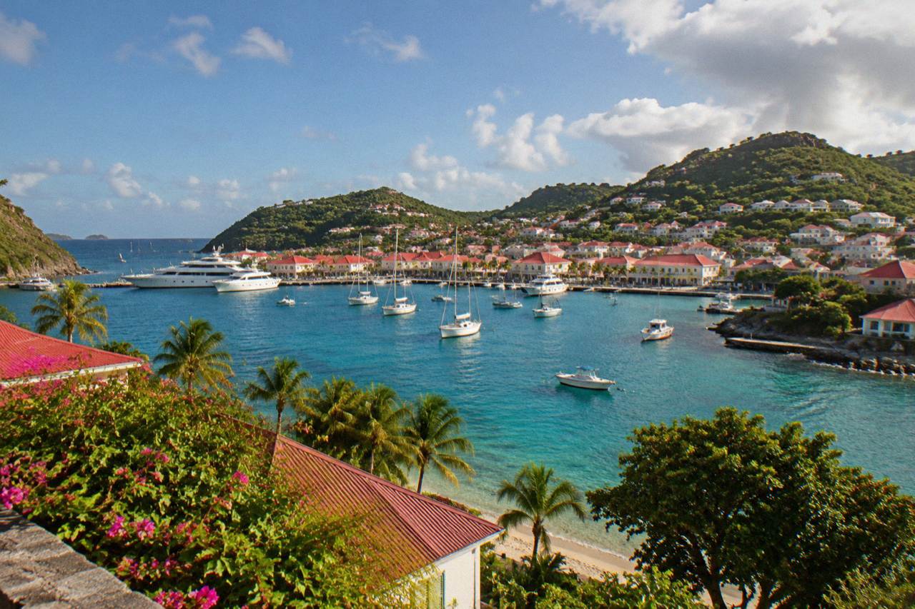
St Barts sits in the northeastern Caribbean, in the Leeward Islands of the Lesser Antilles, about 230 kilometres northwest of Guadeloupe. It is a French overseas collectivity with its capital at Gustavia, and its nearest large neighbour is the shared island of St Martin and Sint Maarten, the main gateway for flights and ferries.
St Barthelemy, usually written St Barts, is a small French island in the Caribbean Sea, and the question of exactly where it sits has a precise answer. It lies in the Leeward Islands, the northern arc of the Lesser Antilles, the chain of islands that curves from the Virgin Islands down toward Guadeloupe and Dominica. The island is an overseas collectivity of France, a status it has held since 2007, and its capital and main harbour town is Gustavia. Its nearest neighbour is the island shared by St Martin on the French side and Sint Maarten on the Dutch side, which is where nearly every long-distance traveller changes planes or boards a ferry to complete the journey.
Where Is St Barts On The Map?
St Barts sits in the northeastern Caribbean, in the Leeward Islands group of the Lesser Antilles, roughly 230 kilometres northwest of Guadeloupe and about 25 kilometres southeast of the island of St Martin and Sint Maarten. It lies near 18 degrees north latitude and 63 degrees west longitude, and its neighbours include Anguilla to the northwest, Saba to the south, and St Kitts and Nevis further southwest. The island is roughly 21 square kilometres in size, with Gustavia, its capital, on the leeward, western side facing the Caribbean Sea. There is no river and no mountain range: the interior is a series of hills that slope down to public beaches on every coast.
To place it against better-known reference points: St Barts is east of Puerto Rico, south of the Virgin Islands, and north of the small volcanic island of Saba. The French side of the neighbouring shared island, St Martin, is the closest substantial landmass, and the channel between the two is short enough that scheduled ferries cross it daily in ordinary weather. Anyone planning the onward leg from that neighbour can read the site's page on getting to St Barts by ferry, which covers the two operators, Great Bay Express from Philipsburg and Voyager from Marigot.
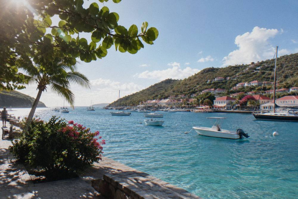
The island's position shapes its weather too. Sitting inside the Atlantic hurricane belt, St Barts has a hurricane season that runs from 1 June to 30 November, with the peak of activity from mid-August to mid-October. The Meteo-France normals, 1991-2020, for the island's station show a mean daily high of 28.5 C in January rising to 31.7 C in September, with 891.3 mm of rain across a typical year and October the wettest month at 135.6 mm. The sea stays warm year-round, about 26 C in winter to about 29 C from August to October.
| Reference point | Direction from St Barts | Note |
|---|---|---|
| St Martin / Sint Maarten | Northwest, about 25 km | Main gateway; ferries and small planes |
| Anguilla | Northwest, beyond St Martin | British territory |
| Saba | South | Dutch special municipality |
| St Kitts and Nevis | Southwest | Federation of two islands |
| Guadeloupe | Southeast, roughly 230 km | French region; regional flights |
| Barbuda | Southwest | Part of Antigua and Barbuda |
The table above is the short geography lesson, and it explains most of the island's transport reality. Everything about reaching St Barts flows from that first row: the shared neighbour island holds the main airport, Princess Juliana on the Dutch side, and the ferry terminals at Marigot and Philipsburg, and from there small aircraft and boats finish the trip.
What Country Does St Barts Belong To?
St Barts belongs to France. It is a French overseas collectivity, a status under Article 74 of the French Constitution that it has held since 2007, when it separated administratively from Guadeloupe. The capital is Gustavia, the currency is the euro, French is the official language and English is widely spoken, and the island sends representatives to the French Parliament. It is not an independent nation, not a Dutch island, and not a US territory, three mix-ups that come up often because of its neighbours. Sint Maarten, visible from St Barts' hills on a clear day, is Dutch; Anguilla to the northwest is British; St Barts itself is French.
The collectivity is small in people as well as land. The census figure reported by INSEE, France's national statistics office, is 10,660 for January 2023, and the 2021 legal population was 10,556, so the honest written form is "about 10,700" or "roughly 10,000" residents. The island is about 21 square kilometres of hills, beaches and red-roofed Gustavia. The island has been French for well over a century, apart from a period under Sweden that lives on in the capital's name and in the island's small museum collections, and its current governance runs through the French state.
One practical consequence of French status matters to travellers: entry rules are set by French authorities, and St Barts sits outside the Schengen area, so the EU's border systems do not govern arrival. A Schengen visa alone does not authorize entry where a visa is required. US, UK, Canadian and EU citizens are generally visa-exempt for short tourist stays of up to 90 days, and onward travel documentation is needed. Readers planning documents can check their own government's travel advice and the site's pages on passports and customs for the detail.
| Question | Answer |
|---|---|
| Sovereign state | France |
| Status | Overseas collectivity (COM) since 2007 |
| Capital | Gustavia |
| Currency | Euro |
| Official language | French, with English widely spoken |
| Population | About 10,700 (2023 census figure of 10,660) |
| Area | About 21 square kilometres |
| Time zone | UTC minus 4, no daylight saving |
How Do You Get To St Barts From Abroad?
There is no long-haul airport on St Barts, so every traveller reaches it through a gateway, and the main gateway is the neighbouring island of St Martin and Sint Maarten. Long flights land at Princess Juliana airport (SXM) on the Dutch side, then a small STOL turboprop covers the last hop to St Barts, or one of two ferries, Great Bay Express from Philipsburg or Voyager from Marigot, makes the crossing. Alternative gateways are San Juan in Puerto Rico, Pointe-a-Pitre in Guadeloupe and Antigua, each served by small carriers flying into St Barts directly. This chain, a big airport followed by a small plane or a boat, defines every journey to the island.
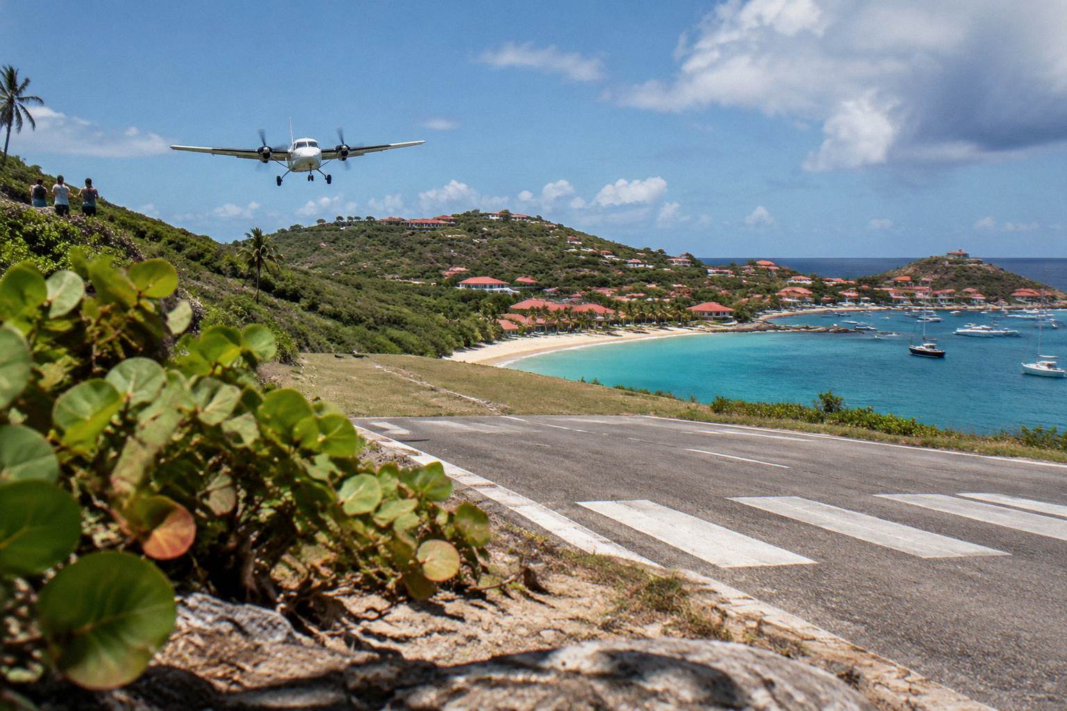
The reason is the runway. Gustaf III Airport, also called Remy de Haenen, has a single runway of 646 metres on the shore at Saint-Jean, and it accepts only small STOL turboprops, in daylight and visual conditions. No jets land on St Barts. The approach over a hill at the end of the runway is one of the well-known landings in aviation circles, and the airport's page on this site covers what to expect. St Barth Commuter flies from SXM, Grand Case on the French side of St Martin, and Pointe-a-Pitre; Tradewind flies from San Juan and Antigua; Winair serves the island from SXM. Fares and schedules sit with each airline.
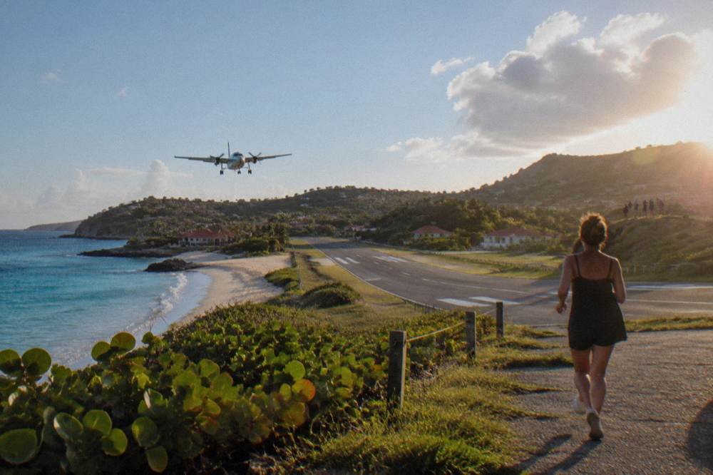
The ferry is the alternative, and it suits travellers who prefer not to fly the short hop. Great Bay Express runs from Bobby's Marina in Philipsburg on the Dutch side, a crossing of about 45 minutes, with check-in well before departure and a passport required. Voyager runs from the Marigot terminal on the French side, a crossing of about 50 to 60 minutes. Both operators' pages carry the current times, and the crossing can be rough, so no smooth passage should be assumed. The site's guides on how to get to St Barts and the airport guide cover each leg in detail.
A third arrival pattern is by sea under sail. Cruiseships anchor offshore and tender passengers into Gustavia, since the harbour has no cruise pier, and yachts arrive on their own anchor or on buoys. Beyond scheduled transport, private boats run day trips and overnight charters from St Martin and Sint Maarten across to St Barts, which is how several of the products on this site reach the island. Every bookable tour listed here departs from St Martin or Sint Maarten, never from St Barts itself, which matters when planning where to stay.
| Gateway | Where | How the last leg runs |
|---|---|---|
| St Martin / Sint Maarten (SXM) | Princess Juliana airport | Small plane to SBH, or ferry from Philipsburg or Marigot |
| Grand Case, St Martin (SFG) | Small French-side airfield | Small plane to SBH |
| San Juan, Puerto Rico (SJU) | Main US-region hub | Small plane to SBH |
| Pointe-a-Pitre, Guadeloupe (PTP) | French Caribbean hub | Small plane to SBH |
| Antigua (ANU) | Eastern Caribbean hub | Small plane to SBH |
How Big Is St Barts Compared With Its Neighbours?
St Barts covers about 21 square kilometres, making it one of the smaller inhabited islands of the Lesser Antilles, smaller than Anguilla, much smaller than the shared St Martin and Sint Maarten island, and a fraction of the size of Guadeloupe. Its roughly 10,700 residents live mostly around Gustavia, Saint-Jean, Lorient and the other coastal settlements, with the hilly interior left largely green. Driving is on the right, roads are narrow and steep, and the island-wide speed limit is 50 km/h, dropping to 30 km/h in built-up areas such as Gustavia and St Jean, so distances that look tiny on a map still take real time to cover.
The island's shape is a rough irregular blob with a long peninsula at the northeast, and its coastline is a string of public beaches, from Saint-Jean under the airport to Saline, Gouverneur and Colombier on the south and west. Colombier Beach, at the island's northwestern tip, sits inside the marine reserve and is commonly reached by boat or on foot. The site's beach pages cover each one, including Saline and Shell Beach near Gustavia.
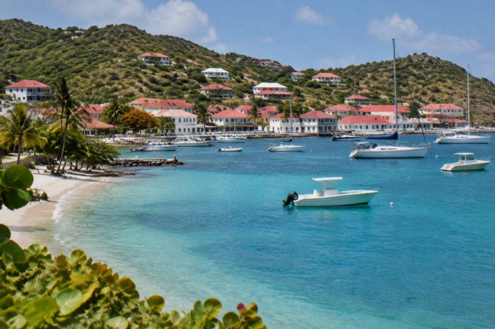
For scale against a familiar reference, St Barts is considerably smaller than Manhattan, a comparison this site answers in full elsewhere. What the small size means in practice is simple: no journey on the island is long, but none is fast either, and a rental car, a Mini Moke or a taxi is the standard way to move between beaches, Gustavia and the airport. The counters at SBH include Avis, Budget and Hertz alongside local agencies, and rates sit with each company.
What Are The Neighbouring Islands Around St Barts?
The islands closest to St Barts are, clockwise from northwest, Anguilla, then the shared island of St Martin and Sint Maarten, then Saba to the south, St Eustatius beyond it, and St Kitts and Nevis to the southwest, with Barbuda and Antigua further southeast. All sit within the Leeward Islands, and several are realistic day-trip or island-hopping destinations from St Barts by boat or small plane. Anguilla and the Dutch Saba are each reachable on organised trips, and the site carries dedicated pages on day trips to Anguilla, Saba and St Kitts for travellers basing themselves on St Barts.
The neighbour that dominates every itinerary is St Martin and Sint Maarten. One island, two administrations: the French side, St Martin, holds Marigot and the Grand Case airfield; the Dutch side, Sint Maarten, holds Princess Juliana airport and Philipsburg. Many travellers add a night or two there around a St Barts stay, and the site's pages on St Barts versus St Martin and what to do on St Martin before crossing cover the pairing.
| Neighbouring island | Administration | Position relative to St Barts |
|---|---|---|
| Anguilla | British territory | Northwest, past St Martin |
| St Martin | French side of the shared island | Northwest, closest large neighbour |
| Sint Maarten | Dutch side of the shared island | Northwest, holds the main airport |
| Saba | Netherlands | South |
| St Eustatius | Netherlands special municipality | South, beyond Saba |
| St Kitts and Nevis | Independent federation | Southwest |
| Antigua and Barbuda | Independent | Southeast |
What Is There To See Around St Barts Once You Arrive?
Once on St Barts, the sightseeing clusters around Gustavia's harbour and forts, the public beaches that ring the island, and the marine reserve that covers the waters off Colombier and Ile Fourchue, all of it inside a few kilometres of driving. The island's classic day moves between beach-hopping, snorkelling, hiking the Colombier trail and watching aircraft land at Saint-Jean. There is no theme park, no casino strip and no mass-market attraction: the island's draw is the setting itself, the water and the small scale of everything.
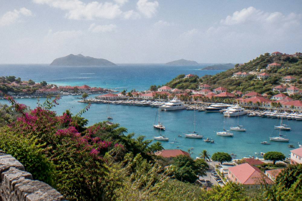
Gustavia anchors a visit. The harbour fills with yachts, the shell museum at Corossol and the island museum sit a short drive away, and the forts above town look out over the anchorage. From the capital, beaches fan out in every direction, all of them public, from Grand Cul-de-Sac and its shallow lagoon on the windward side to Gouverneur and Saline on the calm leeward south. The environment agency's regulatory-zones page lists the marine reserve rules that shape time on the water: a 5-knot limit in reserve zones, no jet skis, 23 dive sites, no dogs on beaches and no touching turtles. The site's things to do in St Barts overview collects the full list.
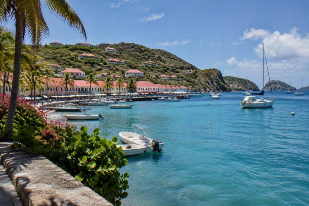
Day trips by boat from St Martin and Sint Maarten are a popular way to see those reserve waters without staying on the island. The group sail that is this site's featured trip crosses to Gustavia, Colombier Beach and Ile Fourchue from St Martin, running on a per-person basis only from 12 May to 31 August 2027 on its listing. Private charters run year-round on request. Details, dates and live availability sit on the operator's listing.
Where Should You Stay Once You Are In St Barts?
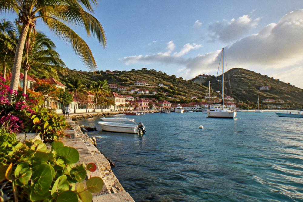
St Barts splits into distinct areas, each with its own character: Gustavia for the harbour, dining and shopping; Saint-Jean for the airport beach and convenience; Lorient and Grand Cul-de-Sac for quieter family-oriented stays; Flamands and Colombier for scenery; and Toiny, Corossol and Pointe Milou for seclusion. The choice of area matters more than on larger islands because each has a genuinely different feel, and the site's guide to the best area to stay in St Barts walks through the trade-offs beach by beach and town by town.
Accommodation runs from the island's well-known hotels to a large villa market with no reliable published count, managed by firms including WIMCO, Sibarth and St Barth Properties. Rates vary by season, and many hotels close each autumn and reopen between mid-October and early November, a recurring pattern rather than a fixed date for any property. One rebrand is current: the property at Grand Cul-de-Sac long operated as Rosewood Le Guanahani becomes Airelles Le Guanahani on 1 November 2026. The site's hotel and villa pages, including St Barts hotels and luxury hotels, carry the named properties.
| Area | Position on the island | Character |
|---|---|---|
| Gustavia | Southwest, the capital | Harbour, shops, restaurants, Shell Beach nearby |
| Saint-Jean | North-central coast | Airport, beach, hotels, easy access |
| Lorient | North coast | Residential and quiet, public beach |
| Grand Cul-de-Sac | Northeast | Shallow lagoon, family-oriented stays |
| Flamands | Northwest | Long beach, larger hotels |
| Colombier | Northwestern tip | Marine reserve, reached by trail or boat |
| Toiny | Southeast | Secluded, rocky coast |
| Corossol | West, north of Gustavia | Traditional village, shell museum |
When Is The Best Time To Visit St Barts?
The busiest and driest period on St Barts runs from December through April, when the Meteo-France normals, 1991-2020, show monthly rainfall between 38.4 mm in February and 79.2 mm in December, against 135.6 mm in October, the wettest month. Hurricane season runs 1 June to 30 November with its peak from mid-August to mid-October, so the May shoulder and the November-to-April window anchor the classic travel calendar. Temperatures vary little: the mean daily high moves from 28.5 C in January to 31.7 C in September, so warmth is a given at any time of year.
The calendar carries weight too. The Bucket Regatta, the superyacht event, falls in mid-March; Les Voiles de St Barth follows in April; the Music Festival runs 8 to 18 January 2027; and the Gourmet Festival runs 9 to 15 November 2026. New Year's Eve draws a large yachting crowd to Gustavia for the fireworks. The site's season guide and month-by-month pages, beginning with the best time to go to St Barts, lay out the trade-offs between crowd, cost and weather month by month.
For visitors interested in St Barthelemy Travel planning beyond location, the same geography that answers "where is St Barts" also answers almost everything practical about the trip: which airport to book, which ferry to consider, and which neighbouring island deserves an extra night.
Common Questions About Where St Barts Is
Where is St Barts exactly?
St Barts is in the northeastern Caribbean, in the Leeward Islands of the Lesser Antilles, about 25 kilometres southeast of the shared island of St Martin and Sint Maarten and roughly 230 kilometres northwest of Guadeloupe. It sits near 18 degrees north, 63 degrees west.
Is St Barts French or Dutch?
St Barts is French. It is an overseas collectivity of France, a status held since 2007, with the euro as currency and French as the official language. The Dutch territory in the neighbourhood is Sint Maarten, the southern half of the neighbouring shared island, which is a separate place entirely.
What is the capital of St Barts?
Gustavia is the capital and main harbour town, on the island's sheltered western side. The name reflects a period under the Swedish crown before the island returned to France, a story the island's own museums tell.
How far is St Barts from St Maarten?
St Barts lies about 25 kilometres southeast of the shared island of St Martin and Sint Maarten. The ferry crossing from Philipsburg takes about 45 minutes and from Marigot about 50 to 60 minutes, and the small-plane hop between the islands' airports is a short flight. Exact times vary with conditions.
Do you need a passport to go to St Barts?
Yes, a valid passport is the standard document, and the ferry operators require one. EU citizens may use a national ID card. Entry rules are set by French authorities and St Barts is outside the Schengen area, so check your own government's travel advice before travelling.
Can you fly directly to St Barts from the US?
No jet aircraft can land on St Barts, because the runway at Gustaf III Airport is only 646 metres long and accepts small STOL turboprops in daylight only. Travellers from the US fly to a gateway such as St Martin, San Juan or Antigua and complete the trip on a small plane or a ferry.
The short version of this whole page: St Barts is a small French island in the Caribbean's Leeward Islands, next door to St Martin and Sint Maarten, reached through that neighbour by small plane or ferry, and organized around Gustavia and a ring of public beaches. Every practical decision about a trip there, from flights to ferry operators to which bay to sleep above, follows from that location.