St Barts Weather
St Barts weather is warm year round, with mean daily highs between 28.5 C and 31.7 C, most rain falling from August to November, and a hurricane season that runs from 1 June to 30 November.
St Barts is warm all year. Meteo-France normals for 1991-2020 show mean daily highs from 28.5 C in January to 31.7 C in September, with 891.3 mm of rain a year, most of it from August to November. Hurricane season runs 1 June to 30 November.
St Barthelemy, written St Barts, sits in the northeastern Caribbean with a climate the Meteo-France normals describe plainly: warm every month of the year, a dry stretch from February into spring, and a wetter half from August to November that overlaps the Atlantic hurricane season. This guide walks through the numbers the St Barthelemy weather station has recorded, what each month actually feels like for planning, and how the seasons shape ferries, flights and boat days. The short version for anyone comparing months: the mean daily high never drops below 28.5 C, annual rainfall is 891.3 mm, and October is the wettest month at 135.6 mm. The long version, month by month, follows.
What Is The Weather Like In St Barts?
St Barts is warm year round with mean daily highs between 28.5 C in January and 31.7 C in September, and nights that rarely fall below about 23 C, according to the Meteo-France normals for 1991-2020 from the St Barthelemy station. Rain totals 891.3 mm a year, falling mostly between August and November, with October the wettest month at 135.6 mm and February the least rainy at 38.4 mm.
That is the statistical shape of the island's weather. The trade winds blow from the east and northeast through the winter half of the year, which is the main reason the same thermometer reading can feel quite different in February than in September, when the air is more humid and the winds often lighter. There is no cold season. The Meteo-France normals show the mean daily low never dropping below 23.3 C in any month, so packing is a matter of light clothing, rain layers and sun protection rather than warmth.
The pattern splits the year into two broad halves. December through April is the drier, breezier stretch, and it is also when the island's hotels, restaurants and events are in full swing. May through November is warmer, more humid and progressively wetter, ending in the wettest months of October and November before the cycle turns again. Neither half is a monsoon and neither is a desert: even in February, the least rainy month, the normals record 38.4 mm of rain. For a plain-language answer to the same question, see the site's St Barts weather question page.
What Are The Monthly Temperatures And Rainfall In St Barts?
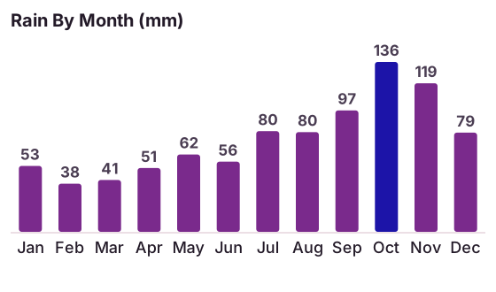
The Meteo-France climate normals for 1991-2020 show mean daily highs rising from 28.5 C in January to 31.7 C in September, mean daily lows between 23.3 C and 26.3 C, and monthly rainfall from 38.4 mm in February to 135.6 mm in October, totalling 891.3 mm across the year. The full month by month table from the St Barthelemy station follows.
| Month | Mean Daily High | Mean Daily Low | Rain (mm) |
|---|---|---|---|
| January | 28.5 C | 23.5 C | 52.6 |
| February | 28.6 C | 23.3 C | 38.4 |
| March | 29.0 C | 23.5 C | 41.4 |
| April | 29.8 C | 24.2 C | 50.9 |
| May | 30.7 C | 25.1 C | 61.7 |
| June | 31.2 C | 25.9 C | 56.0 |
| July | 31.2 C | 26.0 C | 80.4 |
| August | 31.6 C | 26.3 C | 79.6 |
| September | 31.7 C | 26.2 C | 96.9 |
| October | 31.4 C | 25.8 C | 135.6 |
| November | 29.9 C | 25.0 C | 118.6 |
| December | 28.9 C | 24.1 C | 79.2 |
Read the table before generalising about it. February has the lowest monthly rain total, not December or January. September has the highest mean daily high, at 31.7 C, even though October is the wetter month by a wide margin. The jump from 41.4 mm of rain in March to 135.6 mm in October is the single biggest swing in the dataset, and it is the reason the shoulder and low seasons feel so different from one another even when the air temperature barely moves.
Averages also hide the character of Caribbean rain. Showers in the drier months tend to be brief and localized, passing over one side of the island while the other stays in sunshine. In the wetter months, the rain comes in longer spells attached to tropical waves and, occasionally, to named systems, which is where hurricane season enters the planning picture. The St Barts hurricane season guide covers that half of the year in detail.
For travellers whose plans hinge on being on the water, the weather window matters more than the air temperature, which barely changes. Every boat tour listed here departs from St Martin or Sint Maarten and crosses open water to reach St Barts, so sea conditions and swell, not the thermometer, decide whether a given day works.
When Is Hurricane Season In St Barts?
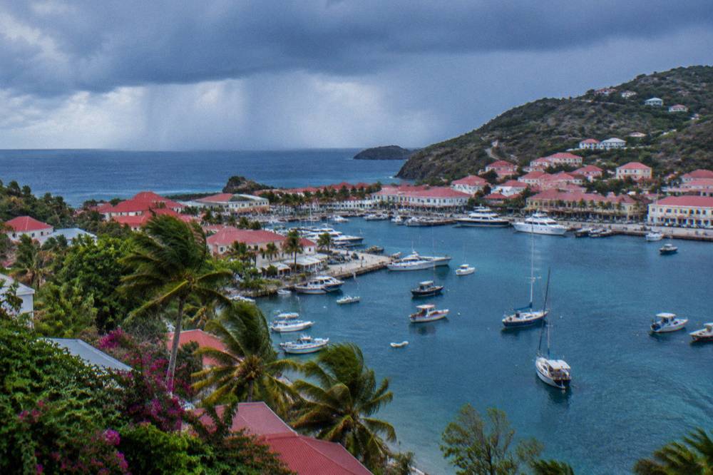
The Atlantic hurricane season runs from 1 June to 30 November, with the peak of activity from mid-August to mid-October and the climatological peak near 10 September. St Barts lies inside that basin, and Hurricane Irma struck the island in September 2017, the strongest recent example of what the season can bring.
The season's edges are usually quiet and its middle is usually active, but no single year follows the script, and no date inside the season can be promised storm-free. What the normals do show is that the statistical peak of the season, mid-August to mid-October, overlaps the island's wetter autumn, and October (135.6 mm) and November (118.6 mm) are the wettest months. That overlap is why many hotels and restaurants on St Barts close for their annual break in this window and reopen between mid-October and early November. It is a seasonal pattern, not a dated announcement, and individual properties shift their dates each year.
The practical reading for a traveller is straightforward. Trips planned for July or early August sit early in the season, when named storms are possible but the deepest peak has not arrived. Trips in late September and the first half of October sit inside both the statistical peak of hurricane activity and the wettest part of the island's rain year. Trips from mid-November onward are outside the season on paper, with 30 November as its formal end. Nobody can predict a storm for a date, and this guide does not try: the National Hurricane Center's outlook products are the live reference during the season itself.
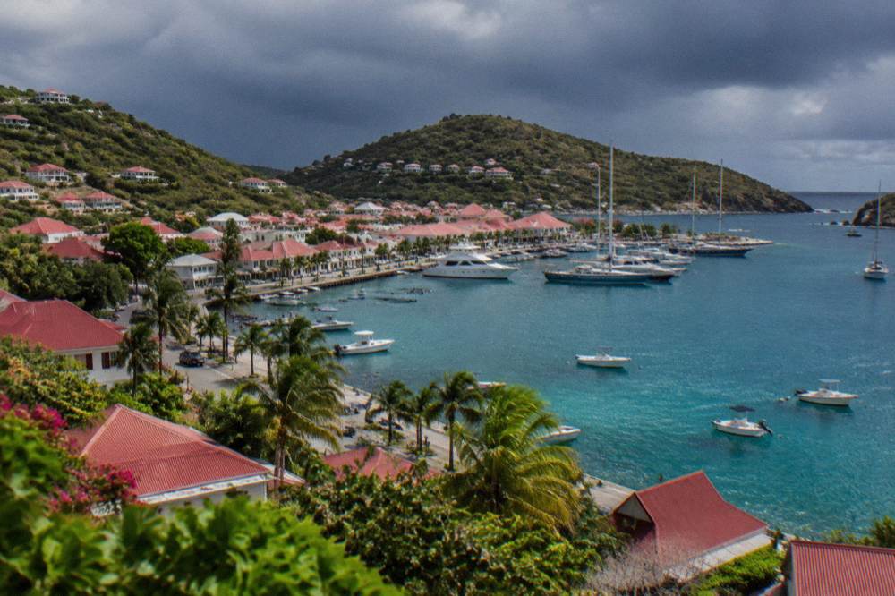
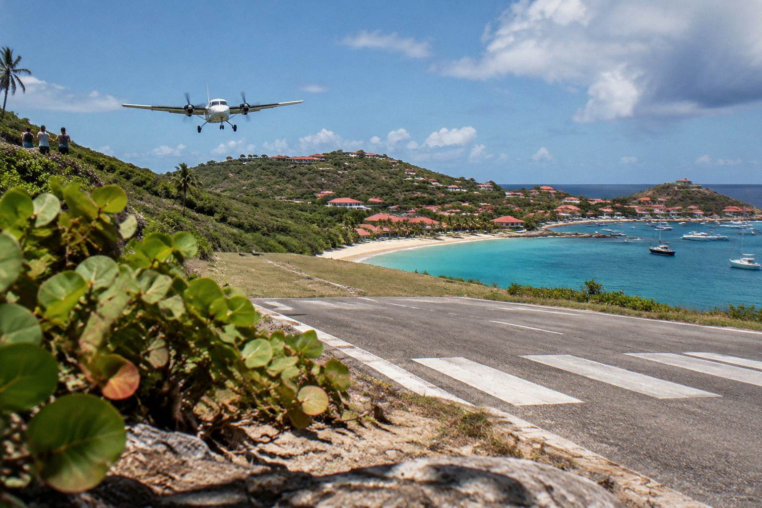
One structural fact matters for storm-season travel logistics. The airport at St Barts operates in daylight and visual conditions only, its 646 m runway serving small turboprops and no jets, so weather of several kinds, not just hurricanes, can interrupt flight schedules. The ferry crossings from St Martin and Sint Maarten are likewise subject to sea conditions, and a rough crossing is always possible. Neither fact argues against travel in the shoulder season; both argue for building a flexible day or two into any tight itinerary. The site's guide to getting to St Barts and its page on St Barts ferry operators and schedules cover the routes in detail.
How Warm Is The Sea Around St Barts?
The sea around St Barts is warm enough for swimming all year, at about 26 C in winter and rising to about 29 C from August to October, figures from a secondary climate source, rounded and approximate. There is no month in which the water requires a wetsuit for ordinary swimming or snorkelling.
The warmest water overlaps the wettest air, which is typical of the tropical Atlantic: the ocean stores the summer's heat through September and October, then cools gradually into the winter dry season. For a beach day, that means winter water that still feels warm to most swimmers and late-summer water that feels like a bath. The site's St Barts water temperature guide takes the topic further, and the seasonal breakdown below places the sea alongside the air.
| Period | Approximate Sea Temperature | Character |
|---|---|---|
| December to February | about 26 C | Warm, refreshed by the trade-wind season |
| March to May | about 26 to 27 C | Warm and steadily climbing |
| June to July | about 28 C | Warm, calm spells more common |
| August to October | about 29 C | The warm stretch of the year |
| November | about 28 C | Warm, cooling from its summer peak |
Sea temperature is one of the few numbers on this page that comes with an "about", because it is a rounded secondary figure rather than a station normal. Treat it as a comfort guide, not a forecast, and treat any live reading, including the site's own live weather block, as the current truth for the day.
Which Months Have The Best Weather In St Barts?
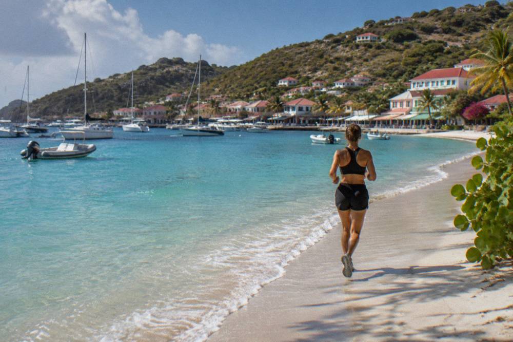
By the numbers, February and March are the least rainy months, at 38.4 mm and 41.4 mm respectively, with mean daily highs near 28.6 to 29.0 C, according to the Meteo-France normals, 1991-2020. October and November carry the highest rainfall, 135.6 mm and 118.6 mm, and September and October coincide with the peak of the Atlantic hurricane season, mid-August to mid-October.
"Best" depends on what a trip is for. The winter half of the year, December through April, pairs the lowest rainfall with the steady trade winds and the island's high season, when hotels, beach clubs and events are fully open. The trade-off is that this is when the island is at its fullest and rates at their seasonal peak, and no availability or crowd prediction is made here. The shoulder months of May and June sit in a middle zone: rainfall in the normals is moderate, at 61.7 mm and 56.0 mm, temperatures are a step warmer, and the hurricane season has only just opened on 1 June.
| Season | Months | Meteo-France Normals Snapshot | Planning Character |
|---|---|---|---|
| Dry, windy high season | December to April | Highs 28.5 to 29.8 C, rain 38.4 to 79.2 mm per month | Steady trades, full island calendar |
| Early shoulder | May to June | Highs 30.7 to 31.2 C, rain 56.0 to 61.7 mm | Warmer, quieter, season opens 1 June |
| Late summer | July to August | Highs 31.2 to 31.6 C, rain 79.6 to 80.4 mm | Warm sea, storms possible, peak approaching |
| Wet, storm-season low | September to October | Highs 31.4 to 31.7 C, rain 96.9 to 135.6 mm | Wet months, many closures |
| Turn of the year | November | High 29.9 C, rain 118.6 mm | Rain easing, island reopening |
The one dated anchor inside the low season concerns a boat option rather than a hotel: the group sail to Gustavia, Colombier and Ile Fourchue runs per-person only from 12 May to 31 August 2027 on its listing, a window that covers the early shoulder and late summer but not the September to October trough. Outside that window, the boat options listed here are private charters priced per group, departing from St Martin or Sint Maarten.
A calmer planning question than "which month is best" is "which month fits this trip". A sailing-focused trip leans on sea state, which is most often settled in the protected months and worth checking live at any time of year. An events-focused trip leans on the calendar, which concentrates in the high season and around the festivals of April and the New Year period. A quiet-beaches trip leans away from the high season altogether. The site's St Barts season guide unpacks that trade-off month by month.
Does It Rain All Day In St Barts?
No month in St Barts is a washout, and the rain that does fall usually arrives in showers rather than all-day drizzle, consistent with a tropical marine climate whose wettest month still averages 135.6 mm across October, roughly 4 to 5 mm a day spread unevenly over passing showers and occasional wet spells.
Caribbean rain in the drier half of the year is characteristically brief: a shower crosses one coast, the sun returns, and an hour later the road is dry again. In the wetter half, from August through November, the same monthly totals arrive more often in longer episodes tied to tropical waves, when a grey morning can genuinely run into a grey afternoon. The distinction matters for expectations more than for packing, since the packing list changes very little: a light rain layer serves every month.
The honest caveat is that no general statement about rain character can promise any specific day dry. The normals describe 30 years of averages, not a forecast for the week of a visit, and the difference between a wet September week and a dry one is simply weather. For day-to-day planning during a trip, the live outlook from the French meteorological service for St Barthelemy, and the National Hurricane Center's products during the season, are the references that update in real time.
What Should You Pack For St Barts Weather?
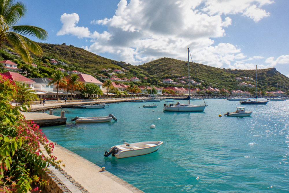
Pack for warm weather in every month: light breathable clothing, swimwear, sun protection including reef-safe sunscreen, a hat and sunglasses, plus a light rain layer for passing showers, and something with long sleeves for breezy evenings when mean daily lows sit between 23.3 C and 26.3 C. Sturdy sandals or water shoes serve rocky entries at some beaches.
The sun deserves as much respect as the rain. St Barts sits at about 18 degrees north, so UV is strong year round, and a beach day without shade or sunscreen is a mistake in February as much as in September. The trade winds can mask the heat, particularly on a boat, which is where a light long-sleeved layer earns its place in the bag even on a warm afternoon.
| Condition | Normals Behind It | What To Pack |
|---|---|---|
| Warm days all year | Highs 28.5 to 31.7 C | Light clothing, swimwear |
| Warm nights all year | Lows 23.3 to 26.3 C | A light layer for evenings |
| Passing showers | 38.4 to 135.6 mm per month | Packable rain jacket or poncho |
| Steady winter trades | December to April wind regime | Windproof layer for boat days |
| Strong sun | Tropical latitude year round | Sunscreen, hat, sunglasses, rash guard |
| Rocky or uneven entries | Public beaches vary by coast | Water shoes, sturdy sandals |
One island rule reaches into the packing list. The marine nature reserve's regulations, published by the territorial environment agency, ban touching or chasing protected species including sea turtles and corals, and ban collecting shells, sand and coral, so nothing leaves a beach except photographs. Reef-safe sunscreen is a sensible complement to those rules, since much of the island's snorkelling happens inside or beside protected zones. The St Barts nature reserve guide lists the zones and the rules that apply in them.
How Does Weather Affect Getting To St Barts?
Weather touches every route into St Barts: the airport operates small turboprops in daylight and visual conditions only, with no jets on its 646 m runway, and the ferry crossings from St Martin and Sint Maarten, about 45 minutes from Philipsburg and about 50 to 60 minutes from Marigot, are subject to sea conditions and can be rough or cancelled in heavy swell.
None of this makes the island hard to reach, but it makes arrival worth planning with margin. Flights from the gateway airports, St Martin, San Juan, Guadeloupe and Antigua, are short hops on small aircraft, and those aircraft stop flying when visibility or wind at the St Barts end breaks minimums, with the airport closing around sunset since the runway has no lighting for night operations. The ferries are the weather-sensitive alternative, and operators cancel sailings when the crossing is unsafe rather than run a rough trip. Both facts favour building a buffer into tight itineraries at any time of year, and especially inside hurricane season. The site's St Barts airport guide covers the flying end of the journey.
Arriving by cruise ship is the one route where the weather decision is made for the passenger: ships anchor offshore and tender passengers into Gustavia, there being no cruise pier, and tender operations themselves can be affected by swell. No prediction of a specific call or a smooth tender is made here, since both depend on the weather of the day.
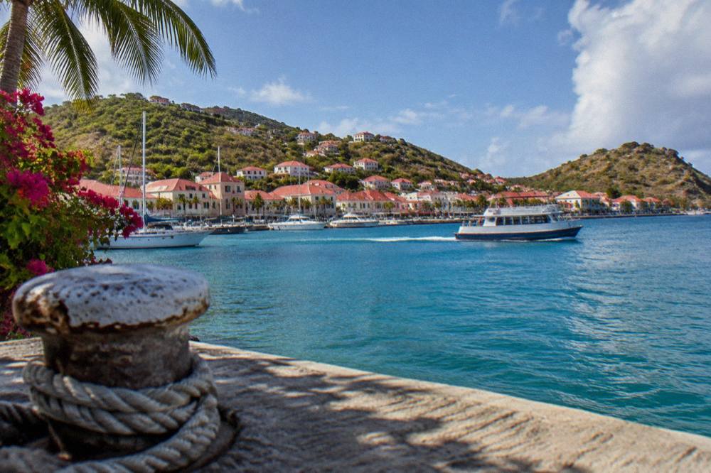
What Is The Weather Like In St Barts Month By Month?
Each month in St Barts is warm, with mean daily highs between 28.5 C and 31.7 C per the Meteo-France normals, 1991-2020, so the real month to month differences are rainfall, wind and the hurricane calendar: rain runs from 38.4 mm in February to 135.6 mm in October, trades steady from December to April, and the storm season spans 1 June to 30 November.
The breakdown below pairs each month with what its numbers mean for a visit. It describes climate, not forecasts, and it makes no promise about any individual week.
December, January and February are the trade-wind months, with highs of 28.9 C, 28.5 C and 28.6 C, lows around 23.3 to 24.1 C, and the year's lowest rain totals in January, 52.6 mm, and February, 38.4 mm. This is the high-season heart of the year, breezy and dry by island standards. The site's St Barts in December, St Barts in January and St Barts in February pages expand each one.
March and April stay dry, at 41.4 mm and 50.9 mm, with highs of 29.0 C and 29.8 C, and April carries the sailing calendar's signature events, with Les Voiles de St Barth held in April each year. May and June warm to 30.7 C and 31.2 C with moderate rain, and the hurricane season opens on 1 June, though the statistical peak is still months away. The group sail window opens in May: its listing runs per-person departures from 12 May to 31 August 2027.
July and August are the warm midsummer months, highs of 31.2 C and 31.6 C, rain near 80 mm, with the sea at its warmest and the storm season's peak approaching from mid-August. September and October bring 96.9 mm and 135.6 mm of rain, with September's 31.7 C the highest mean daily high of the year and the climatological peak of hurricane activity near 10 September. Many hotels and restaurants take their annual closure across this stretch and reopen between mid-October and early November. November begins the turn, rain easing to 118.6 mm, high of 29.9 C, and the season closing on 30 November, with the Gourmet Festival held 9 to 15 November 2026.
| Month | Mean High | Rain (mm) | Season Notes |
|---|---|---|---|
| Dec | 28.9 C | 79.2 | Trades settled, high season |
| Jan | 28.5 C | 52.6 | Cool month by island standards |
| Feb | 28.6 C | 38.4 | Least rain of the year |
| Mar | 29.0 C | 41.4 | Dry, warm, sailing season |
| Apr | 29.8 C | 50.9 | Les Voiles de St Barth month |
| May | 30.7 C | 61.7 | Shoulder, group sail window opens |
| Jun | 31.2 C | 56.0 | Hurricane season opens 1 June |
| Jul | 31.2 C | 80.4 | Warm sea, quiet island |
| Aug | 31.6 C | 79.6 | Season peak begins mid-month |
| Sep | 31.7 C | 96.9 | Peak activity near 10 September |
| Oct | 31.4 C | 135.6 | Wettest month, closures |
| Nov | 29.9 C | 118.6 | Rain easing, season ends 30 November |
Common Questions About St Barts Weather
What Is The Weather Like In Saint Barts?
Warm all year. The Meteo-France normals for 1991-2020 show mean daily highs from 28.5 C in January to 31.7 C in September, mean daily lows between 23.3 C and 26.3 C, and 891.3 mm of rain a year, most of it from August to November.
What Is The Rainy Season In St Barts?
The wettest months are October, at 135.6 mm, and November, at 118.6 mm, with September close behind at 96.9 mm, all per the Meteo-France normals, 1991-2020. Rain in these months often comes in longer spells, while dry-season showers are usually brief.
What Is Hurricane Season In St Barts?
The Atlantic hurricane season runs 1 June to 30 November, with peak activity from mid-August to mid-October and the climatological peak near 10 September. Hurricane Irma struck the island in September 2017.
What Is The Warmest Month In St Barts?
September has the highest mean daily high, 31.7 C, in the Meteo-France normals, 1991-2020, narrowly ahead of August at 31.6 C and October at 31.4 C. The sea is also at its warmest, about 29 C, from August to October.
When Is The Least Rainy Time To Visit St Barts?
February, at 38.4 mm, and March, at 41.4 mm, are the least rainy months in the Meteo-France normals, 1991-2020. These months fall inside the dry, breezy high season from December to April.
Is The Sea Warm Enough For Swimming In Winter?
Yes. Sea temperature around St Barts is about 26 C in winter, rising to about 29 C from August to October, rounded figures from a secondary climate source, warm enough for swimming and snorkelling in every month.
Whatever month is on the calendar, St Barthelemy Travel keeps a live weather block on its destination pages, and the month guides linked above take the planning further, one month at a time. The climate is steady, the sea is warm, and the only real variable is rain: pick the month that matches the trip, then watch the forecast rather than the averages.