St Barts Hurricane Season
The Atlantic hurricane season runs from 1 June to 30 November, and it shapes autumn in St Barts more than any other factor. Here is what the official season dates, the climate normals and the island's autumn closure pattern actually say.
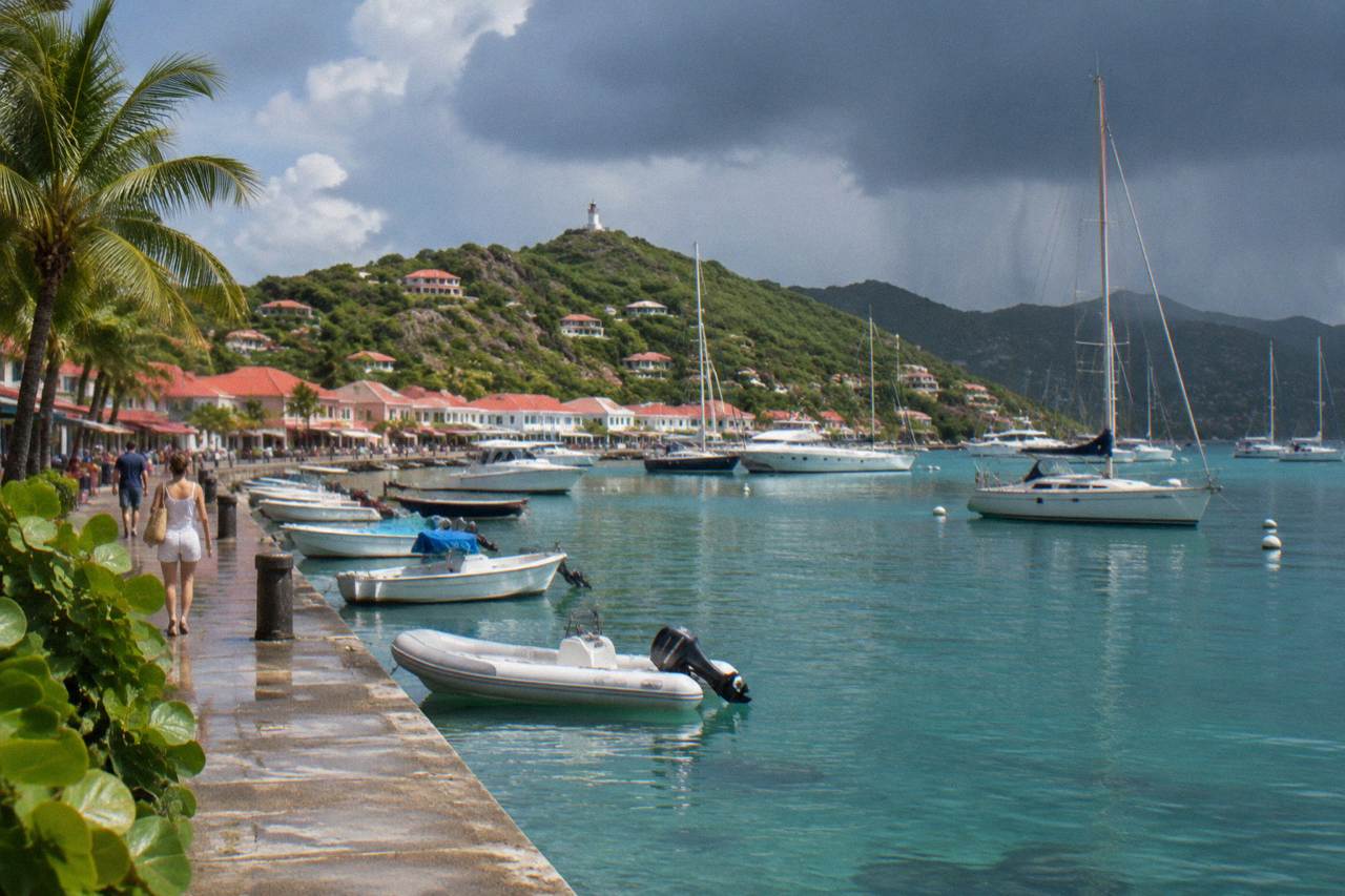
Hurricane season in St Barts runs 1 June to 30 November, with peak activity from mid-August to mid-October and the climatological peak near 10 September. October is the wettest month at 135.6 mm of rain, many hotels and restaurants close for the autumn, and reopenings run from mid-October to early November.
St Barthelemy, written St Barts, sits squarely inside the Atlantic hurricane belt, and every year the season from 1 June to 30 November reshapes the island's weather, its flight schedules and its hotel calendar. Météo-France supplies the climate record for the island's own station in Gustavia; and the Collectivité's autumn reopening rhythm follows the same months. This guide sets out the season month by month, without predicting a single storm, because no honest forecast can. The St Barthelemy Travel season coverage pairs this page with a wider best time to go guide for readers weighing the whole year.
When Exactly Is The St Barts Hurricane Season?
The Atlantic hurricane season that covers St Barts runs from 1 June to 30 November each year, with the busiest stretch from mid-August to mid-October and the climatological peak of activity near 10 September. Météo-France vigilance bulletins for St Martin and St Barthelemy operate across the same window, and the island's wettest months fall inside it.
Those dates are a convention of the Atlantic basin, not a forecast. The National Hurricane Center opens its tropical weather outlook products for the basin from late May and watches the basin through the end of November, and St Barthelemy, at the northern edge of the Lesser Antilles, sits inside that area of responsibility. Within the six-month window, activity is far from even. The early weeks of June and July are usually quiet across the basin, the pace picks up from August, and the historical concentration of named storms falls between mid-August and mid-October. The single date most often cited as the climatological peak is 10 September.
The practical reading is that "hurricane season" is not one block of risk but a curve. A trip in late June falls inside the official season but well ahead of the statistical peak. A trip in late September falls in the heart of it. The island's own climate record, discussed below, shows that the wettest months of the year, October and November, overlap the tail of that peak, which is one reason the island's hotel calendar also bends around these weeks.
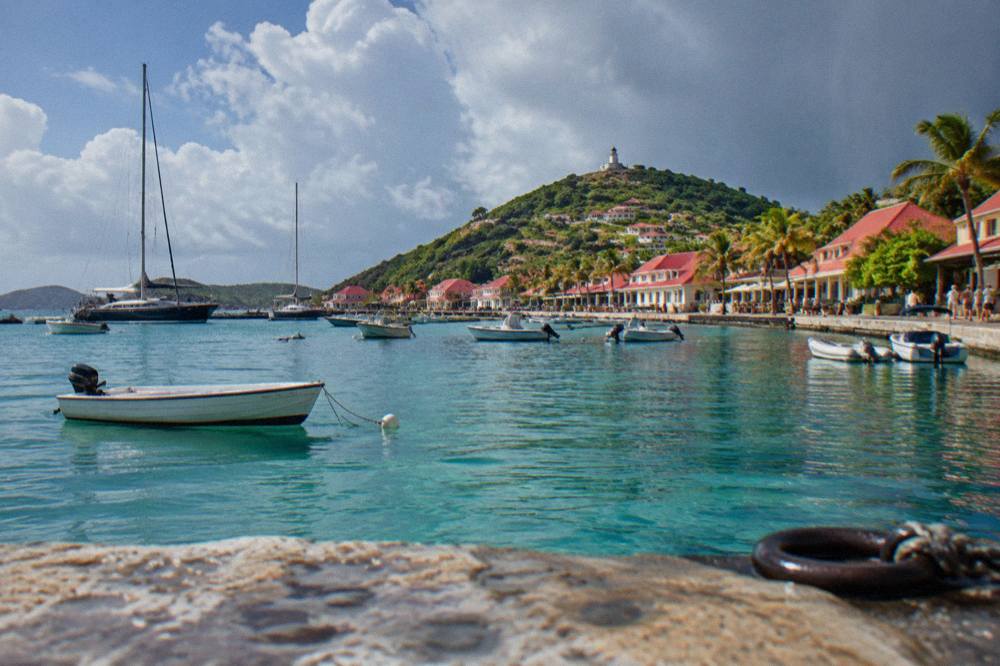
One more framing point: the season's dates do not describe conditions in any individual year. The National Hurricane Center publishes its seasonal outlooks each spring, and Météo-France issues colour-coded vigilance warnings for the French Caribbean islands when a specific system approaches. Those live products, not a calendar, are what govern any real decision close to travel dates.
What Are The Wettest Months In St Barts?
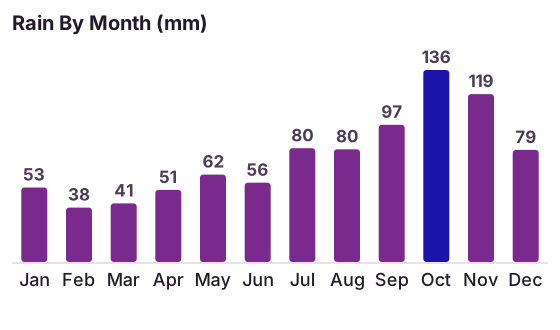
October is the wettest month in St Barts at 135.6 mm of rain on the Meteo-France normals, 1991-2020, for the island's Gustavia station, followed by November at 118.6 mm and September at 96.9 mm, while February is the wet season's opposite at just 38.4 mm. Annual rainfall totals 891.3 mm, and every one of those figures comes from the official 30-year station normals, not from any single recent year.
The Meteo-France normals give a smooth picture of what the island's weather has averaged over three decades, and the rain column tells a clear seasonal story. The first half of the year is comparatively dry: February at 38.4 mm, March at 41.4 mm, January at 52.6 mm and April at 50.9 mm. From May the totals climb, and from July they climb steeply, with 80.4 mm in July, 79.6 mm in August, 96.9 mm in September and the annual maximum of 135.6 mm in October. November stays wet at 118.6 mm before December falls back to 79.2 mm.
| Month | Mean daily high | Mean daily low | Rain (mm) |
|---|---|---|---|
| Jan | 28.5 C | 23.5 C | 52.6 |
| Feb | 28.6 C | 23.3 C | 38.4 |
| Mar | 29.0 C | 23.5 C | 41.4 |
| Apr | 29.8 C | 24.2 C | 50.9 |
| May | 30.7 C | 25.1 C | 61.7 |
| Jun | 31.2 C | 25.9 C | 56.0 |
| Jul | 31.2 C | 26.0 C | 80.4 |
| Aug | 31.6 C | 26.3 C | 79.6 |
| Sep | 31.7 C | 26.2 C | 96.9 |
| Oct | 31.4 C | 25.8 C | 135.6 |
| Nov | 29.9 C | 25.0 C | 118.6 |
| Dec | 28.9 C | 24.1 C | 79.2 |
Two cautions go with that table. First, the same normals show the island stays warm through the wet months: the mean daily high never drops below 28.5 C in any month of the year, and September's 31.7 C is the annual maximum on the mean-daily-high measure. Rain, not cold, is the seasonal variable. Second, a monthly normal is an average built from thirty years of Septembers and Octobers, some dry and some soaked. It cannot say what any coming October will do, and neither can this page.
| Season window | Rain pattern on the normals | Position in hurricane season |
|---|---|---|
| December to April | Driest stretch, monthly totals from 38.4 to 79.2 mm | Entirely outside the season |
| May to July | Rising totals, 61.7 to 80.4 mm | Early season, before the statistical peak |
| August to October | Wettest stretch, 79.6 to 135.6 mm | Peak season window, mid-August to mid-October |
| November | Still wet at 118.6 mm | Late season, closing 30 November |
Readers comparing months across the whole year will find the fuller breakdown in the site's season guide and its companion page on the quieter low season months.
How Do Flights And Ferries To St Barts Work In Hurricane Season?
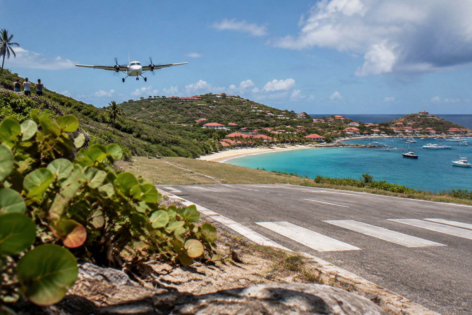
Flights to St Barts arrive at Gustaf III Airport, whose single 646 m runway accepts only small STOL turboprops in daylight and visual conditions, so any weather that lowers visibility or raises crosswinds can stop operations outright, while the two ferries from St Martin, Great Bay Express from Philipsburg and Voyager from Marigot, run crossings of about 45 and about 50 to 60 minutes that are subject to weather cancellation.
If a delayed or cancelled flight upends your plans, book a flight delay compensation check.
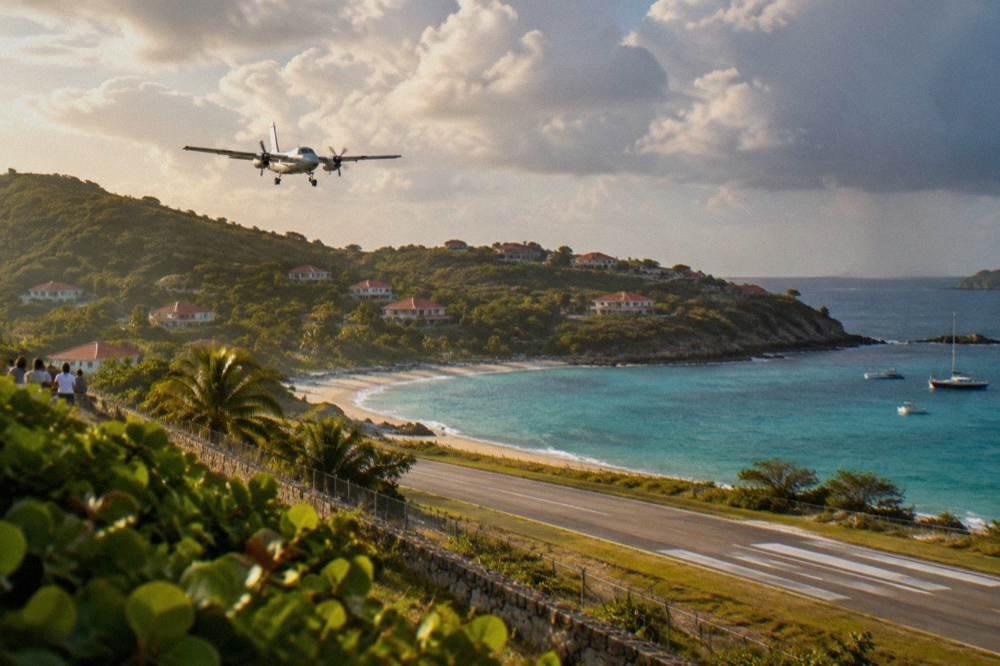
The airport's constraints are structural, not seasonal. The runway at Gustaf III, also called Remy de Haenen and coded SBH, is 646 m long with no runway lighting, and operations are limited to daylight hours in visual flight conditions. Only STOL-certified turboprops serve it, flown by pilots specially qualified for the approach over the hill at Col de la Tourmente. Passengers reach the island through gateway airports at St Martin, San Juan, Guadeloupe or Antigua, then transfer to a small plane or a ferry. What hurricane season adds is a higher chance that low cloud, heavy rain or rough seas disrupt either leg, and the airport's daylight-only rule removes the option of waiting for evening departures.
On the sea side, the two scheduled ferry operators are Great Bay Express, sailing from Bobby's Marina in Philipsburg on the Dutch side, and Voyager, sailing from the Marigot terminal on the French side. The crossing from Philipsburg runs about 45 minutes and the crossing from Marigot about 50 to 60 minutes, and both operators state that services are subject to weather. The sea between St Martin and St Barts can be rough at any time of year; in the autumn months, swells and tropical waves raise the odds of a rough or cancelled crossing, and no operator promises a smooth one. The site's page on ferry operators and schedules covers the mechanics, and the route from SXM airport to the ferry explains the common connection.
The same weather logic applies to every boat trip listed here, because every bookable tour that visits St Barts departs from St Martin or Sint Maarten rather than from the island itself. Operators watch the forecast and the marine reserve's rules, and the environment agency's regulatory-zones page sets a 5-knot limit inside reserve waters, bans jet skis and lists 23 dive sites within its zones. A weather day in September can scrub a sailing as readily as a flight.
Do St Barts Hotels And Restaurants Close During Hurricane Season?
Many St Barts hotels and restaurants close for a stretch each autumn, typically from late August into October, and reopen in waves between mid-October and early November for the new high season, a repeating annual pattern rather than a fixed calendar, with a smaller number of local spots staying open year-round and villas remaining available through the low months.
The closure pattern tracks the season's peak weeks almost exactly. The deepest quiet falls in September and early October, which is when the biggest properties take their annual maintenance closure and much of the island's restaurant scene pauses alongside them. The reopening then arrives in waves: the first tables and smaller properties come back in early to mid-October, the largest group returns in the second half of October, and a few trailing names follow in early November. By mid-November the island is substantially back in operation, in time for the St Barth Gourmet Festival, which runs 9 to 15 November 2026.
| Autumn window | What the pattern shows |
|---|---|
| Late August | The largest hotels begin their annual closures, typically from mid-to-late August |
| September | Deepest low period, most seasonal properties and many restaurants closed |
| Early October | First reopenings among local restaurants and smaller properties |
| Mid-to-late October | The main reopening wave across hotels, hotel tables and beach clubs |
| Early November | Final reopenings, ahead of the Gourmet Festival from 9 to 15 November 2026 |
The practical consequences are straightforward. A traveller set on September should expect a reduced island: some beaches fully open, since all beaches on St Barts are public, but a thinner choice of tables and closed hotel facilities. A traveller in the second half of October gets the reopening island, with the season's wettest month on the normals still on the weather board. Villas generally remain available year-round, which makes them the standard choice for the shoulder weeks, and the site's hotels guide names the island's properties with that pattern in mind.
Two dated items sit inside this window and are worth flagging as facts, not predictions. The group sail listed here, which runs from St Martin to Gustavia, Colombier Beach and Ile Fourchue, operates only from 12 May to 31 August 2027 on its listing, so it is a summer product rather than an autumn one. And the Music Festival opens the deep-winter calendar on 8 to 18 January 2027, months after the season closes.
How Warm Is St Barts During Hurricane Season?
St Barts stays warm through every month of hurricane season, with mean daily highs between 30.7 and 31.7 C from June to October on the Meteo-France normals, 1991-2020, mean daily lows that never fall below 25.1 C in that stretch, and sea temperatures of about 26 C in the cooler months rising to about 29 C from August to October, the warmest water of the year.
The temperature column of the normals is remarkably flat. June through October runs from 30.7 C to 31.7 C on the mean daily high, with September's 31.7 C the highest monthly figure on that measure and June and July tied at 31.2 C. Overnight lows across the same months sit between 25.1 and 26.3 C. There is no cool season inside the hurricane window; there is only a wetter and a drier month. Sea temperature follows the same curve, from about 26 C in winter to about 29 C from August to October, figures from a secondary source and written as approximations.
| Hurricane-season month | Mean daily high | Mean daily low | Rain (mm) |
|---|---|---|---|
| Jun | 31.2 C | 25.9 C | 56.0 |
| Jul | 31.2 C | 26.0 C | 80.4 |
| Aug | 31.6 C | 26.3 C | 79.6 |
| Sep | 31.7 C | 26.2 C | 96.9 |
| Oct | 31.4 C | 25.8 C | 135.6 |
| Nov | 29.9 C | 25.0 C | 118.6 |
That warmth is why the shoulder months remain attractive despite the season label. The water is at its warmest, the air is steady, and rain, when it comes, more often arrives in heavy passing showers than in all-day grey. The normals cannot promise that pattern on any given week, and Météo-France's seven-day forecasts and vigilance map for the St Martin and St Barthelemy area are the live tools for judging a specific date.
What Did Hurricane Irma Do To St Barts?
Hurricane Irma struck St Barts in September 2017 as a Category 5 storm, causing widespread destruction to buildings and infrastructure, flooding, power outages and insured losses running into the hundreds of millions of euros across the French territories, and it stands as the reference event for why the island takes the season seriously, eight decades of quiet years notwithstanding.
Irma's date, September 2017, and its Category 5 strength are the core facts, and they line up with the climatological peak near 10 September described by the National Hurricane Center. The storm's effects on St Barts and neighbouring St Martin were severe: buildings destroyed or damaged, streets flooded, the power supply knocked out, and waves and surge that hit the exposed coasts hardest. Reconstruction on St Barts took years, and several of the island's best-known hotels rebuilt fully or in part afterward. No page should dramatise the event beyond the facts, and none should use it to predict the next one, because a single storm, however destructive, is one draw from a long distribution.
The years since Irma illustrate the same point from the other side. Named systems have passed near the northern Leeward Islands several times since, with varying effects on St Bths and St Martin, and some seasons have produced no direct threat at all to the island. The season's dates and the peak window describe probability, and the probability is what the island's autumn closure pattern, its vigilance system and its rebuilding standards are built around.
Is It Safe To Book St Barts During Hurricane Season?
The honest answer is procedural: Météo-France publishes colour-coded vigilance warnings for St Barthelemy, the National Hurricane Center tracks systems in real time, flexible fares and refundable accommodation reduce the cost of a cancellation, and travel insurance terms vary by policy, which is why checking your own government's travel advice before booking is the standard recommendation.
The decision framework matters more than a verdict. Flights to the island depend on visual conditions at a daylight-only airport, ferries are subject to weather, and boat trips from St Martin are subject to both, so a late change of plan is a real possibility in the peak weeks rather than a remote one. Booking structures that absorb change, refundable rooms, flexible fares and tours with cancellation terms on the operator's live listing, cost a little more and remove most of the downside. Insurance is worth reading closely, because hurricane-related cancellation cover differs widely between policies and some exclude storms already named at the time of purchase.
| Decision factor | What To Know |
|---|---|
| Season dates | 1 June to 30 November, peak mid-August to mid-October, climatological peak near 10 September |
| Island closure pattern | Many hotels and restaurants closed late August to October, reopening mid-October to early November |
| Airport | Daylight, visual-conditions operations only, STOL turboprops only, 646 m runway |
| Ferries | Great Bay Express from Philipsburg and Voyager from Marigot, both subject to weather |
| Live warnings | Météo-France vigilance for St Barthelemy, National Hurricane Center outlooks |
Timing within the season is the main lever a traveller controls. June and July sit in the quiet early weeks with monthly rain totals on the normals of 56.0 and 80.4 mm, still warm, with the sea already at summer temperatures. Late August and September carry the statistical weight of the peak. Late November falls inside the official season but past the peak window, with the reopening island and the Gourmet Festival as compensation for the 118.6 mm monthly normal. Each of those statements describes the pattern, not a forecast for any year.
What Should A Hurricane-Season Packing List For St Barts Include?
A hurricane-season packing list for St Barts should cover rain and sun in equal measure: a light rain layer and quick-dry clothing for the 79.6 to 135.6 mm months of August to October, reef-safe sun protection for a sun that stays strong under a 28.5 to 31.7 C mean daily high all year, sturdy shoes for the island's steep footpaths, and copies of travel documents kept with the phone, since storm disruptions can strand plans rather than people.
The island's terrain argues for the shoes. St Barts is about 21 square kilometres of hills, and paths such as the Colombier trail climb and descend on uneven ground that turns slick in a downpour. A headlamp or torch is a reasonable inclusion anywhere in the peak weeks, less for the island's grid than for the general prudence of the season. Plug adapters for types C and E cover the electrical side, and the island's currency is the euro, with cards widely accepted, so a small amount of cash simply covers the corners.
Documents deserve their own sentence. Entry to St Barthelemy is outside the Schengen area and follows French overseas rules, and passport requirements differ by nationality, so the guidance is to check your own government's travel advice for the territory before travel rather than rely on a secondhand rule. An onward ticket is a standing requirement for entry.
How Does Hurricane Season Affect The Sea Around St Barts?
The sea around St Barts stays warm through hurricane season, at about 29 C from August to October by secondary estimates, while the marine reserve's rules hold unchanged year-round, including the 5-knot speed limit in its zones, the ban on jet skis and powered water toys, the prohibition on touching turtles, corals or other protected species, and the no-dogs rule on the island's beaches, all listed on the environment agency's regulatory-zones page.
Storm swell is the seasonal variable. Long-period swell from distant tropical systems can reach the island's coasts days before any local weather changes, and the anchoring rules in Colombier and Ile Fourchue bays, where vessels over 25 m are excluded and ecological mooring buoys are preferred, exist partly to protect the sea grass and coral those swells already stress. Swimmers and snorkellers should read the water on the day rather than the calendar, because conditions on St Barts' different coasts vary with wind and swell direction.
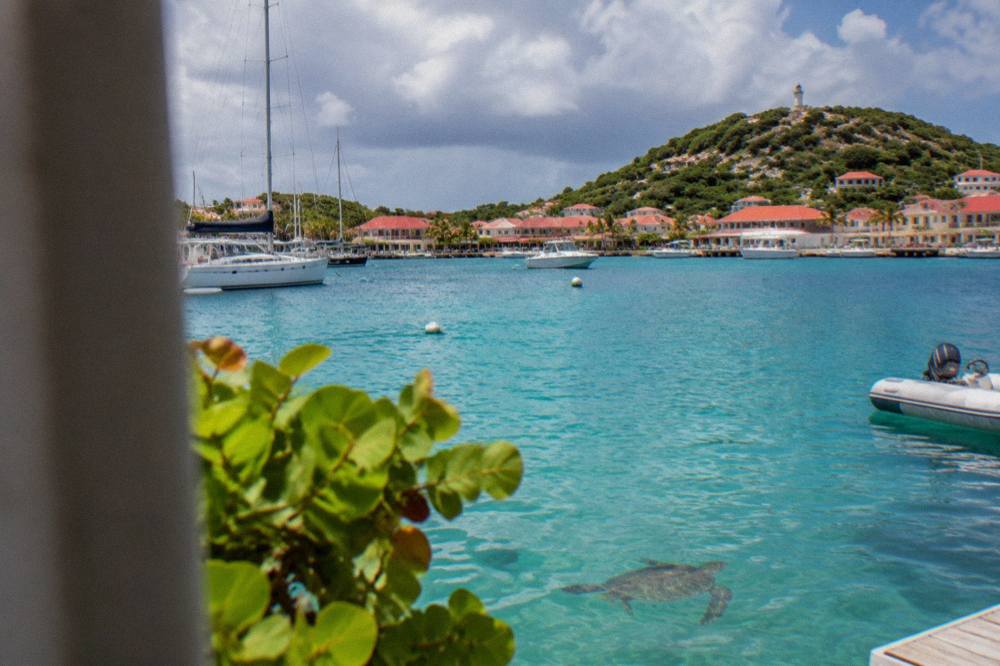
The turtle population is a year-round feature rather than a seasonal one. Green and hawksbill turtles are common in the waters around St Barts, including the lagoon at Grand Cul-de-Sac and the bay at Colombier, and the environment agency asks that nests and sightings be reported and that light and noise near nesting areas be kept down. The rule against touching turtles applies in every month, hurricane season or not.
Planning Around The St Barts Hurricane Season
Planning around the St Barts hurricane season comes down to four anchors: the official season dates of 1 June to 30 November with the peak from mid-August to mid-October, the Meteo-France normals showing October as the wettest month at 135.6 mm, the island's hotel and restaurant closure pattern from late August through October with reopenings between mid-October and early November, and live vigilance products from Meteo-France and the National Hurricane Center as the only real-time tools worth consulting.
For a reader who wants the warmest sea and the fewest closures inside the season, the early window fits best: June and July sit before the statistical peak, the reopening wave has long passed, and the monthly rain normals of 56.0 and 80.4 mm sit below the autumn figures. For a reader set on late autumn, the second half of October and November trade the wettest months of the year for a fully reopened island, the Gourmet Festival from 9 to 15 November 2026, and the run-up to the winter season that begins with the Music Festival from 8 to 18 January 2027 and the Bucket Regatta in mid-March.
The one planning habit that carries through every month is checking the live sources rather than the averages. The Météo-France vigilance map for St Martin and St Barthelemy, the National Hurricane Center's tropical weather outlook and the operators' own service pages answer the question a normals table cannot: what is happening this week. The low season guide and the getting to St Barts guide carry the same habit into the rest of the trip.
Common Questions About The St Barts Hurricane Season
When is hurricane season in St Barts?
The Atlantic hurricane season runs from 1 June to 30 November, with peak activity from mid-August to mid-October and the climatological peak near 10 September.
What is the wettest month in St Barts?
October, at 135.6 mm of rain on the Meteo-France normals, 1991-2020, for the island's Gustavia station, followed by November at 118.6 mm and September at 96.9 mm.
Do hurricanes hit St Barts often?
St Barts lies in the Atlantic hurricane belt and has been struck by major storms, most notably Hurricane Irma in September 2017. The season's dates describe probability, not a schedule.
Is St Barts warm during hurricane season?
Yes. Mean daily highs run from 30.7 to 31.7 C between June and October on the Meteo-France normals, and sea temperature is about 29 C from August to October by secondary estimates.
Are St Barts hotels closed in September?
Many hotels and restaurants close for an annual autumn pause, typically from late August into October, and reopen in waves between mid-October and early November. Villas generally remain available year-round.
Can flights to St Barts be cancelled by weather?
Yes. Gustaf III Airport operates a 646 m runway with small STOL turboprops only, in daylight and visual conditions, and the ferries from St Martin are also subject to weather, so disruptions are possible in any season and more likely in the peak weeks.