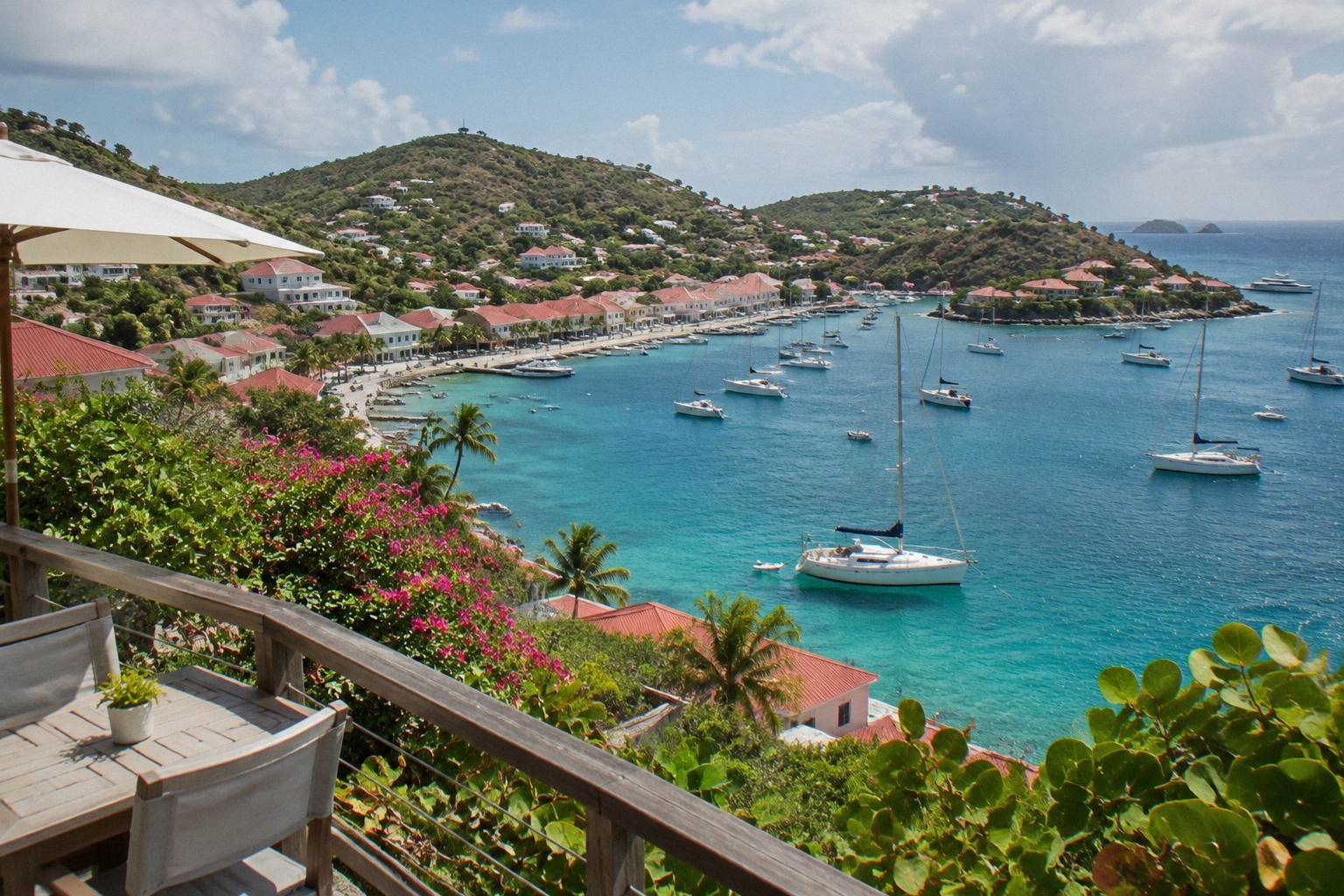
Is It Safe To Go To St. Barts Right Now?
A source-based look at safety in St Barts right now: hurricane season, entry rules, roads, the ferry crossing and marine reserve rules, with current figures from official climate and environment data.
St Barthelemy, usually written St Barts, is a French overseas collectivity in the Caribbean with about 10,700 residents, and the honest answer to whether it is safe to visit right now depends on three predictable things: the time of year, the state of the sea, and how you plan to get around an island of steep, narrow roads. Official sources give clear answers on all three. The Meteo-France climate normals, the environment agency's marine reserve rules and the French emergency system all publish exactly the information a cautious traveler needs, and this page puts it in one place without inventing a verdict no source supports.
For a broader look at the island, including the same question asked without the "right now" framing, see the site's general safety guide, and for planning beyond safety, the things to do in St Barts overview covers the whole list.
Yes, in the sense that every official framework applying to St Barts describes a routine, well-governed destination: it is French territory with the standard French emergency numbers (15, 17, 18 and 112), a tropical climate with mean daily highs of 28.5 to 31.7 C across the year, a marine reserve with published rules, and an outside-Schengen entry regime that is unchanged. No source states a travel warning specific to the island, and no crime statistic is published here because none has been confirmed.
The honest framing matters more than the verdict. Safety questions about St Barts are almost always weather questions, transport questions or sea questions. The island has one small airport with a 646 m runway served only by small turboprop aircraft in daylight and visual conditions, no cruise pier, and ferry crossings from St Martin that operators themselves describe as weather-dependent. Those are the real variables, and each has an official answer later on this page.
What the island does not have, according to every source consulted, is any unusual structural risk: it is an overseas collectivity of France (since 2007) with euro currency, French as the official language and English widely spoken, and it operates under French civil-protection and emergency systems. Practical health questions such as drinking water are covered separately in is tap water safe to drink in St Barts, and expectant travelers have a dedicated page on safety during pregnancy in St Barts.
What Are The Main Safety Considerations In St Barts?
The four considerations are the tropical sun and heat, the sea and marine reserve rules, the island's steep and narrow roads, and the timing of any trip against the Atlantic hurricane season. Mean daily highs run from 28.5 C in January to 31.7 C in September (Meteo-France normals, 1991-2020), and the sea is warm year-round, about 26 C in winter and about 29 C from August to October. None of these is exotic; all are manageable with ordinary preparation.
Sun and heat need stating first because they are the most likely thing to actually affect a visitor: the island is warm in every month, with mean daily lows never below 23.3 C. The sea questions come next. All beaches are public, and the marine reserve's rules, published by the Agence Territoriale de l'Environnement, exist partly for visitor safety: no touching or chasing turtles, rays or sharks, no gloves in the water, and a strict ban on jet skis, seabobs and towed water sports in reserve zones.
| Safety topic | What official Notes | Practical consequence |
|---|---|---|
| Emergency numbers | 15 (medical), 17 (police), 18 (fire), 112 (European standard) | Standard French system applies island-wide |
| Sun and heat | Mean daily high 28.5 C (Jan) to 31.7 C (Sep), Meteo-France normals 1991-2020 | Ordinary tropical sun protection |
| Sea temperature | About 26 C in winter to about 29 C August to October | Warm year-round, no cold-water risk |
| Marine reserve rules | 5-knot limit in zones, no jet skis, no touching protected species | Follow posted rules at Colombier and other zones |
| Roads | Narrow, winding, hilly; 50 km/h island-wide, 30 km/h in Gustavia and St Jean | Drive cautiously, especially at night |
The road question deserves its own section below, and the hurricane question is big enough that it gets a full section too. What rounds out the everyday picture is infrastructure of ordinary French standard: the island operates under French law, French emergency dispatch and the French health system's territorial arrangements. No medical-evacuation claim is made here, but travelers arranging their own cover should treat it as they would any small Caribbean island.
For activity on the water, the one per-person group sail listed here, the Boomerangs Group Sail and Snorkel, runs only from 12 May to 31 August 2027 on its listing, departs from St Martin or Sint Maarten, and operates inside the reserve's published rules. You can See the operator's live listing.
How Does Hurricane Season Affect A St Barts Trip?
Hurricane season in the Atlantic runs from 1 June to 30 November, with the peak of activity from mid-August to mid-October and the climatological peak near 10 September, and it overlaps the warmest and wettest months on the island. Hurricane Irma struck in September 2017 and caused severe damage, and the 2025 season brought Hurricane Erin past the region in mid-August with moderate effects on St Barts. No prediction of any storm is made or can be made.
The timing is the whole answer. Meteo-France's own normals, 1991-2020, show October as the wettest month at 135.6 mm and February the lowest at 38.4 mm, so the calendar itself tells the story of risk concentration. The 2026 season to mid-October has been quiet, with the season's first hurricane not forming until early October and none affecting the island, but a quiet season to date is not a forecast, and nothing on this page should be read as one.
| Month | Mean daily high (C) | Rainfall (mm) |
|---|---|---|
| January | 28.5 | 52.6 |
| April | 29.8 | 50.9 |
| July | 31.2 | 80.4 |
| September | 31.7 | 96.9 |
| October | 31.4 | 135.6 |
| February | 28.6 | 38.4 |
Source for all figures: Meteo-France climate normals, 1991-2020, for the St Barthelemy station.
Two practical consequences follow. First, ferry crossings and small-plane flights into Gustaf III Airport are weather-sensitive by design: the airport operates in daylight and visual conditions only, and both ferry operators describe services subject to weather cancellations, so any autumn itinerary should carry slack. Second, check the National Hurricane Center's outlook for the current Atlantic picture at the moment you book; no forecast is typed into this article.
A seasonal note with a safety edge: many hotels and restaurants close each autumn and reopen in waves between mid-October and early November, which means the island is quieter and services are thinner exactly when weather risk peaks. Anyone traveling in that window should confirm openings directly with each property.
Is The St Barts Airport And Ferry Crossing Safe?
Gustaf III Airport (SBH) has a single 646 m runway served only by small STOL turboprop aircraft, operating in daylight and visual conditions with specially qualified pilots, a regime that exists precisely to keep the famous short approach safe. The ferry crossings from St Martin, about 45 minutes from Philipsburg with Great Bay Express and about 50 to 60 minutes from Marigot with Voyager, are subject to weather cancellation, and no smooth crossing is ever promised.
The airport's restrictions are the safety system. Only STOL-rated aircraft such as Twin Otters, Cessna Grand Caravans and Pilatus PC-12s fly the route, pilots need specific certification for the approach, and operations stop at dusk because the runway has no lighting. Gateway flights land at St Martin (SXM), San Juan (SJU), Guadeloupe (PTP) or Antigua (ANU), followed by a small plane or the ferry; no jet lands on the island. Travelers weighing the flying options can read more in can you fly direct to St Barts from the US and do US citizens need a passport for St Barts.
The ferry is a different kind of calculation. The crossing can be rough, and both operators suspend sailings when sea conditions require it; passports are required, and Great Bay Express asks passengers to arrive 45 minutes before departure, with check-in closing 15 minutes before. Travelers sensitive to swell may also want the site's dedicated guidance on seasickness, but the essential point stands: the operators themselves treat weather as the governing variable, not the passenger. The wider set of guides lives on St Barthelemy Travel.
For those who prefer to arrive by private boat, the trip list includes charters from St Martin that let a group set its own pace across the channel; the group sail linked above and the private options below all depart from the St Martin or Sint Maarten side.
What Rules Keep Beaches And Water Safe In St Barts?
The marine nature reserve's regulatory-zones page lists the rules that govern the water: a 5-knot speed limit in protected zones, a total ban on jet skis, seabobs and towed motorized sports, 23 dive sites, no touching or feeding of turtles, corals, sharks or rays, no gloves in the water, no collecting shells or coral, and no dogs on any beach island-wide under a long-standing municipal order. These are enforceable rules, not etiquette.
For visitors, three of these matter most day to day. The turtle rule is absolute: green and hawksbill turtles are common around Colombier and in the Grand Cul-de-Sac lagoon, and the environment agency asks that nests and sightings be reported to it directly. The dog ban applies to all beaches, even on a leash. And the anchoring and mooring rules in Colombier and Ile Fourchue bays, including ecological mooring buoys and restrictions on vessels over 25 m, shape how any boat day actually runs.
Drones deserve a mention because many travelers do not expect it: they are prohibited in and near the reserve without prior authorization, including at Colombier. As with every rule on this list, the environment agency's own pages carry the current text, and beach entrance signs repeat the basics. Swimmers should simply note that no beach on the island carries a lifeguard claim or a calm-water guarantee, so conditions are read on the day.
What Should You Know About Roads And Driving In St Barts?
Driving is on the right under French traffic rules, on roads that are narrow, winding and steep enough to need low gear on some grades, with a 50 km/h speed limit island-wide and 30 km/h in Gustavia and St Jean, one roundabout near the airport, and French priority-to-the-right rules at unsigned intersections. Roads, not crime, are the most common source of visitor incidents on hilly Caribbean islands, and St Barts concentrates its hazards into short, steep, lightly marked stretches.
The vehicle choice follows from the terrain. Small cars, Smart cars and open-air Mini Mokes are typical rentals, and automatics predominate; rental counters at the airport include Avis, Budget and Hertz, alongside local agencies. No rental price, minimum-driver-age figure or parking tariff is confirmed, and each company sets its own terms. Parking in Gustavia is described in guides as limited, especially in the high season, with free public lots and timed Blue Zone street spaces using a parking disc.
Readers weighing whether a car is necessary at all can turn to is it worth renting a car in St Barts. The safety-relevant summary is simple: drive slowly, expect blind crests and tight passing, and treat scooters with extra caution given the grades. More exploration of the island's layout, including where to base yourself, is in what part of St Barts is best to stay in.
Common Questions About St Barts Safety
Is It Safe To Go To St. Barts Right Now?
Every official framework applying to St Barts describes a routine French Caribbean destination: standard emergency numbers (15, 17, 18, 112), published marine reserve rules and a well-documented climate. The real variables are hurricane-season timing, the weather-dependent ferry and small-plane crossings, and the island's steep roads. Check current government travel advice for your nationality before booking.
When Is Hurricane Season In St Barts?
The Atlantic hurricane season runs 1 June to 30 November, with peak activity from mid-August to mid-October and the climatological peak near 10 September. Hurricane Irma struck the island in September 2017. No prediction of any storm is possible; the National Hurricane Center's outlook shows the current Atlantic situation.
Are The Beaches In St Barts Safe To Swim?
All beaches are public. The sea is warm year-round, about 26 C in winter to about 29 C from August to October. No beach has a lifeguard or a calm-water guarantee, so read conditions on the day and follow the marine reserve's posted rules, including the ban on touching turtles and other protected species.
Is The Flight Into St Barts Airport Dangerous?
The airport's restrictions are its safety system: a 646 m runway, small STOL turboprops only, specially certified pilots, and operations restricted to daylight and visual conditions because the runway has no lighting. No jet lands on the island; travelers connect through St Martin, San Juan, Guadeloupe or Antigua.
Is It Safe To Rent A Car And Drive In St Barts?
Yes, with ordinary care. Driving is on the right under French rules, roads are narrow, winding and steep, and limits are 50 km/h island-wide and 30 km/h in Gustavia and St Jean. Small automatic cars and Mini Mokes are the typical rentals. Terms and minimum ages vary by company, so confirm with the rental provider.
Do I Need Travel Insurance For St Barts?
No insurance requirement is published for St Barts. St Barts is a small island reached by small aircraft or ferry, both weather-dependent, so travelers should arrange cover as they would for any remote island trip and check their own government's travel advice.