Can You Swim At Shell Beach In St Barts?
Shell Beach in St Barts is a public swimming beach a short walk from Gustavia. What the rules, the climate normals and the marine reserve say about swimming there.
St Barthelemy, usually written St Barts, is a small French island in the Caribbean of about 21 square kilometres, and one of its most convenient beaches sits a short walk from the harbour capital of Gustavia. Shell Beach, also called Grand Galet on the island's maps, is a public beach on the open-water side of the Gustavia peninsula. The short answer for swimmers is yes, and the details below cover the rules, the water, and what the island's own climate record says about the conditions you will meet.
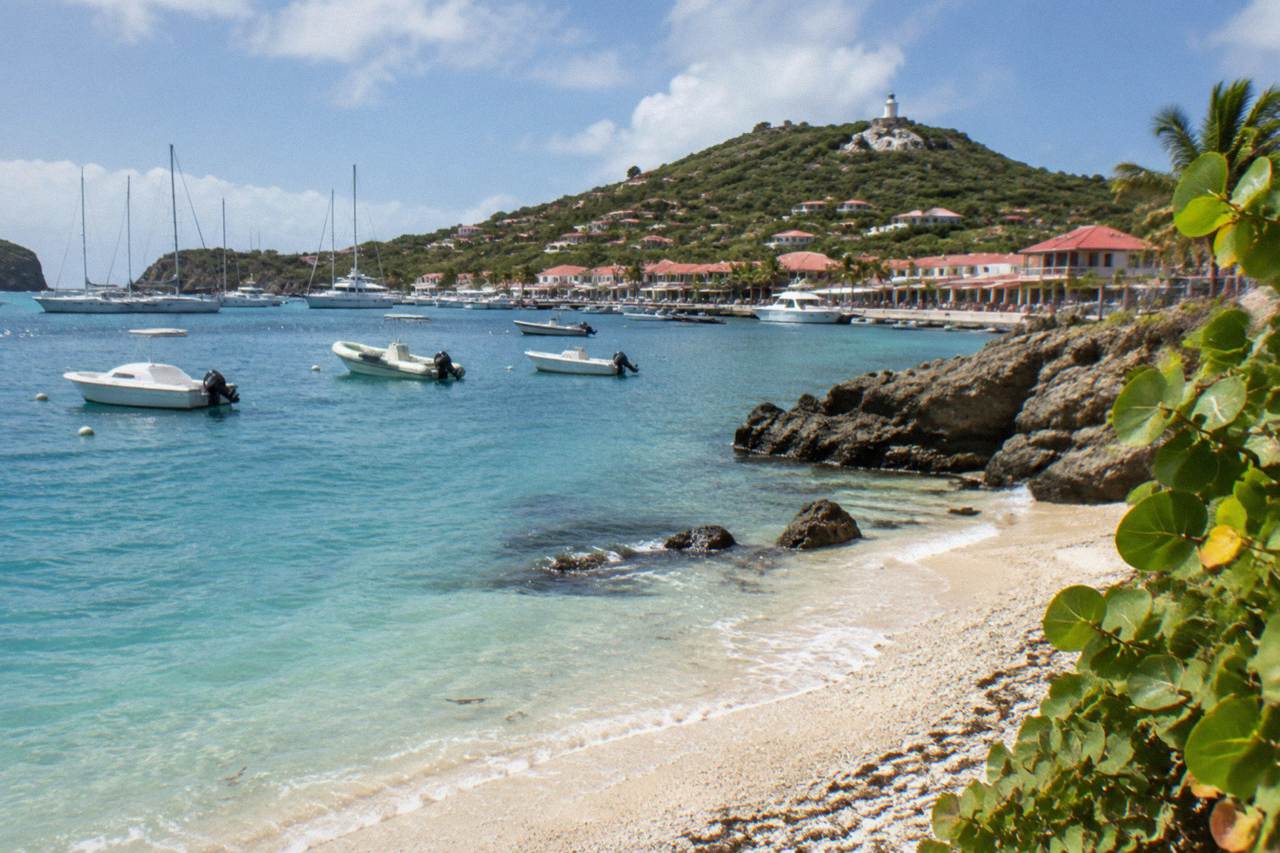
Yes, swimming is allowed at Shell Beach in St Barts. It is a public beach, like every beach on the island, reached on foot from the edge of Gustavia, and the marine reserve's rules that apply around it concern how you behave in the water rather than whether you may enter it: no touching protected species, no collecting shells or coral, and no dogs on the sand.
That last point matters more here than on most beaches, and it is worth spelling out. Shell Beach takes its name from the broken shells that make up its surface, and the instinct to pocket a handful is exactly what the island's environment agency prohibits. The territorial environment agency's regulatory-zones page lists a ban on collecting shells, sand, rocks, coral, plants, shellfish and crustaceans anywhere inside the protected zones, and its beach-rules page states that dogs are banned from the beaches of St Barts by a standing municipal order, even on a leash. The tourism committee lists Shell Beach (Grand Galet) among the island's named public beaches, alongside Saint-Jean, Gouverneur, Saline, Flamands, Colombier, Grand Cul-de-Sac, Lorient, Toiny, Marigot and Corossol.
The full picture of the beach itself, its map position and its access path is on the site's Shell Beach attraction page, which covers the headlands and the walk out from town in detail. What this page adds is the swimming-specific picture: the rules that govern the water, the climate record for the island, and the honest comparison with the island's other swimming beaches.
Where Is Shell Beach And Why Does Location Matter For Swimmers?
Shell Beach sits on the southern coast of the Gustavia peninsula, facing open water rather than the sheltered harbour, a short walk from the centre of Gustavia along the harbor road and over the headland. Its position matters because it is the one named beach of St Barts you can reach on foot from the cruise tender quay and the town's streets without a car, taxi or boat.
That geography shapes who swims there. Arriving passengers tender into Gustavia's harbour, and the island's port authority confirms there is no cruise pier, so ships anchor offshore and land guests by tender boat near the town centre. From there, Shell Beach is the nearest named beach. Day visitors on a tight schedule can swim without arranging transport, which no other beach on the island offers in quite the same way. The trade-off is exposure: the beach faces the open Caribbean side of the island rather than a protected bay, and conditions in the water follow the weather and the season rather than any shelter the harbour gives.
The other consequence of location is regulatory. The waters around St Barts fall under the Saint-Barthélemy Marine Nature Reserve, which the environment agency's regulatory-zones page describes as covering five zones, including areas of simple and enhanced protection. The rules below apply to swimmers and snorkellers throughout those zones, including the stretch of coast Shell Beach sits on.
The island's official position on beaches is simple: all of them are public and free to access. The tourism committee states this plainly, and it holds for Shell Beach as much as for the far ends of the island. Plan on the basis that you arrive, swim and leave under your own judgment, as the island's residents do.
For travellers whose idea of a beach day is a boat rather than a walk, the list of bookable trips from St Martin includes a group sail that stops at Colombier and Ile Fourchue, two swim spots the road network does not reach. The Gustavia, Colombier and Ile Fourchue sail departs from St Martin or Sint Maarten, never from St Barts itself, and its listing shows the current per-person price and dates.
What Is The Water Like Around St Barts Through The Year?
The Meteo-France normals for St Barts, 1991-2020, show a mean daily high of 28.5 C in January rising to 31.7 C in September, with sea temperature about 26 C in winter and about 29 C from August to October, so the water is warm enough for swimming in every month of the year. Rain totals 891.3 mm annually, with October the wettest month at 135.6 mm.
Those figures are station normals, the long-run averages recorded at the island's Meteo-France station, not a forecast for your dates, and the island never predicts a storm. What they establish is that there is no cold season for swimming. The practical planning question is not temperature but the Atlantic hurricane season, which runs from 1 June to 30 November with its peak from mid-August to mid-October, and a climatological peak near 10 September. Sea conditions at any exposed beach, Shell Beach included, follow that calendar: summer and autumn bring the warmest water and also the season in which swells and weather systems are more likely. More of these guides are collected on St Barthelemy Travel.
| Month | Mean Daily High | Mean Daily Low | Rainfall |
|---|---|---|---|
| January | 28.5 C | 23.5 C | 52.6 mm |
| February | 28.6 C | 23.3 C | 38.4 mm |
| March | 29.0 C | 23.5 C | 41.4 mm |
| April | 29.8 C | 24.2 C | 50.9 mm |
| May | 30.7 C | 25.1 C | 61.7 mm |
| June | 31.2 C | 25.9 C | 56.0 mm |
| July | 31.2 C | 26.0 C | 80.4 mm |
| August | 31.6 C | 26.3 C | 79.6 mm |
| September | 31.7 C | 26.2 C | 96.9 mm |
| October | 31.4 C | 25.8 C | 135.6 mm |
| November | 29.9 C | 25.0 C | 118.6 mm |
| December | 28.9 C | 24.1 C | 79.2 mm |
Two patterns in the table are worth a swimmer's attention. February has the lowest rainfall total in the normals at 38.4 mm, while October has the highest at 135.6 mm, and the months with the warmest air, August through October, are also the months inside the hurricane season's peak window. The winter half of the year, December through April, combines the cooler end of the island's temperature range with the drier end of its rainfall record. None of this describes the sea state at Shell Beach on any given day, which the weather of the moment decides.
What Rules Apply When You Swim At Shell Beach In St Barts?
The environment agency's regulatory-zones page lists the rules that govern swimming in the St Barts marine reserve: a 5-knot speed limit for boats in its zones, no touching, chasing or feeding protected species including turtles, corals and rays, no gloves in the water, no collecting coral, shells, sand or rocks, no jet skis or seabobs of any motorized kind, and no dogs on the beaches or in the water.
For a swimmer at Shell Beach the rules reduce to a short list. Look, do not touch: green and hawksbill turtles are present in the island's waters and are strictly protected, and the agency's beach page asks that nests and sightings be reported rather than approached. Take nothing: the shell surface of the beach is part of what makes it distinctive, and collecting it is an offence inside the reserve's rules, not a souvenir. Leave the dog behind: the island-wide ban applies on every beach, not just reserve ones, and signs at the entrances say so.
Snorkelling follows the same rules. The reserve's enhanced protection zones add bans on fishing, anchoring and scuba in places, and the regulatory page distinguishes those zones from the simple protection areas. The reserve lists 23 dive sites in its waters, and snorkellers around the rocks at either end of a beach see a fraction of the same fauna. Drones are prohibited in and near the reserve without authorization, which matters to anyone filming a swim.
The full set of rules and zone boundaries is on the environment agency's site, and its beach page carries the practical summary for visitors. The table below condenses what applies to a day at Shell Beach.
| Rule | What It Means At Shell Beach |
|---|---|
| No collecting shells, sand or rocks | The beach's shell surface stays on the beach |
| No touching protected species | Turtles, corals, urchins and rays are observed from a distance |
| No gloves in the water | Snorkellers keep hands free and visible |
| No dogs on beaches or in water | Applies island-wide, on and off the leash |
| No jet skis or electric surfboards | No motorized craft in the reserve's zones |
| 5-knot boat speed limit | Boats pass slowly inside protected zones |
If a beach day in St Barts is on your itinerary, a boat trip is one way to combine several of these rules-respecting swim stops in a single day. The Boomerangs group sail and snorkel trip runs per person, and its listing shows that the 2027 season runs from 12 May to 31 August 2027; outside those dates the private charters below are the sea option. You can See the operator's live listing.
How Does Shell Beach Compare With Other Beaches In St Barts?
Shell Beach's distinction among St Barts beaches is access rather than scale: it is the public beach closest to Gustavia, reachable on foot from town, while the island's other named beaches, Saint-Jean, Gouverneur, Saline, Flamands, Colombier, Grand Cul-de-Sac, Lorient, Toiny, Marigot and Corossol, sit along the coast reached by road, or in Colombier's case by boat or by a walk.
Every one of them is public, so an honest comparison sticks to geography. The map tells most of the story. Saint-Jean curves beside the airport's runway on the north coast. Gouverneur and Saline face south on the island's Atlantic side. Flamands and Marigot sit on the northwest corner, Lorient and Grand Cul-de-Sac on the calmer-sounding northeast shore, and Corossol preserves its fishing-village character west of Gustavia. Colombier, at the island's western tip, has no road at all, which is why the boat trips from St Martin make it their anchorage.
| Beach | Position On The Island | How It Is Reached |
|---|---|---|
| Shell Beach (Grand Galet) | Just outside Gustavia | On foot from town |
| Saint-Jean | North coast beside the airport | By road |
| Gouverneur | South coast | By road |
| Saline | South coast | By road |
| Flamands | Northwest coast | By road |
| Colombier | Western tip | By boat or by a walk |
| Grand Cul-de-Sac | Northeast shore | By road |
| Lorient | North coast east of Gustavia | By road |
| Corossol | West of Gustavia | By road |
Readers weighing one beach against another will find the site's longer treatments useful: what is the nicest beach in St Barts and the beach guide by best-for both compare the named beaches by position and access. For the question of swimwear specifically, the island's French character shows up at Saline, where the clothing-optional question is answered in its own page, and topless sunbathing is the norm the tourism sources describe across French beaches. Shell Beach, given its closeness to town and to arriving tender passengers, is simply a busier proposition for that than the far coves.
The other comparison worth making is land against sea. Colombier's water is a fixture of the boat itineraries from St Martin precisely because no road serves it, and the Colombier beach page covers its walk and its anchorage. A swimmer who wants both, a walk-in beach from town and a boat-only cove, can do one on a St Barts day and the other on a day trip that departs from the neighbouring island.
Common Questions About Swimming At Shell Beach In St Barts
Can you swim at Shell Beach in St Barts?
Yes. Shell Beach is a public beach on the coast just outside Gustavia, and swimming is allowed. The marine reserve rules that apply concern behaviour in the water: no touching protected species, no collecting shells or coral, and no dogs on the sand.
Is Shell Beach free to enter?
Yes. The tourism committee states that all beaches in St Barts are public and free to access, and Shell Beach is no exception.
Can you collect shells at Shell Beach?
No. The environment agency's regulatory-zones page bans collecting shells, sand, rocks, coral, plants, shellfish and crustaceans inside the protected zones, and the beach's shell surface is covered by that rule.
How warm is the water in St Barts?
Sea temperature runs about 26 C in winter to about 29 C from August to October, so the water is warm year-round. Air temperatures, per the Meteo-France normals 1991-2020, average a daily high of 28.5 C in January and 31.7 C in September.
Can you walk to Shell Beach from Gustavia?
Yes. Shell Beach sits on the Gustavia peninsula a short walk from the town centre, which makes it the nearest named beach for tender passengers arriving in the harbour.
Are dogs allowed on Shell Beach?
No. A standing municipal order bans dogs from all beaches in St Barts, even on a leash, and the environment agency's beach page states the rule applies island-wide.
A swim at Shell Beach is, in the end, the simplest beach proposition on the island: a public shore, a walk from town, warm water in every month of the year, and a short list of reserve rules that ask you to leave the shells where they lie.